
MyTopo
Jennie Lakes Wilderness MyTopo Explorer Series Map
Couldn't load pickup availability
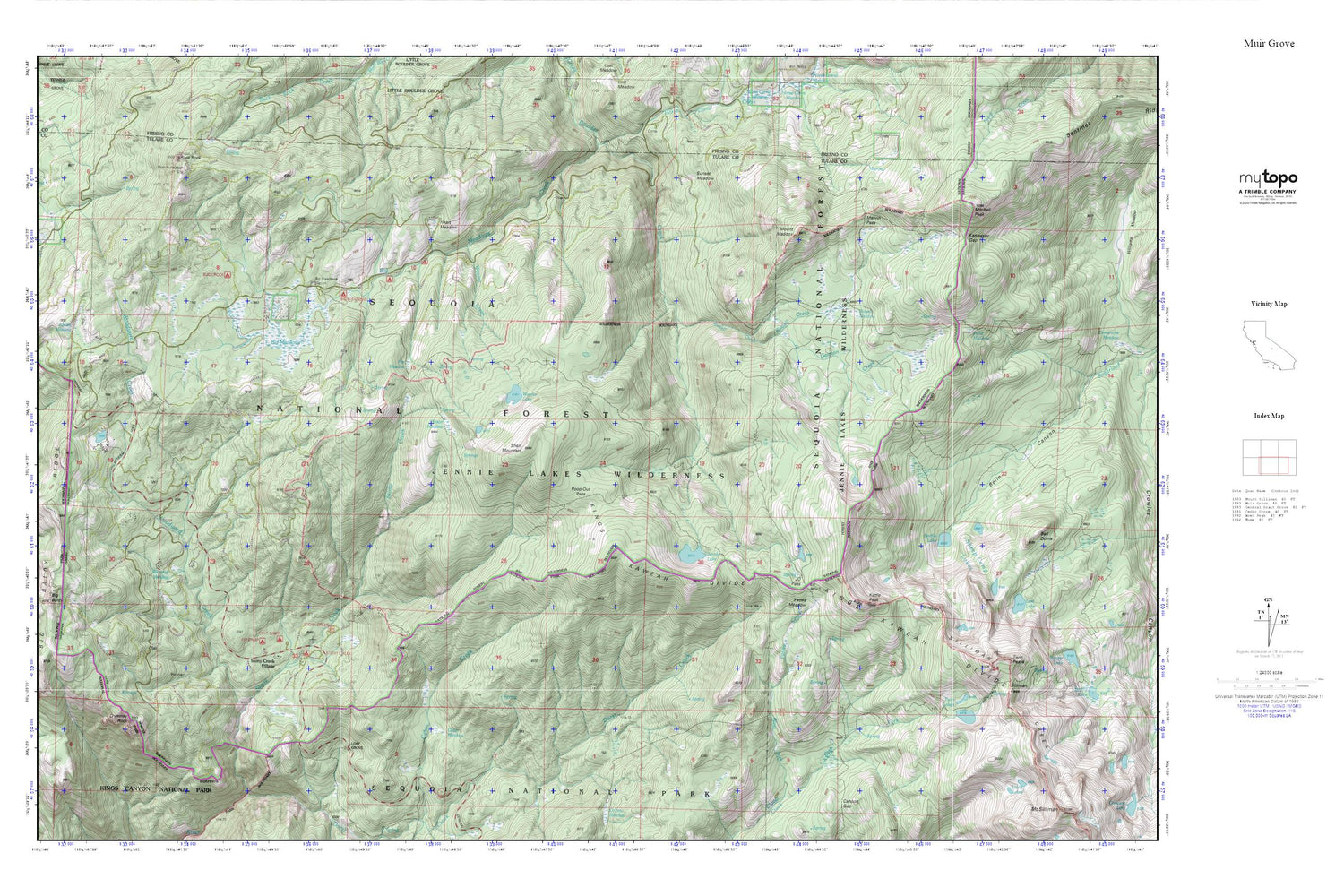
Topographic map of Jennie Lakes Wilderness in the state of California. From the MyTopo Explorer Series.
This topo map features shaded relief and comes with UTM / MGRS and Latitude/Longitude grids.
For more than two decades, MyTopo has provided maps to the most adventurous among us.. those who love to explore our nation’s remote wilderness areas, climb our highest peaks, and trek across our vast public lands. This map is part of a curated collection of the most popular places for which MyTopo customers have designed maps. It is a “bucket list” of the most amazing places to hike, hunt, and explore.
This map contains the following named places: Beartrap Meadow,Big Baldy,Big Baldy Grove,Big Baldy Ridge,Big Meadows,Big Meadows Campground,Big Meadows Nordic Ski Trail,Big Meadows Station,Buck Rock,Buck Rock Campground,Buena Vista Grove,Cabin Meadow,Chimney Rock,Cove Camp Campground,Fir Camp Campground,Fox Meadow,Gannon Creek,Heart Meadow,J.O. Pass,Jennie Lake,Jennie Lakes Wilderness,Kanawyer Gap,Kettle Peak,KMPH-TV (Visalia),Lost Grove,Lost Lake,Marvin Pass,Mitchell Peak,Mount Maddox,Pattee Creek,Pattee Meadow,Poison Meadow,Pond Meadow,Poop Out Pass,Profile View,Rabbit Meadow,Rowell Creek,Rowell Meadow,Sentinel Ridge,Seville Lake,Sheep Camp Lakes,Shell Mountain,Silliman Pass,Stony Creek Campground,Stony Creek Picnic Area,Stony Creek Village,Sunset Meadow,Twin Lakes,Twin Peaks,Weaver Creek,Weaver Lake,Western Camp,Weston Meadow,Woodward Creek


