MyTopo
Snowdon Peak MyTopo Explorer Series Map
Couldn't load pickup availability
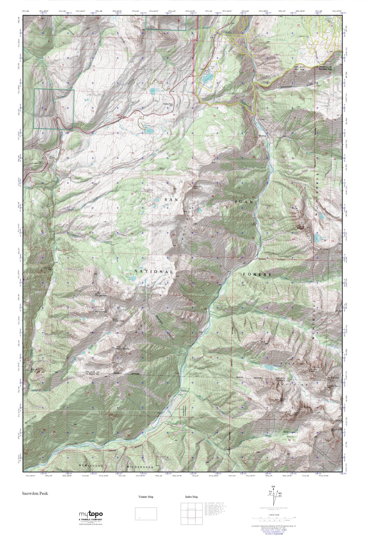
Topographic map of Snowdon Peak in the state of Colorado. From the MyTopo Explorer Series.
This topo map features shaded relief and comes with UTM / MGRS and Latitude/Longitude grids.
For more than two decades, MyTopo has provided maps to the most adventurous among us.. those who love to explore our nation’s remote wilderness areas, climb our highest peaks, and trek across our vast public lands. This map is part of a curated collection of the most popular places for which MyTopo customers have designed maps. It is a “bucket list” of the most amazing places to hike, hunt, and explore.
This map contains the following named places: Andrews Lake,Andrus Mine,Animas Mountain,Coal Creek,Crater Creek,Crater Lake,Deer Creek,Deer Creek Observation Point,Duck Slough Dam,East Lime Creek,Elk Creek,Elk Park,Elk Park Mine,Garfield Lake,Lime Creek Campground,Little Finger,Little Molas Lake,Mabel Mine,Molas Creek,Molas Lake,Molas Mine,Molas Park,Molas Pass,Mount Garfield,Needle Creek,Needleton,Needleton Water Tank,Noname Creek,North Lime Creek,North Twilight Peak,Peak Fifteen,Peak Fourteen,Pigeon Creek,Pigeon Peak,Point Pun,Ruby Creek,Ruby Lake,San Juan County,Senior Warden Mine,Silverton Division,Snowdon Peak,South Twilight Peak,Sultan Creek,Tenmile Creek,The Index,Three Lakes Creek,Tie Creek,Turret Needles,Turret Peak,Twilight Peak,Watertank Canyon,West Needle Mountain,West Needle Mountains,Whitehead Gulch