MyTopo
Harrisburg MyTopo Explorer Series Map
Couldn't load pickup availability
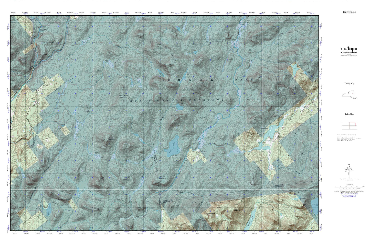
Topographic map of Harrisburg in the state of New York. From the MyTopo Explorer Series.
This topo map features shaded relief and comes with UTM / MGRS and Latitude/Longitude grids.
For more than two decades, MyTopo has provided maps to the most adventurous among us.. those who love to explore our nation’s remote wilderness areas, climb our highest peaks, and trek across our vast public lands. This map is part of a curated collection of the most popular places for which MyTopo customers have designed maps. It is a “bucket list” of the most amazing places to hike, hunt, and explore.
This map contains the following named places: Bakertown,Cattle Mountain,Corrigan Hill,Dayton Creek,Dunning Creek,East Branch Sacandaga River,East Vly,Harrisburg Lake,Hill Creek,Jimmy Creek,Masher Vly,New Lake,New Lake Mountain,New Lake Outlet,Pine Mountain,Pine Orchard,Smith Mountain,South Brook,Spruce Mountain,Steve Bigle Mountain,Taylor Vly,Tenant Mountain,Wilcox Lake,Wilcox Mountain,Wilcox Outlet,Willis Lake,Windfall,Wolf Point