MyTopo
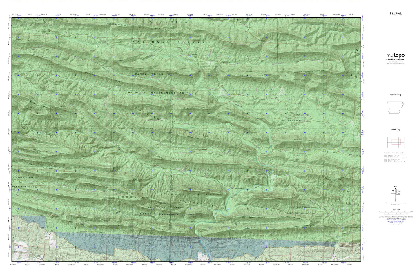
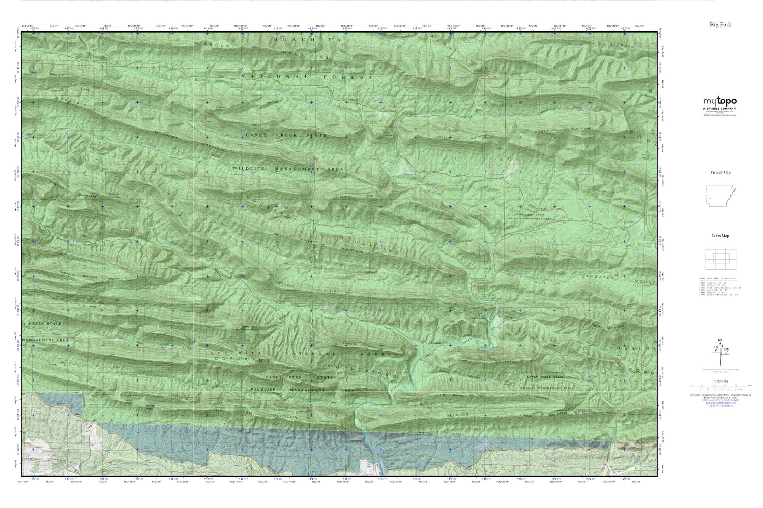
Ouachita National Forest_Eagle Rock Loop MyTopo Explorer Series Map
Couldn't load pickup availability
Topographic map of Ouachita National Forest_Eagle Rock Loop in the state of Arkansas. From the MyTopo Explorer Series.
This topo map features shaded relief and comes with UTM / MGRS and Latitude/Longitude grids.
For more than two decades, MyTopo has provided maps to the most adventurous among us.. those who love to explore our nation’s remote wilderness areas, climb our highest peaks, and trek across our vast public lands. This map is part of a curated collection of the most popular places for which MyTopo customers have designed maps. It is a “bucket list” of the most amazing places to hike, hunt, and explore.
This map contains the following named places: Albert,Albert Pike Recreation Area,Albert School,Bard Springs Recreation Area,Big Tom Mountain,Blaylock Creek,Blaylock Mountain,Brier Creek,Brier Creek Mountains,Brush Heap Mountain,Caney Creek State Wildlife Management Area,Cossatot Mountains,Crooked Creek,East Saline Creek,Fodderstack Mountain,Hurricane Knob,Leader Mountain,Little Missouri Falls Recreation Area,Little Missouri Wild and Scenic River,Little Mountain,Little Raven Mountain,Long Creek,McKinley Mountain,North Fork Saline River,Paul Mountain,Pryor Mountain,Putman Cemetery,Raspberry Mountain,Roaring Branch Natural Area,Rock Springs Cemetery,Round Mountain,Round Top,Shady Lake,Shady Lake Dam,Shady Lake Recreation Area,Sherman Mountain,South Fork Saline River,Statehouse Mountain,Straight Creek,Sugartree Mountain,Township of Rock Springs,Viles Branch