MyTopo
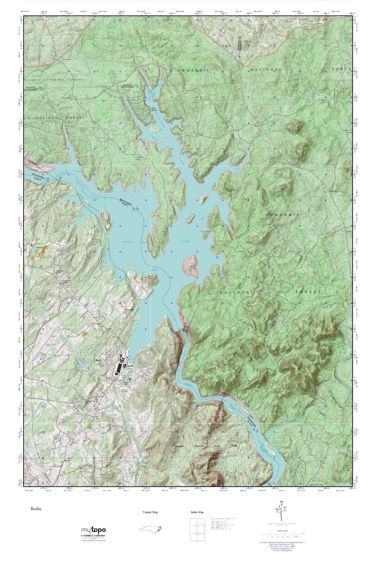
Badin Lake MyTopo Explorer Series Map
Couldn't load pickup availability
Topographic map of Badin Lake in the state of North Carolina. From the MyTopo Explorer Series.
This topo map features shaded relief and comes with UTM / MGRS and Latitude/Longitude grids.
For more than two decades, MyTopo has provided maps to the most adventurous among us.. those who love to explore our nation’s remote wilderness areas, climb our highest peaks, and trek across our vast public lands. This map is part of a curated collection of the most popular places for which MyTopo customers have designed maps. It is a “bucket list” of the most amazing places to hike, hunt, and explore.
This map contains the following named places: 28009,Albemarle Correctional Institution,Alcoa Plant,Alls Fork,Badin,Badin Dam,Badin Lake,Badin Lake Campground,Badin Lake Group Campground,Badin Lake Volunteer First Response and Rescue - Blaine,Badin Lake Volunteer First Response and Rescue - Pinehaven,Badin Lake Volunteer First Response and Rescue - Uwharrie Pointe,Badin Police Department,Badin Post Office,Badin School,Badin Volunteer Fire Department,Badin Waterworks,Beaverdam Creek,Blaine,Browns Chapel,Camp Barnhard,Cedar Grove Church,Center Church,Chandler Grove Church,Cove Boat Ramp,Dafor Dam,Dafor Lake,Daniel Mountain,Dutch John Creek,Dutchmans Creek,Eldorado,Eldorado Baptist Church,Eldorado School,Fall Mountain,Falls Dam,Falls Mountain,Falls Reservoir,FirstHealth of the Carolinas Emergency Medical Services Base 7,Garr Creek,Glady Fork,Graveyard Island,Great Falls,Lanes Chapel Cemetery,Lanes Chapel Methodist Church,Morrow Mountain State Park,Mountain Branch,Mountain View Creek Church,Narrous Dam,Narrows of the Yadkin,New Hope Church,Palmer Island,Palmer Mountain,Palmerville,Peenington,Pine Haven,Pine Hill Church,Prospect Baptist Church,Prospect Cemetery,Reeves Spring Branch,Reynolds Creek,Russell Cemetery,Shingle Trap Mountain,Spring Branch,Stanly County Airport,Stanly County Country Club,Taylor Grove Church,The Canal,Town of Badin,Township of Eldorado,Uwharrie Mountains,Uwharrie Wildlife Area,West Branch Moccasin Creek,Whitney,Yadkin Falls Dam