
MyTopo
Big Bend National Park_Outer Loop Trail MyTopo Explorer Series Map
Couldn't load pickup availability
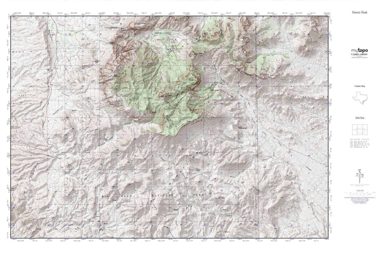
Topographic map of Big Bend National Park_Outer Loop Trail in the state of Texas. From the MyTopo Explorer Series.
This topo map features shaded relief and comes with UTM / MGRS and Latitude/Longitude grids.
For more than two decades, MyTopo has provided maps to the most adventurous among us.. those who love to explore our nation’s remote wilderness areas, climb our highest peaks, and trek across our vast public lands. This map is part of a curated collection of the most popular places for which MyTopo customers have designed maps. It is a “bucket list” of the most amazing places to hike, hunt, and explore.
This map contains the following named places: Apache Canyon Trail,Basin Loop,Blacktail Peak,Blue Creek Canyon,Blue Creek Ranch,Blue Creek Trail,Boot Canyon,Boot Rock,Boot Springs,Burro Mesa Pouroff,Burro Mesa Pouroff Trail,Burro Mesa Pouroff Window,Carousel Mountain,Casa Grande Peak,Cattail Canyon,Cattail Falls,Cattail Falls Spring,Cedar Spring,Chisos Mountain Lodge,Chisos Mountains,Crown Mountain,Dodson Ranch Trail,Dodson Spring,Dodson Trail,Emory Peak,Emory Peak Trail,Goat Mountain,Hayes Ridge,Juniper Canyon,Juniper Canyon Trail,Kibbe Spring,Laguna Meadow,Laguna Meadows - Pinnacles Trail,Lost Mine Trail,Lower Juniper Spring,Outer Mountain Loop,Pine Canyon Trail,Reynolds Well,Sierra Quemada,Sotol Vista Overlook,South Rim,South Rim Trail - Boot Springs Trail,Southeast Rim Keyhole,Toll Mountain,Tortuga Mountain,Townsend Point,Upper Juniper Spring,Ward Mountain,Ward Spring,Ward Spring Trail


