MyTopo
Newcomb MyTopo Explorer Series Map
Couldn't load pickup availability
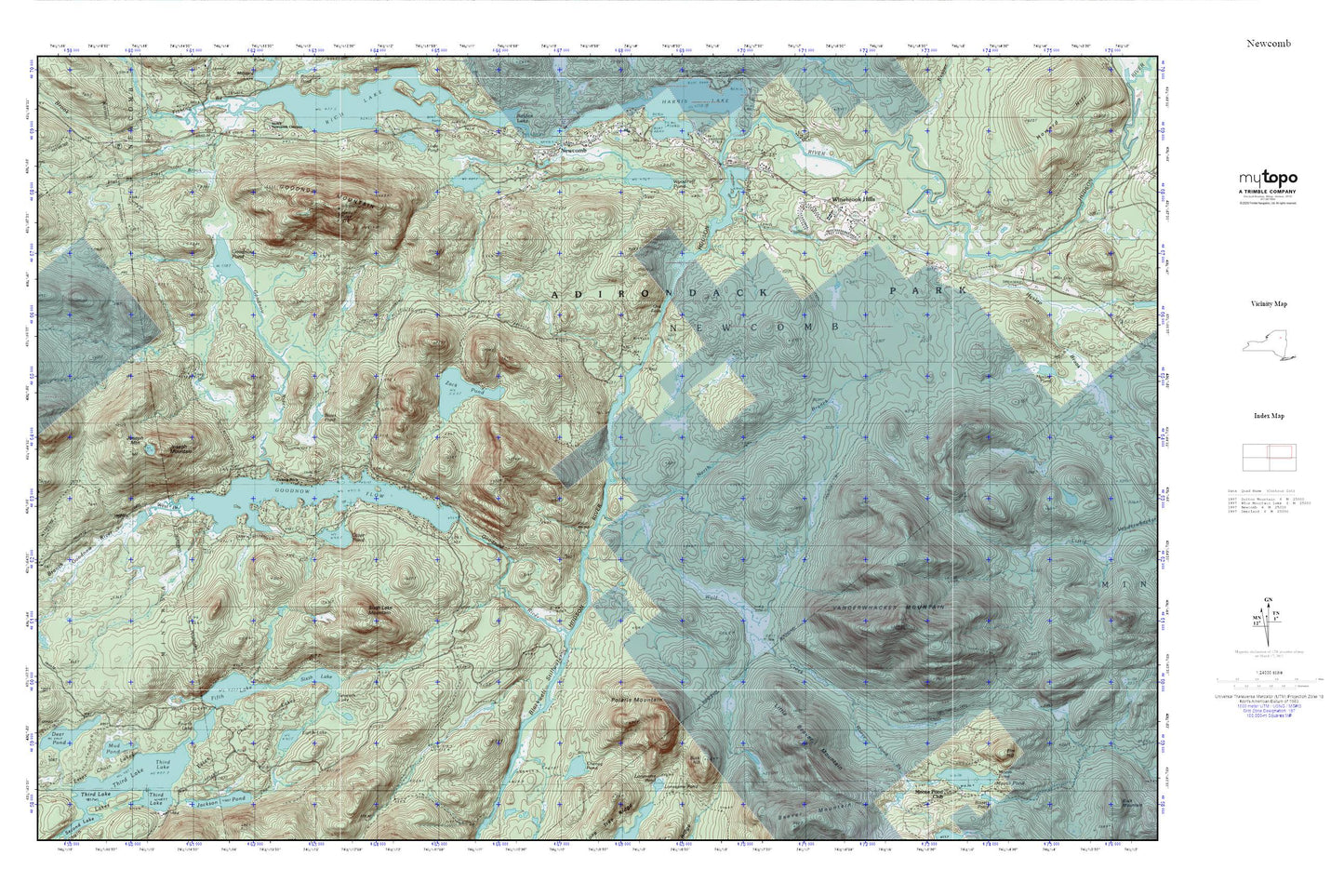
Topographic map of Newcomb in the state of New York. From the MyTopo Explorer Series.
This topo map features shaded relief and comes with UTM / MGRS and Latitude/Longitude grids.
For more than two decades, MyTopo has provided maps to the most adventurous among us.. those who love to explore our nation’s remote wilderness areas, climb our highest peaks, and trek across our vast public lands. This map is part of a curated collection of the most popular places for which MyTopo customers have designed maps. It is a “bucket list” of the most amazing places to hike, hunt, and explore.
This map contains the following named places: 12852,Bates Pond,Blackwell Stillwater,Buck Hill,Cheney Pond,Eighth Lake,Essex Chain Lakes,Fifth Lake,Fishing Rock,Fourth Lake,Goodnow Flowage,Goodnow Mountain,Goodnow Pond,Goodnow River,Hyslop Brook,Joseph Mountain,Little Beaver Mountain,Moose Pond,Moose Pond Brook,Mud Pond,Newcomb Post Office,North Branch Wolf Creek,Ord Falls,Otter Pond,Polaris Mountain,Saint Therese Church,Seventh Lake,Sixth Lake,Sixth Lake Mountain,Third Lake,Vanderwhacker Mountain,West Branch Goodnow River,Wolf Creek,Woodruff Pond,Zack Pond