
MyTopo
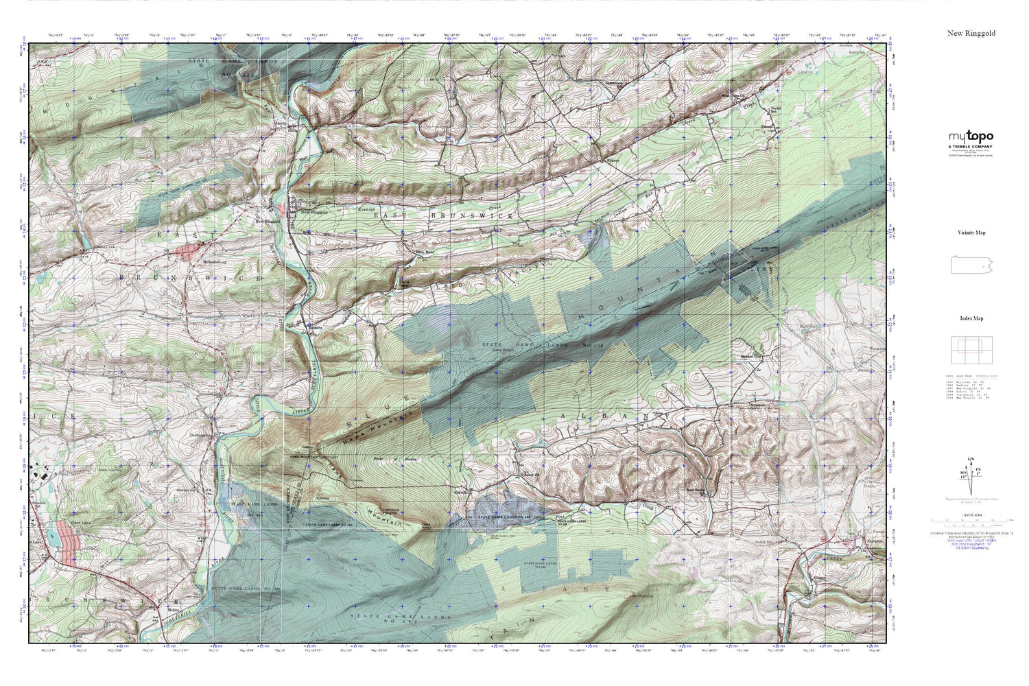
New Ringgold MyTopo Explorer Series Map
Couldn't load pickup availability
Topographic map of New Ringgold in the state of Pennsylvania. From the MyTopo Explorer Series.
This topo map features shaded relief and comes with UTM / MGRS and Latitude/Longitude grids.
For more than two decades, MyTopo has provided maps to the most adventurous among us.. those who love to explore our nation’s remote wilderness areas, climb our highest peaks, and trek across our vast public lands. This map is part of a curated collection of the most popular places for which MyTopo customers have designed maps. It is a “bucket list” of the most amazing places to hike, hunt, and explore.
This map contains the following named places: 17960,17961,Appalachian Overlook,Bald Lookout,Bolich Church,Bolich's Cemetery,Borough of Deer Lake,Borough of New Ringgold,Buteo Brook,Cobble,Cold Run,Dans Pulpit,Deer Lake,Deer Lake and West Brunswick Township Fire Company District 42 Station 1,Deer Lake Dam,Deer Lake Fossil Site,Deer Lake Pond,Drehersville,Eckville,Friedens Lutheran Cemetery,Grims Mill Bridge,Hawk Mountain,Hawk Mountain Sanctuary,Hawk Mountain Sanctuary Visitors Center,Hecla,Heinrich 3 Cemetery,Hemlock Heights,Indian Run,Keenigs Creek,Kepner,Koenigs Creek,Koenigs Creek Dam,Kunkles Dam,McKeansburg,McKeansburg Census Designated Place,Mountain School,New Bethel School,New Bethel Union Cemetery,New Bethel Union Church,New Ringgold,New Ringgold Ambulance,New Ringgold Community Fire Company District 55 Station 1,New Ringgold Post Office,North Lookout,Owls Head,Pinedale,Pinedale School,Quaker City,Rauschs,Red Valley,Rene Mont,Ridge Overlook,Rip Rap Run,River of Rocks,River of Rocks Overlook,River of Rocks Trail,Snyders Evangelical Cemetery,South Lookout,State Game Lands Number 106,Stevens School,The Pinnacle,Township of Albany,Township of East Brunswick


