MyTopo
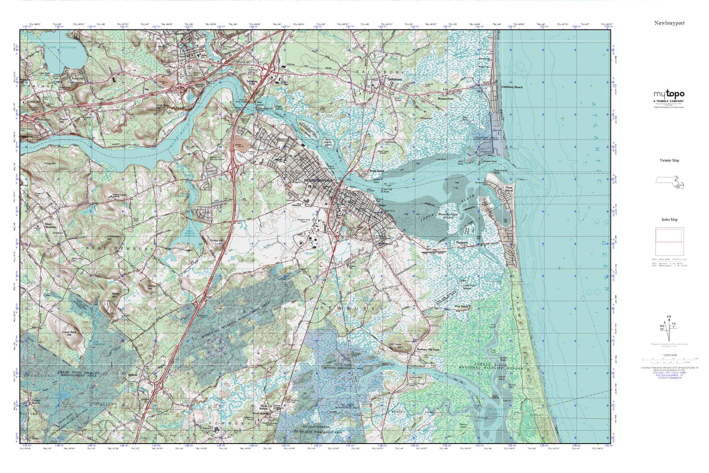
Newburyport MyTopo Explorer Series Map
Couldn't load pickup availability
Topographic map of Newburyport in the state of Massachusetts. From the MyTopo Explorer Series.
This topo map features shaded relief and comes with UTM / MGRS and Latitude/Longitude grids.
For more than two decades, MyTopo has provided maps to the most adventurous among us.. those who love to explore our nation’s remote wilderness areas, climb our highest peaks, and trek across our vast public lands. This map is part of a curated collection of the most popular places for which MyTopo customers have designed maps. It is a “bucket list” of the most amazing places to hike, hunt, and explore.
This map contains the following named places: 01922,01950,01951,01985,Allen Creek,Allen Rock,Alliance Park,Amesbury Town Landing,Anna Jaques Hospital,Archelaus Hill,Arrowhead Farm,Artichoke Dairy,Artichoke River,Artichoke River Dam,Ash Swamp,Assembly of God Church,Atkinson Common,Back River,Badgers Rock,Bailey Pond,Bailey Pond Dam,Bartlett Mall,Beaver Brook,Belleville Cemetery,Belleville School,Black Rock Creek,Black Rocks,Brown Square,Browns Island,Browns Point,Butlers Toothpick,Byfield,Byfield Fire Department,Byfield Post Office,Byfield School,Byfield Town Hall,Cape Merrill,Cardinal Cushing Academy,Carolton Creek,Carr Island,Carr Island State Reservation,Cashman Park,Central Congregational Church,Chaces Island,City of Newburyport,Coastal Educational Collaborative School,Cobbler Brook,Coffin House,Coffin House Museum,Coffin Point,Crane Neck Hill,Crane Pond,Cross Roads Plaza Shopping Center,Currier School,Curzon Mill,Cushing,Cushing House,Dalton House,Davenport School,Deer Island,Dexter Industrial Green,Doctor John C Page School,Dole Island,Downfall Wildlife Management Area,Eagle Island,First Cemetery,First Church of Christ Scientist,First Parish Burying Ground,First Religious Society Church,First Settlers Burying Ground,Floating Island,Fox Island Creek,Francis T Bresnahan Elementary School,Frog Pond,Gangway Rock,George W Brown School,Goodwin Creek,Governor Dummer Academy,Greater Newburyport Chamber of Commerce,Green Street Cemetery,Half Tide Rocks,Harbor School,Hate Cove,Healy House,Highland Cemetery,Hope Chapel,Immaculate Conception School,Indian Hill,Indian River,Ireland Point,Isley House,Isleys Hill,Jackman School,Jericho Creek,Joppa,Joppa Flats,Joppan House,Kents Island,Knights Crossing,Little Crane Pond,LIttle Old Town Hill,Little Pine Island,Little Pine Island Creek,Little River,Little River Marshes,Lone Tree Hill,Long Hill,Long Hill Cemetery,Long Hill Orchard,Long Point,Lower Artichoke Reservoir,Lower Artichoke Reservoir Dam,Lower Corner Cemetery,Lunt Rock,Maplewood Cemetery,Massachusetts State Police Troop A2 Newbury Barracks,Merrimack River,Merrimacport,Merrimacport Post Office,Mill Pond,Mill Pond Dam,Mill River,Morrill Creek,Mud Creek,Newbury Elementary School,Newbury Fire Department,Newbury Old Town,Newbury Police Department,Newbury Town Library,Newburyport,Newburyport City Hall,Newburyport Fire Department,Newburyport Harbor Light,Newburyport High School,Newburyport High School Library,Newburyport Montessori School,Newburyport Police Department,Newburyport Post Office,Newburyport Public Library,Newburyport Station,Nichols Creek,North Pier,North Pier Light,Oak Hill Cemetery,Old Newbury Golf Club,Old Town Bridge,Old Town Cemetery,Old Town Hill,Outer Badger Rocks,Parker River,Parker River Dam,Parker River Dam at Central Street,Parker River Marshes,Parker River Reservoir,Patmos,Pine Island,Pine Island Creek,Pipestave Hill,Plum Island,Plum Island Airport,Plum Island Point,Plum Island River,Plum Island River Marshes,Plumbush,Plumbush Creek,Pond Hill,Poplar Hill,Pork Island,Port Plaza,Powwow River,Quills Pond,Ram Island,Rings Island,River Valley Charter School,Rogers Medical Library,Rupert A Nock Middle School,Saint Marys Cemetery,Salisbury,Salisbury Beach State Reservation,Salisbury Census Designated Place,Salisbury Point,Salisbury Police Department,Salisbury Post Office,Salisbury Public Library,Sawyer Creek,Sawyer Hill Burying Ground,Shad Creek,South Pier,Sow and Pigs,The Basin,The Thorofare,Town Creek,Town Creek Marshes,Town of Newbury,Town of West Newbury,Turkey Hill,Upper Artichoke Reservoir,Upper Green,Walnut Hill Cemetery,West Newbury Central School,West Newbury Fire Department Garden Street Station,West Newbury Fire Department Headquarters,West Newbury Police Department,Whittier Memorial Bridge,WNBP-AM (Newburyport),Woodbridge Island,Woodbridge School


