MyTopo
Mount Tahepia MyTopo Explorer Series Map
Couldn't load pickup availability
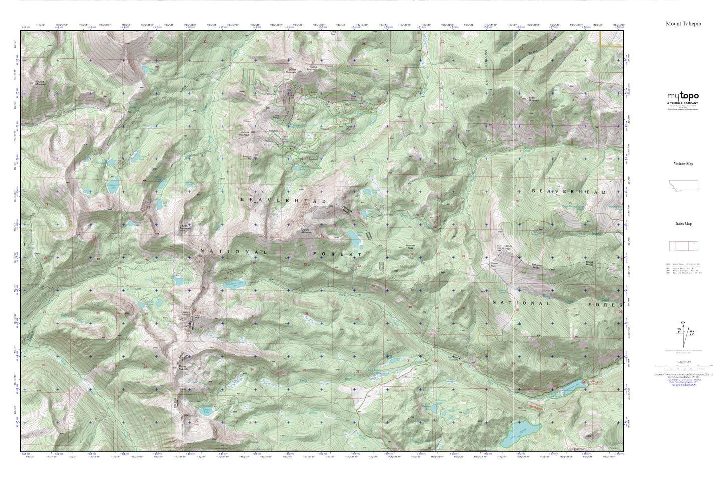
Topographic map of Mount Tahepia in the state of Montana. From the MyTopo Explorer Series.
This topo map features shaded relief and comes with UTM / MGRS and Latitude/Longitude grids.
For more than two decades, MyTopo has provided maps to the most adventurous among us.. those who love to explore our nation’s remote wilderness areas, climb our highest peaks, and trek across our vast public lands. This map is part of a curated collection of the most popular places for which MyTopo customers have designed maps. It is a “bucket list” of the most amazing places to hike, hunt, and explore.
This map contains the following named places: Barbour Hill,Bear Gulch,Brownes Peak,Canyon Lake,Cherry Lake,Cleopatra Mine,Cleve Mine,Crescent Lake,Elm - Orlu Mine,Franklin Mine,Gold Creek Trail,Granite Lake,Granite Mountain,Grayling Lake,Green Lake,Hecla,Hecla Mines,Hecla Post Office,Hecla School,Keokirk Mine,Keokirk Mountain,Lake Abundance,Lion City,Lion Creek,Lion Lake,Lion Mountain,Long Branch,Long Branch Lake,Long Lake,Lower Cleve Mine,Minnie-Gaffney Mine,Morrison Hill,Mount Alverson,Mount Tahepia,Rainbow Lake,Rock Creek Guard Station,Sappington Creek,Schulz Lakes,SE Section 3 Mine,Sharp Mountain,Silver King Mine,Storm Park,Storm Peak,Storm Spring,SW Section 11 Mine,Tahepia Lake,Teacup Lake,Tendoy Lake,Trapper Lake,Trapper Mine,True Blue Mine,Vera Lake,Waukena Lake,Waukena Lake Dam