MyTopo
Eldorado Springs MyTopo Explorer Series Map
Couldn't load pickup availability
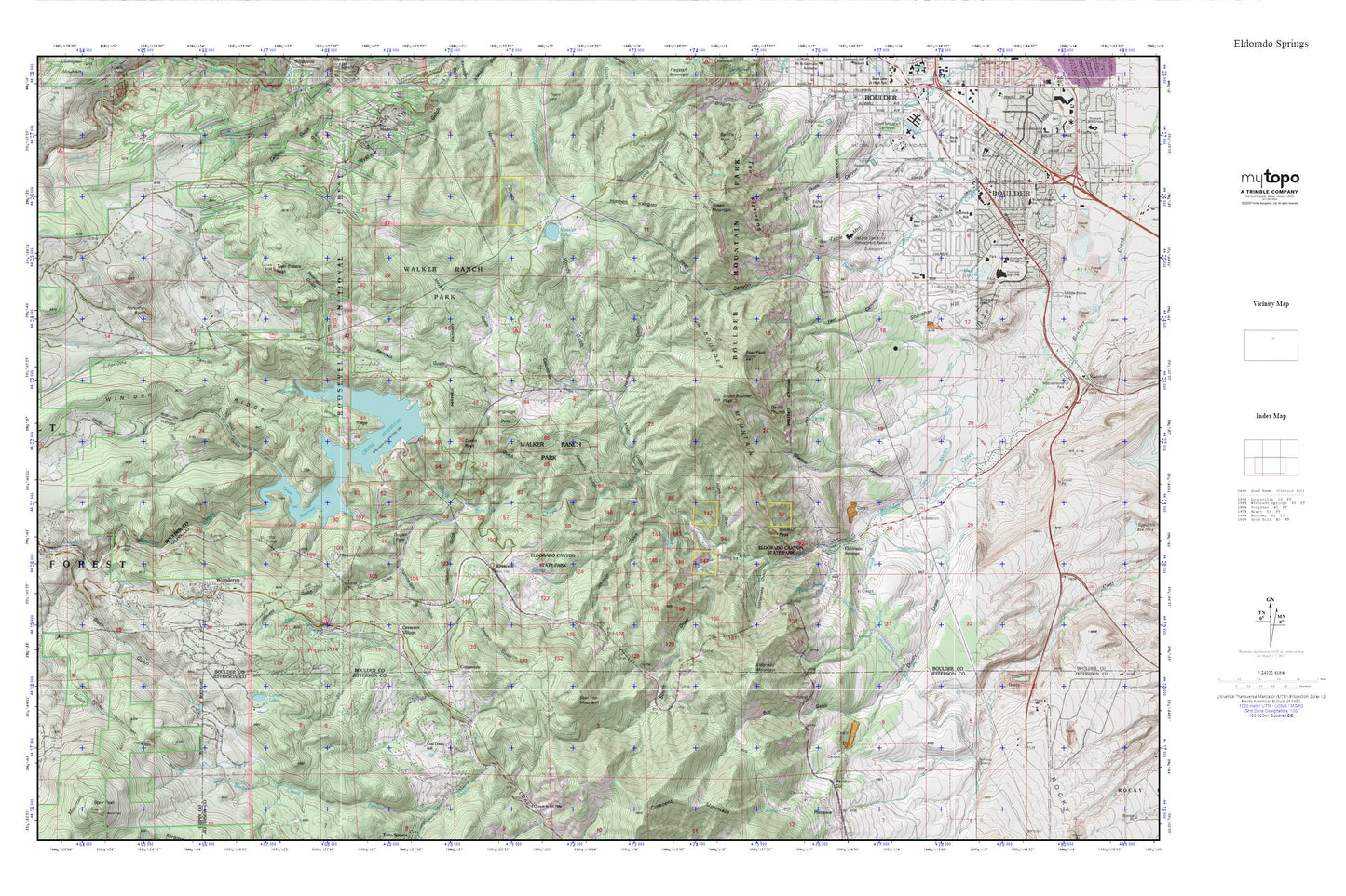
Topographic map of Eldorado Springs in the state of Colorado. From the MyTopo Explorer Series.
This topo map features shaded relief and comes with UTM / MGRS and Latitude/Longitude grids.
For more than two decades, MyTopo has provided maps to the most adventurous among us.. those who love to explore our nation’s remote wilderness areas, climb our highest peaks, and trek across our vast public lands. This map is part of a curated collection of the most popular places for which MyTopo customers have designed maps. It is a “bucket list” of the most amazing places to hike, hunt, and explore.
This map contains the following named places: 80025,80305,80471,Advent Gulch,Aspen Meadows,Audophone Mine,Bear Canyon,Bear Creek Elementary School,Bear Peak,Bear Peak Trail,Beaver Creek,Ben C Lowell Mine,Black Gulch,Boiling Gulch,Boulder Fire Rescue Department Station 4,Boulder Mountain,Boulder Mountain Park,Bull Gulch,California Mine,Carter Lake,Castle Rock,Chamberlain Gulch,Coal Creek,Coal Creek Canyon Fire Department Station 2,Coal Creek Canyon Fire Rescue Station 1,Coal Creek Canyon K - 8 School,Coal Creek Census Designated Place,Columbine Gulch,Community Montessori School,Copeland Group Mine,Copeland Mines,Copperdale,Creekside Elementary School,Crescent,Crescent Village,Devils Thumb,Doudy Draw,Dugan Park,Echo Rock,Eclipse Mine,Eldorado Canyon State Park,Eldorado Mine,Eldorado Mountain,Eldorado Springs,Eldorado Springs Cemetery,Eldorado Springs Census Designated Place,Eldorado Springs Post Office,Eskimo Mine,Fairview High School,Fern Canyon,First Baptist Church,Forsythe Canyon,Forsythe Rock,Green Mountain,Gross Dam,Gross Reservoir,Harmon Gulch,Homestake Mine,Jay Bird Mine,Johnson Gulch,KBCO-FM (Boulder),Kekionga Mine,Kentucky Gulch,Keystone Mine,Kohler Reservoir,Kossler Dam,Kossler Lake,KQKS-FM (Longmont),Lake Shore Park,Langridge Dyke,Magner Mine,Magnolia Mine,Manchester Mine,Martin Gulch,May Blossom Number Two Mine,McCann Clay Mine,Mesa Elementary School,Mesa Trail,Meyers Gulch,Miramonte,Nineteen Gulch,North Draw,Panther Canyon,Pinecliffe,Rainbow Cut,Rattlesnake Gulch,Retallack Gulch,Ridgewood,Rocky Mountain Fire District Station 4,Rocky Mountain Fire District Station 6,Royal Arch,Sawmill Gulch,Scar Top Mountain,Shadow Canyon,Shanahan Hill,Shirttail Peak,South Boulder Foothills Ditch,South Boulder Peak,South Draw,Spring Brook,Table Mesa Pit,Table Mountain,Telephone Mine,The Flatirons,Timberline Fire / Rescue Station 4,Tom Davis Gulch,Tungsten King Mine,Twin Sisters Peak,Viele Lake,Viele Lake Dam,Viele Park,Walker Ranch Park,William E Walker Mine,Winiger Gulch,Wondervu,Woods Gulch