MyTopo
Pocasset MyTopo Explorer Series Map
Couldn't load pickup availability
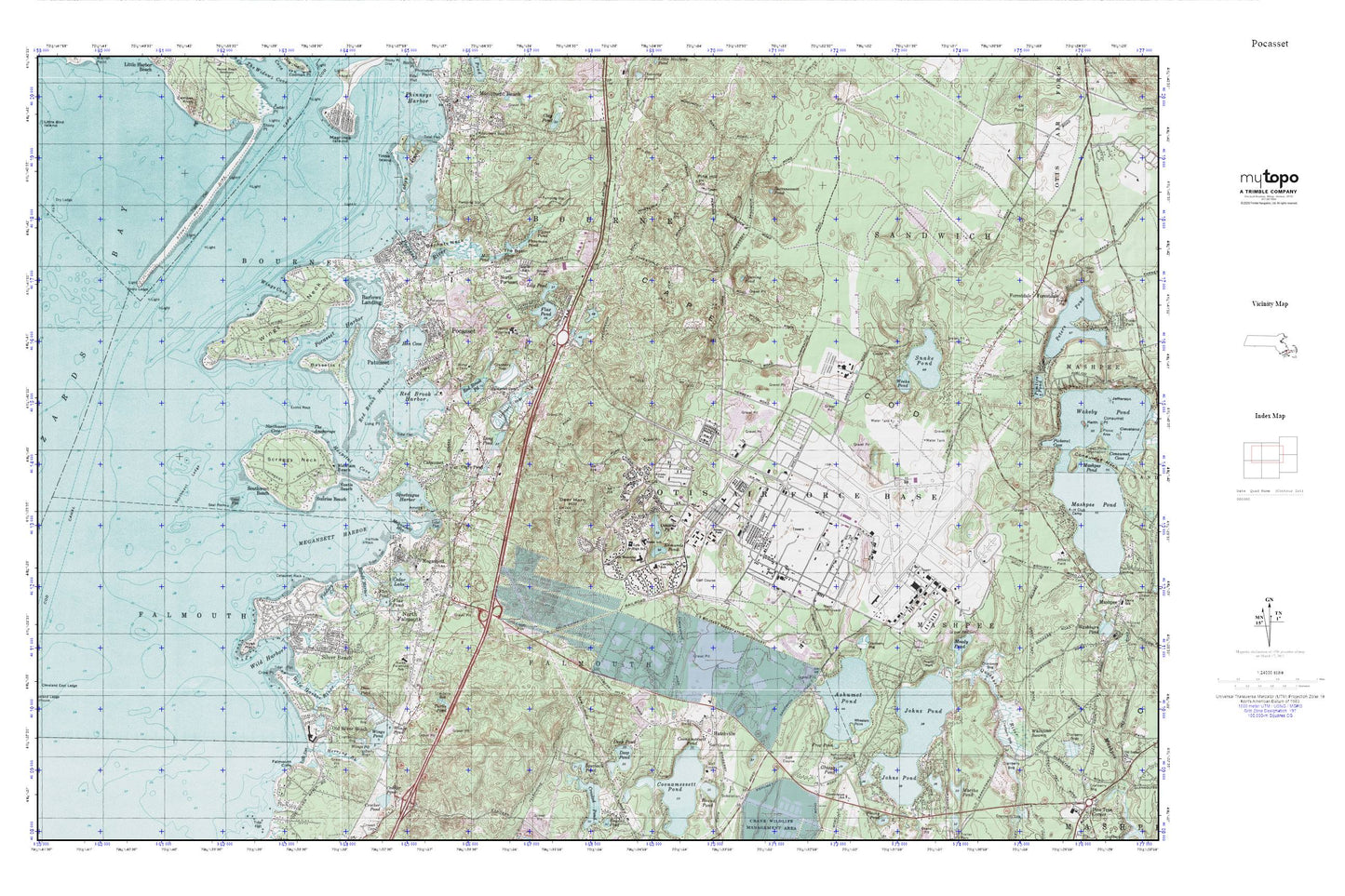
Topographic map of Pocasset in the state of Massachusetts. From the MyTopo Explorer Series.
This topo map features shaded relief and comes with UTM / MGRS and Latitude/Longitude grids.
For more than two decades, MyTopo has provided maps to the most adventurous among us.. those who love to explore our nation’s remote wilderness areas, climb our highest peaks, and trek across our vast public lands. This map is part of a curated collection of the most popular places for which MyTopo customers have designed maps. It is a “bucket list” of the most amazing places to hike, hunt, and explore.
This map contains the following named places: 02534,02542,02553,02556,02559,02644,Abiels Ledge,Amrita,Amrita Island,Ashimuit,Ashumet Holl Reservation,Ashumet Pond,Ballymeade Golf Course,Barlows Landing,Barnstable County Hospital,Barnstable County Sheriff's Office,Bassetts Island,Beaton Bog,Bennets Neck,Bourne Fire Department Station 4,Camp Edwards,Camp Edwards Heliport,Camp Goodwill,Campbell School,Cape Cod Coast Guard Air Station,Cataumet,Cataumet Cemetery,Cataumet Methodist Church,Cataumet Pier,Cataumet Post Office,Cataumet Rock,Cataumet Station,Cedar Lake,Cleveland Ledge Channel,Cleveland Ledge Channel Range Light,Coast Guard Air Station Cape Cod,Colonel James P Lyle Middle School,Crow Point,Cuffs Pond,Dam Pond,Deep Pond,Deer Horn Hill,Edmunds Pond,Edward C Stone Middle School,Eustis Beach,Eustis Rock,Falmouth Cliffs,Falmouth Fire Station 3,Fiddlers Cove,Flax Pond,Forestdale Census Designated Place,Freeman Pond,Frog Pond,General Leonard Wood Homestead,Grassy Pond,Half Tide Rock,Handy Point,Hatchville,Hen Cove,Herring Brook,Hog Island Channel,Hospital Cove,James Pond,Jenkins Pond,Johns Pond,Lawrence Island,Lily Pond,Lily Pond Bog,Little Long Pond,Long Point,Long Pond,Martha Pond,Massachusetts Military Reservation,Massachusetts National Cemetery,Megansett,Megansett Harbor,Merriam Beach,Mill Pond,Moody Pond,North Falmouth,North Falmouth Census Designated Place,North Falmouth Elementary School,North Falmouth Post Office,North Falmouth Station,North Pocasset,Northwest Cove,Nyes Neck,Old Silver Beach,Opening Pond,Osborne Pond,Otis Memorial School,Patuisset,Phinneys Harbor Channel Light,Pine Hill,Pocasset,Pocasset Census Designated Place,Pocasset Golf Club,Pocasset Harbor,Pocasset Iron Works,Pocasset Post Office,Pocasset River,Pocasset Station,Pocosset River,Pucasset River Marshes,Rands Harbor,Red Brook,Red Brook Harbor,Red Brook Pond,Red Brook Pond Dam,Scraggy Neck,Seal Rocks,Shop Pond,Silver Beach,Silver Beach Harbor,Snake Pond,Snake Pond Beach,South Pocasset,Southwest Beach,Southwest Ledge,Spectacle Pond,Squeteague Harbor,Stony Point Dike,Succonnessett Pond,Sunrise Beach,Tahanto Beach,The Anchorage,The Basin,Tim Pond,Tobys Island,Trout Pond,Turtle Pond,Upper Pond,US Coast Guard Morale Well-Being and Recreation Library,Weeks Pond,Wenaumet Station,Wheelers Point,Wild Harbor,Wild Harbor River,Wings Cove,Wings Cove Marshes,Wings Neck,Wings Neck Lighthouse,Wings Pond