MyTopo
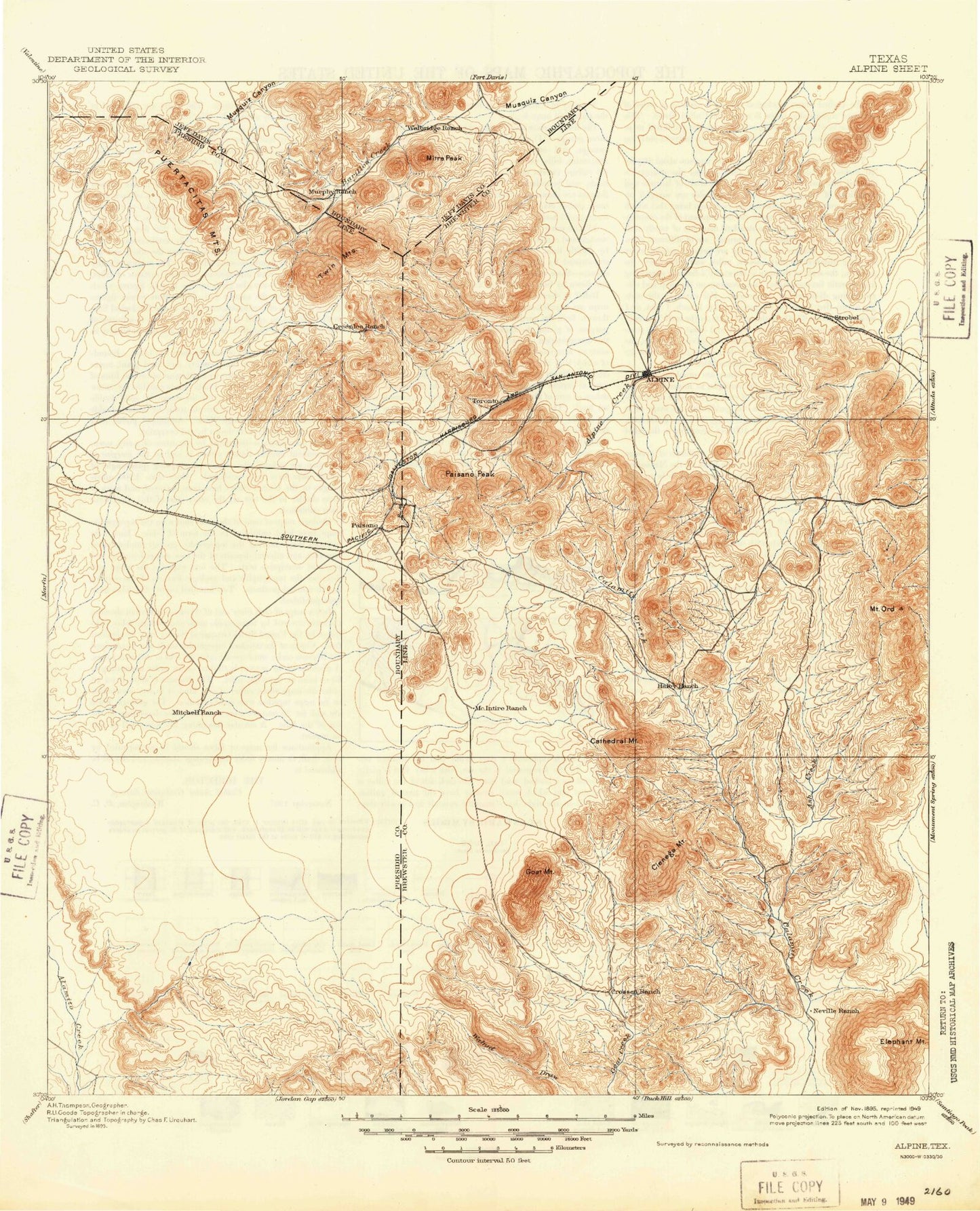
Historic 1895 Alpine Texas 30'x30' Topo Map
Couldn't load pickup availability
Historical USGS topographic map of Alpine in the state of Texas. Scale: 1:125000. Print size: 17" x 24"
This map was published in 1895 and is in the following counties: Brewster, Jeff Davis, Presidio.
The map contains contour lines, roads, rivers, towns, streams, and lakes. Printed on high-quality waterproof paper with UV fade-resistant inks.
Contains the following named places: Alpine Hill, Baylor Tank, Bear Canyon, Big Hill, Bird Mountain, Black Peaks, Catto Tank, Cienega Creek, Cienega Mountain, Crenshaw Mountain, Crenshaw Tank, Deer Lick Draw, Elephant Mountain, Goat Mountain, Good Tank, Good Tank Draw, Hancock Hill, Jackson Field, Kokernot Municipal Park, L-H Draw, Lizard Mountain, Long Draw, McIntyre Creek, Mount Ord, Nopal Ranch, Orphan Hill, Paisano, Paisano Encampment, Paisano Pass, Paisano Peak, Perdiz Creek, Ranger Peak, Red Haw Draw, Short Draw, Smith Peak, Stockton Canyon, Sunny Glen Tank, Sunny Glen Windmill, W-Bar Tank, Wilson Canyon, Antelope Peak, Barillos Creek, Box Canyon, Castle Rock, Cone Mountain, Copeland Tank, Elam Mountain, Emerson Draw, Franks Canyon, Mano Prieto Mountain, Merriweather Ranch, Mitre Peak, Mitre Peak Camp, Pine Canyon, Pinon Canyon, Puertacitas Mountains, Ramirez Tank, Twin Mountains, Hill Creek, Moss Creek, Ponder Draw, Ramsey Draw, Sunny Glen, Toronto, Titley, Sheep Creek, Chambers Draw, Colquitt Draw, Cathedral Mountain, Twin Sisters, House Mountain, Alpine, The Haystack, Bird Mine, Marble Mine, Marble Mountain, Haley Ranch, Haleys Peak, Titley, Stroebel, Nopal, Marfa Municipal Golf Course, Paisano Creek, Tinaja, Long Draw, Mount Ord Basin, Pete P Gallego Center, Graves Pierce Complex, Kokernot Baseball Park, Elephant Mountain Wildlife Management Area, Baines Park, Kokernot Park, Shipman Park, New Town Park, Eagle Peak, Open Mine Hill, Hidden Valley, Bird Creek, Bird Hills, Panther Hole, Ash Creek, Torvea Canyon, Crossen Mesa, Nevill Mesa, City of Alpine, McIntyre Peak, Terry Mesa, Robbers Roost Canyon, Joe Williams Draw, Willow Canyon