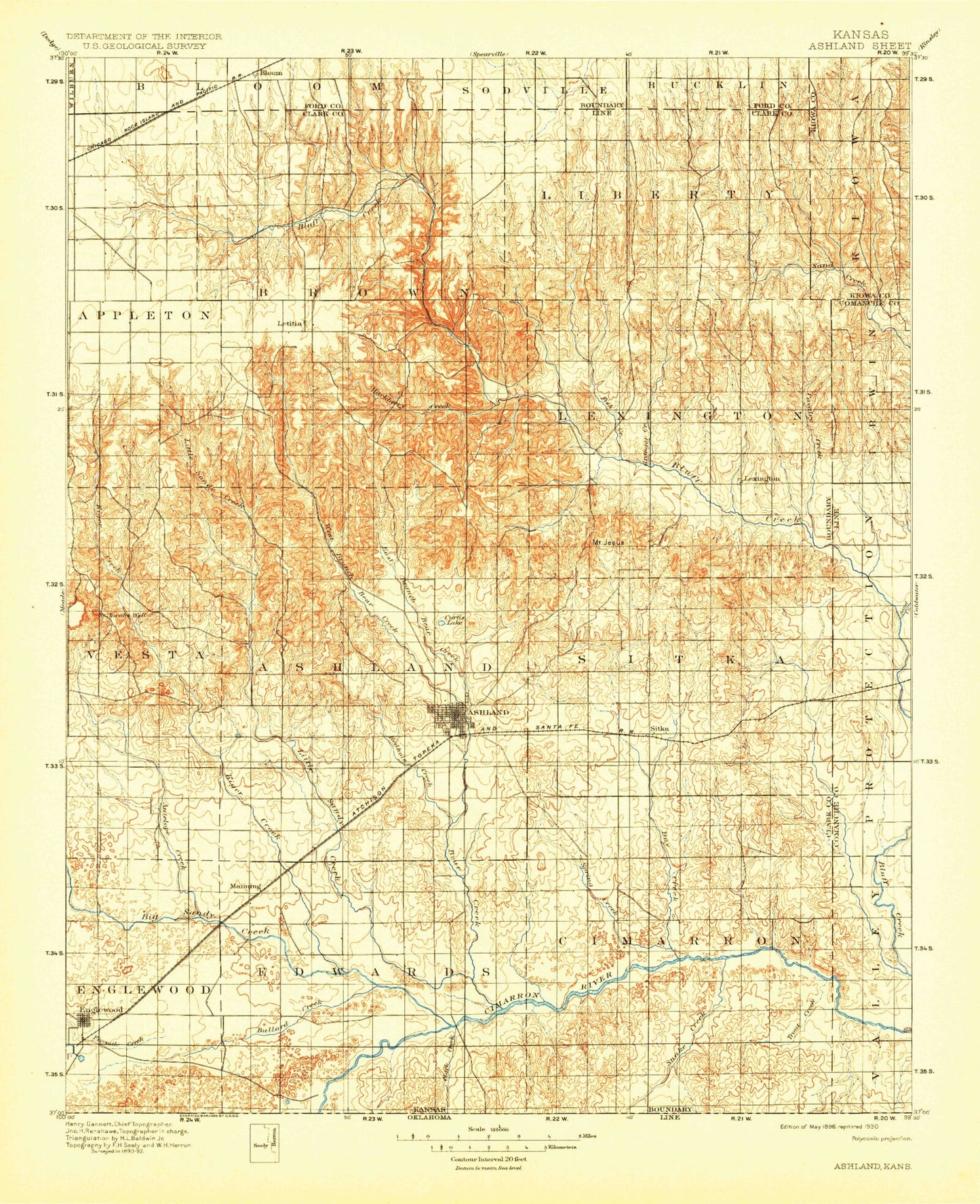
MyTopo
Historic 1896 Ashland Kansas 30'x30' Topo Map
Couldn't load pickup availability
Historical USGS topographic map of Ashlandin the states of Kansas, Oklahoma. Scale: 1:125000. Print size: 17" x 24"
This map was published in 1896 and is in the following counties: Clark, Comanche, Ford, Harper, Kiowa.
The map contains contour lines, roads, rivers, towns, streams, and lakes. Printed on high-quality waterproof paper with UV fade-resistant inks.
Contains the following named places: Bloom, Brites Creek, Simmons Creek, Hargis Creek, Clark County State Lake, Township of Liberty, Little Turkey Creek, Turkey Creek, Sand Creek, Sugarloaf, Township of Appleton, Hackberry Creek, Cat Creek, Fish Creek, Granger Creek, Mount Lookout, Mount Jesus, Cavalry Creek, Nichols Creek, Lone Tree Creek, Township of Lexington, Beckys Knob, Big Basin, Little Basin, Mount Casino, Ashland Oil Field, West Branch Bear Creek, East Branch Bear Creek, Ashland, Redhole Creek, Casino Creek, Sugarloaf, Buzzard Creek, Little Sandy Creek, Perry Lake, Acres, Blue Hole, Antelope Creek, Fivemile Creek, Township of Englewood, Clark Creek, Spring Creek, Keiger Creek, Stink Creek, Bullard Creek, Englewood, Redoubt Creek, Big Sandy Creek, Township of Center, Bear Creek, Spring Creek, Township of Sitka, Trout, Day Creek, Snake Creek, Willow Creek, Clark State Fishing Lake and Wildlife Area, Clark County Fairgrounds, Clark County State Lake Dam, Lexington, Sitka, Clark County, Ashland Country Club, Mount Nebo, City of Ashland, City of Englewood, Ashland Wastewater Treatment Facility, Ashland Municipal Power Plant, Englewood Wastewater Treatment Facility, Minneola Co - Operative Grain Elevator Number 2, Farmers Co - Operative Grain Elevator Number 2, Farmers Co - Operative Grain Elevator Number 5, Clark Creek, Bullard Creek, Redoubt Creek, Snake Creek, Willow Creek