MyTopo
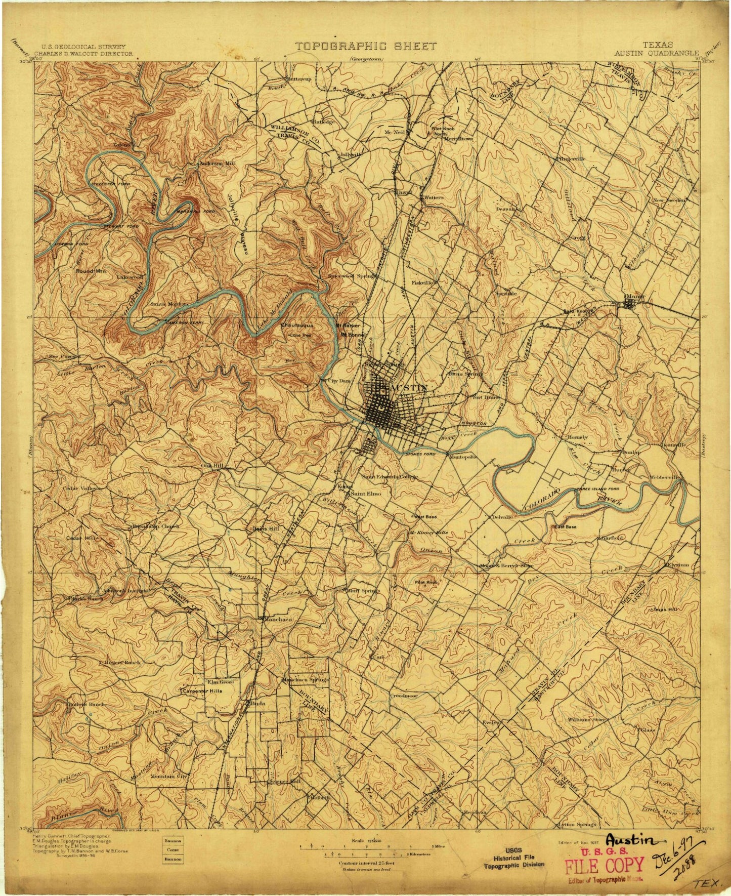
Historic 1897 Austin Texas 30'x30' Topo Map
Couldn't load pickup availability
Historical USGS topographic map of Austin in the state of Texas. Scale: 1:125000. Print size: 17" x 24"
This map was published in 1897 and is in the following counties: Bastrop, Caldwell, Hays, Travis, Williamson.
The map contains contour lines, roads, rivers, towns, streams, and lakes. Printed on high-quality waterproof paper with UV fade-resistant inks.
Contains the following named places: Abercrombie, Andrews Branch, Bailey Park, Barber Falls, Mount Barker, Bartholomew Park, Barton Hill, Bee Cave, Bee Creek, Boggy Creek, Bohls Hollow, Mount Bonnell, Buck Hollow, Buda, Bunton Overpass, Butler Park, Camp Tom Wooten, Capital Plaza Shopping Center, Carl, Carpenter Hills, Cat Mountain, Cedar Creek, Cedar Hollow, Chalk Knob, Chalk Knob Hollow, Coldwater Creek, Connors Creek, Covert Park, Creedmoor, Decker, Decker Creek, Walter E. Long Lake, Deep Eddy Park, Disch Field, Dittmar Hill, Dry Creek, East Avenue Park, Eastwoods Park, Elm Creek, Elroy, Elroy Oil Field, Farris Ranch, Flint Rock Hill, Friday Mountain, Garfield, Givens Park, Govalle Playground, Govalle Shopping Center, Grape Creek, Greenshores, Gregg Ranch, Halifax Creek, Halifax Ranch, Hancock Creek, Hancock Shopping Center, Harrison Hollow, Hebbingston Hollow, Heissner Ranch, Hemphill Park, Hickson Hollow, Hog Pen Creek, Holman Hollow, Honey Creek, Hoskins Ranch, Hucks Slough, Hunter Bend, Hurst Creek, Iglehart, Johnson Branch, Koenig Ranch, Kuykendall Ranch, Lake Austin Metropolitan, Lakeland Park, Lakeway, Lamar Plaza Shopping Center, Limekiln Branch, Little Barton Creek, Little Bee Creek, Long Branch, Long Hollow, Lytton Springs, Lytton Springs Creek, Manor, Maul Hill, Metz Park, Michaelis Ranch, Mount Larson, Mouse Park, Mustang Branch, Myrtle Creek, New Katy, Niederwald, North Village Shopping Center, Northwest Park, Onion Creek Lodge, Owl Hollow, Palm Playground, Pan American Playground, Panorama Ranch, Patterson Park, Pease Park, Perry Park, Pershing, Phillips Ranch, Ramsey Playground, Red Bud, Reed Park, Richmond Branch, Rim Rock Trail, River Hills, Rocky Creek, Rollingwood, Rosewood Park, Round Mountain, Ruby Ranch, Rutherford Ranch, Saint Marys Community Center, Sawyer Ranch, Science Hall, Shield Ranch, Shipe Playground, Short Spring Branch, Signal Hill, Signal Hill Ranch, Spillar Ranch, Spillman Hollow, Spring Hollow, Tannehill Branch, Thomas Springs Branch, Tom Miller Dam, Trigg Lake, Turkey Creek, Waller Creek, Webberville, West Austin Park, West Lake Hills, Westenfield Park, White Branch, Woods Hill, Wooldridge Park, Yaupon Creek, Yorks Creek, Zargosa Park, Zilker Park, Anderson Bend, Arkansas Bend, Arrowhead Point, Bald Mountain, Barrel Hollow, Beacon Cove, Bear Creek, Buffalo Gap, Bullick Hollow, Buttercup Creek, Calcasieu Point, Collier Hollow, Comanche Peak, Cottonwood Creek, Cottonwood Hollows, Cox Hollow, Coxville, Cunningham Cove, Cypress Creek, Cypress Creek Arm, Defeat Hollow, Devils Hollow, Edgewater Beach, Eubank Acres, Fisher Hollow, Four Points, Gragg Hollow, Graveyard Point, Gun Hollow, Hatter Cove, Hudson Bend, Idyle Hour Acres, Jollyville, Jonestown, Kings Village, Lago Vista, Lakeshore Ranch, Lime Creek, Little Devils Hollow, Long Hollow, Long Hollow, Macks Canyon, Mansfield Dam, Marshall Ford, Martin Hill, McNeil, Mossy Hollow, North Shore Acres, Pecan Park, Pflugerville, Pond Springs, Pool Point, Rattan Creek, Sandy Creek Arm, South Jonestown Hills, Starnes Island, Tar Branch, Three Points, Three Points, Volente, Walnut Creek Metropolitan Park, Walnut Forest, Waters Park, Wells Branch, West Beach Cove, Windy Point, A F Siding, Lake Austin, Barton Creek, Bear Creek, Big Stacy Park, Bluff Springs, Blunn Creek, Boggy Creek, Bull Creek, Carson Creek, Cedar Valley, Civitan Park, Cluck Creek, Cottonmouth Creek, Country Club Creek, Cow Fork, Davis Hill, Davis Spring Branch, Del Valle, East Bouldin Creek, Elm Waterhole, Fiesta Gardens, Ford Oaks, Ganzert Lake, Garlic Creek, Gilleland Creek


