MyTopo
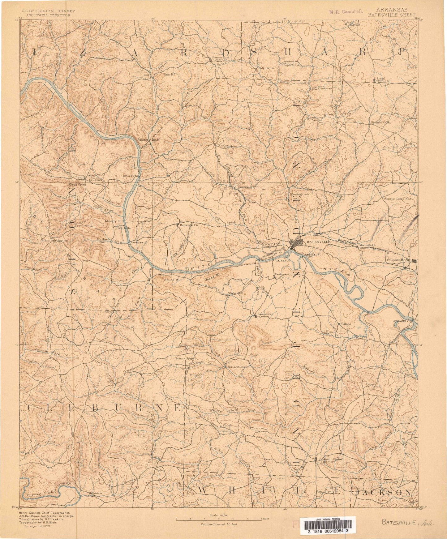
Historic 1890 Batesville Arkansas 30'x30' Topo Map
Couldn't load pickup availability
Historical USGS topographic map of Batesville in the state of Arkansas. Scale: 1:125000. Print size: 16" x 24"
This map was published in 1890 and is in the following counties: Cleburne, Independence, Izard, Jackson, Sharp, Stone, White.
The map contains contour lines, roads, rivers, towns, streams, and lakes. Printed on high-quality waterproof paper with UV fade-resistant inks.
Contains the following named places: Barren Fork, Fletcher Branch, Abrams Branch, Adler Hollow, Alder Creek, Alder Creek, Alderbrook Branch, Arnold Hollow, Aydelotte Washer, Bailey Brooks Branch, Bailey Creek, Bailey Falls, Bailey Hollow, Bailey Mountain, Basket Creek, Batesville Shoal, Baxter Hill, Bear Ridge, Beatty Hollow, Beckman Hollow, Beech Island, Ben Frank Hollow, Berry Branch, Berry Hollow, Betsey Gill Creek, Big Creek, Big Hollow, Big Hollow, Bill Hill, Blackground Hollow, Blowing Cave Creek, Blue Hole Branch, Blue Hole Hollow, Blue Ridge, Blue Spring Branch, Bracy Mountain, Brier Creek, Brock Mountain, Brown Creek, Brush Island, Brushy Branch, Bryant Hollow, Buckalew Hill, Buffalo Creek, Bullock Branch, Burton Point, Buzzard Roost Hollow, Byler Branch, Camp Crossed Arrows, Camp Tahkodah, Campbell Hollow, Caney Creek, Caney Creek, Canoe Creek, Carr Hollow, Cason Mine, Cave Creek, Cave Hollow, Cedar Branch, Cedar Creek, Chalybeate Spring Creek, Chapel Creek, Chappel Hollow, Chastain Springs Branch, Chimney Rocks, Chinquapin Creek, Churchill Ridge, Clark Hollow, Clubhouse Spring Branch, Colley Branch, Concord, Conditt Hollow, Cookfield Branch, Coon Creek, Coon Creek, Cooper Cane Creek, Cooper Hollow, Crane Hollow, Crosby Hollow, Cushman, Cypert Mountain, Dam Site Recreation Area, Dan Hollow, Dave Green Hollow, Davidson Hollow, Davis Mountain, Deer Lick Hollow, Deer Lick Woods, Dennison Bottoms, Dill Branch, Dilliner Hollow, Dishwater Branch, Dodd Branch, Dog Lick Branch, Dokken Hollow, Double Branch, Douglas Hollow, Dry Creek, Dry Creek, Dry Fork, Dry Hollow, Dry Hollow, Duck River, Dugger Spring Hollow, Duggle Hollow, Eagle Mountain, Earnheart Island, East Lafferty Creek, East Rocky Bayou, Ed Taylor Hollow, Egard Hollow, Elbow Creek, Fallen Ash Creek, Fitzhugh Park, Five Branch, Fort Mountain, Fortune Point, Foster Hollow, Foushee Island, Foushee Slough, Fulbright Hill, Fulk Hollow, George Hollow, Glenn Creek, Glenn Slough, Goat Den, Goodie Creek, Goodwin Slough, Grady Camp, Grassy Creek, Gravel Creek, Gray Hollow, Greenbrier Creek, Grooms Hollow, Groove Hollow, Guion Park, Gum Hollow, Gypsum Hollow, Hackley Branch, Haley Fort Mountain, Halsey Hollow, Haney Hollow, Hankins Hollow, Harmon Creek, Hawkins Ridge, Helm Hollow, Henderson Hollow, Hidden Creek, Hills Hill, Holliman Branch, Holly Branch, Hook Hollow, Howl Hollow, Hub Chute Hollow, Hurricane Hollow, Hutchinson, Ida, Inman Creek, Iron Spring Hollow, Ivy Hollow, Jackson Creek, Jamestown Creek, Jamestown Mountain, Jesse Pines, John Dowell Hill, Johnson Branch, Johnson Hollow, Jones Bottom, Kettle Hollow, Kingston Branch, Kinsey Creek, Kirkland Creek, Knights Cove, Knights Cove Creek, Kyler Creek, Ladd Branch, Lafferty Creek, Lafferty Hollow, Latch Hollow, Liberty Creek, Lick Fork, Lickin Hollow, Little Bayou, Locust Grove, Logan Hollow, Logan Point, Long Branch, Love Hollow, Low Gap, Low Gap, Luster Island, Macedonia Creek, Macedonia Hollow, Massey Creek, Massey Hollow, McBride Mines, McCarty Ridge, McCoy Branch, McDermon Hollow, McGee Point, McIntosh Branch Big Creek, Midway, Mike Hollow, Mill Creek, Mill Hollow, Miller Creek, Miller Prong, Mills Hollow, Mitchell Branch, Modlin Hollow, Moffett Hollow, Montgomery Branch, Montgomery Mine, Moore Hollow, Moorefield, Moorefield Creek, Mose Mountain, Muddy Branch, Mulligan Hollow, Mundy Point, Murray Branch, Neal Mountain, Ned Hollow, Nelson Ridge, Negro Hill, North Holly Branch, Nubbin Ridge, O'Neal Creek, Ogan Hollow, Old River, Owl Hollow, Palmer Hollow, Pat Hollow, Pentecost Hollow, Peter Martin Hill, Pilgrim Hollow


