MyTopo
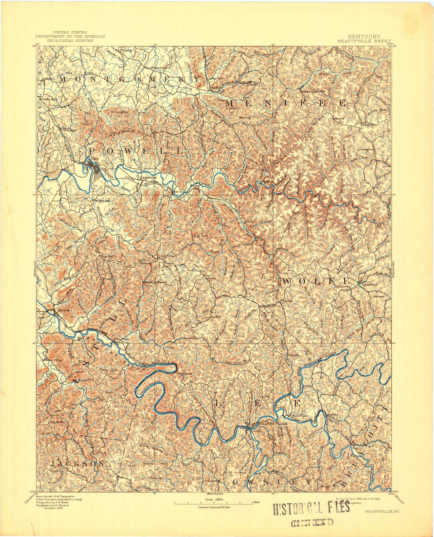
Historic 1892 Beattyville Kentucky 30'x30' Topo Map
Couldn't load pickup availability
Historical USGS topographic map of Beattyville in the state of Kentucky. Scale: 1:125000. Print size: 17" x 24"
This map was published in 1892 and is in the following counties: Bath, Breathitt, Clark, Estill, Jackson, Lee, Menifee, Montgomery, Morgan, Owsley, Powell, Wolfe.
The map contains contour lines, roads, rivers, towns, streams, and lakes. Printed on high-quality waterproof paper with UV fade-resistant inks.
Contains the following named places: Anvil Knob, Barlow Ridge, Bean Fork, Bear Creek, Beginning Branch, Bowles Branch, Bowling Fork, Bowman Branch, Brewer Fork, Bryant Creek, Camargo, Camp McKee Boy Scout Reservation, Canyon Falls, Chapmans Fork, Clover Branch, Coal Branch, Combs Branch, Cooperas Creek, Cope Branch, Cream Alley Branch, Douglas Point, Falls Branch, Ficklin Knob, Grape Knob, Gravel Knob, Hog Creek, Hollywood Springs, Horseshoe Bend, Indian Fields, Keen Fork, Kiddville, Kit Point, Lick Creek, Little Bear Creek, Little Rock Lick Creek, Lower Twin Creek, Lynam Creek, Mary Jane Mountain, Mill Creek, Mud Tunnel, North Branch Lulbegrud Creek, Oil Springs, Indian Old Fields, Pilot Knob, Potato Knob, Puncheon Camp Creek, Rotten Point, Sage Point, Silvermine Arch, Spencer Bend, Toler Mountain, Tyler Tunnel, Upper Twin Creek, Ware Point, Westbend, Westbrook Mountain, White Rock Mountain, White Rock Quarry, Wildcat Knob, Wolfpen Branch, Still House Branch, Hardwicks Branch, Dry Branch, Brushy Lick Fork, Athol, Copebranch, Fillmore, Jetts Creek, Levee, Lone, Monica, Oakdale, Primrose, Tallega, Vada, Virden, Widecreek, Williba, Flat Rock Branch, Mill Seat Branch, Red Lick Creek, Abner Hollow, Adams Creek, Airedale, Alcorn Branch, Alexander Branch, Allen Hollow, Alumbaugh, Amburgy Hollow, Anders Branch, Anderson Branch, Angel Windows, Armine Branch, Arvel, Ash Ground Branch, Ash Gut Branch, Auger Hole Branch, Auxier Branch, Auxier Branch Trail, Auxier Ridge, Auxier Ridge Trail, Balanced Rock, Bald Rock Fork, Ballard Branch, Banks Branch, Barker Branch, Barker Rockhouse Branch, Barnes Mountain, Barnett Branch, Battleship Rock, Bean Branch, Bear Branch, Bear Branch, Bear Branch, Bear Hollow, Bear Pen Creek, Bearpen Branch, Bearpen Branch, Beattyville, Becky Jane Hollow, Bee Branch, Beech Fork, Beech Stand Fork, Bell Branch, Belle Point, Bet Cash Branch, Betsy Ridge, Betty Gap Ridge, Big Amos Creek, Big Andy Ridge, Big Bend Ridge, Big Branch, Big Calaboose Creek, Big Cordual Branch, Big Doe Creek, Big Oak Hollow, Big Round Mountain, Big Sinking Creek, Big Stonecoal Branch, Billey Fork, Bird Branch, Black Creek, Black John Creek, Blackburn Branch, Blackinghouse Branch, Blackstand Branch, Blaines Branch, Blankey Branch, Blevins Hollow, Bloody Creek, Blythes Branch, Board Cut Branch, Boling Branch, Boone Branch, Boonesboro Fork, Booth, Booth Ridge, Botts Fork, Bowen, Bowen Hollow, Bowen Ridge, Bowman Fork, Boyd Hollow, Branham Branch, Brewer Hollow, Brier Branch, Browns Branch, Brush Creek, Brush Creek, Brushy Fork, Brushy Mountain, Buck Creek, Buck Lick Branch, Buck Trail, Buckner Branch, Bull Fork, Buzzard Roost, Cain Branch, Camp Branch, Camp Branch, Campbell Creek, Campton, Campton Lake, Cane Branch, Cane Creek, Caney Fork, Castle Arch, Cat Creek, Cavanaugh Creek, Cave Branch, Cave Branch, Cave Branch, Cave Branch, Cave Branch, Cave Hollow, Caves Fork, Cedar House Hollow, Cedar Knob, Cedar Point Ridge, Chamberlain Branch, Chester Creek, Chestnut Log Branch, Chimney Rocks, Chimney Top Creek, Chimney Top Rock, Chop Chestnut Ridge, Clay City, Clay Lick Branch, Clear Branch, Clear Creek, Clem Branch, Clifty Creek, Cloud Splitter, Coalbank Hollow, Cobhill, Cold Oak Hollow, Cold Spring Branch, Cold Spring Hollow, Coldiron Fork, Combs Branch, Combs Ridge, Commissary Branch, Congleton, Congleton Mountain, Contrary Creek, Cooks Branch, Cooperas Cave Branch, Copperas Creek, Corner Ridge, Cornwell, Cornwell Branch, Courthouse Rock, Courthouse Rock Trail, Cow Creek, Cow Creek, Cow Hoof Branch


