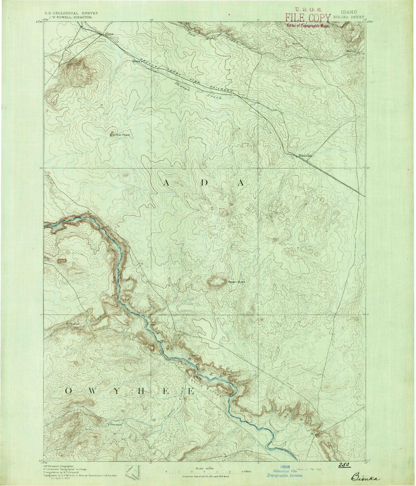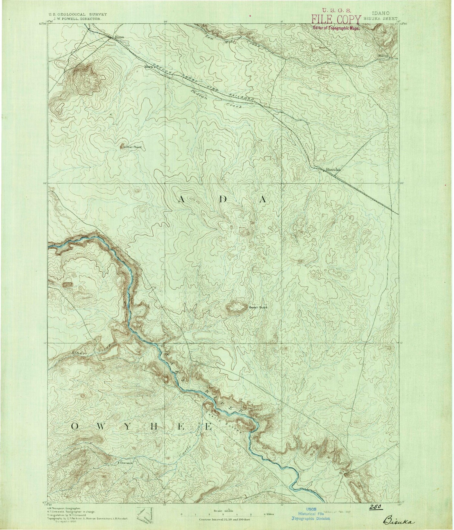
MyTopo
Historic 1892 Bisuka Idaho 30'x30' Topo Map
Couldn't load pickup availability
Historical USGS topographic map of Bisuka in the state of Idaho. Scale: 1:125000. Print size: 17" x 24"
This map was published in 1892 and is in the following counties: Ada, Canyon, Elmore, Owyhee.
The map contains contour lines, roads, rivers, towns, streams, and lakes. Printed on high-quality waterproof paper with UV fade-resistant inks.
Contains the following named places: Catherine Creek, Bates Creek, Benton Lateral, Birch Creek, Black Butte, Bonneville Point, Castle Creek, Christmas Mountain, Coyote Butte, East Fork Golden Gulch Drain, Gabica Ranch, Henderson Flats, Hubbard Lateral, Initial Point, Jack Creek, Jackass Butte, Leonard Lateral, Little Joe Butte, McClenagan Lateral, McKeeth Wash, Middle Line Canal, Montini Ranch, Mora Canal, North Indian Creek, Otter Massacre Site, Priest Ranch, Rye Patch, Sinker Butte, Sinker Creek Butte, South Railroad Lateral, Tadpole Lake, Teed Lateral, Van Duzer Lateral, Wind Butte, Wind Butte Lakes, Sand Creek, Big Foot Bar, Bonus Cove Ranch, Chattin Flat, Corder Creek, Hart Creek, Kuna Butte, Little Hart Creek, Rabbit Creek, Swan Falls, Bonneville Point Historical Site, Idaho State Correctional Institution, Oregon Trail - South Alternate, Trueblood Wildlife Area, Bryans Run, Sand Hollow, Ada County, Cloudburst Wash, Cloudburst Gulch, Cloudburst Wash, Pickett Creek, Blacks Creek, Bowns Creek, Castle Butte, Chattin Hill, Garbutt Wash, Dorsey Butte, Flagstaff Butte, Fossil Butte, Kuna, Leone, Mora, Morgan Place, New York Canal, Orchard, Oreana, Owyhee, Pleasant Valley, Blacks Creek Reservoir, Browns Creek, Foremans Reservoir, Fossil Creek, Halverson Lake, Indian Creek Reservoir, Murphy Flat, Vinson Wash, Wild Horse Butte, Sinker Creek, Pacific Land Company Dam, Swan Falls Dam, Foreman Dam, Nicholson Dam, Orchard Dam, Blacks Creek Dam, Blacks Creek, Hickey, Ted Trueblood Wildlife Habitat Area, Big Foot Butte, Thomas Flats, Snake River Bird of Prey Natural Area, Blacks Creek Rifle Range, Indian Creek Reservoir Public Fishing Area, Orchard Division, City of Kuna, Hobbs Lateral, Hogue Lateral, King Lateral, Jacobs Lateral