MyTopo
Historic 1911 Blackfoot Montana 30'x30' Topo Map
Couldn't load pickup availability
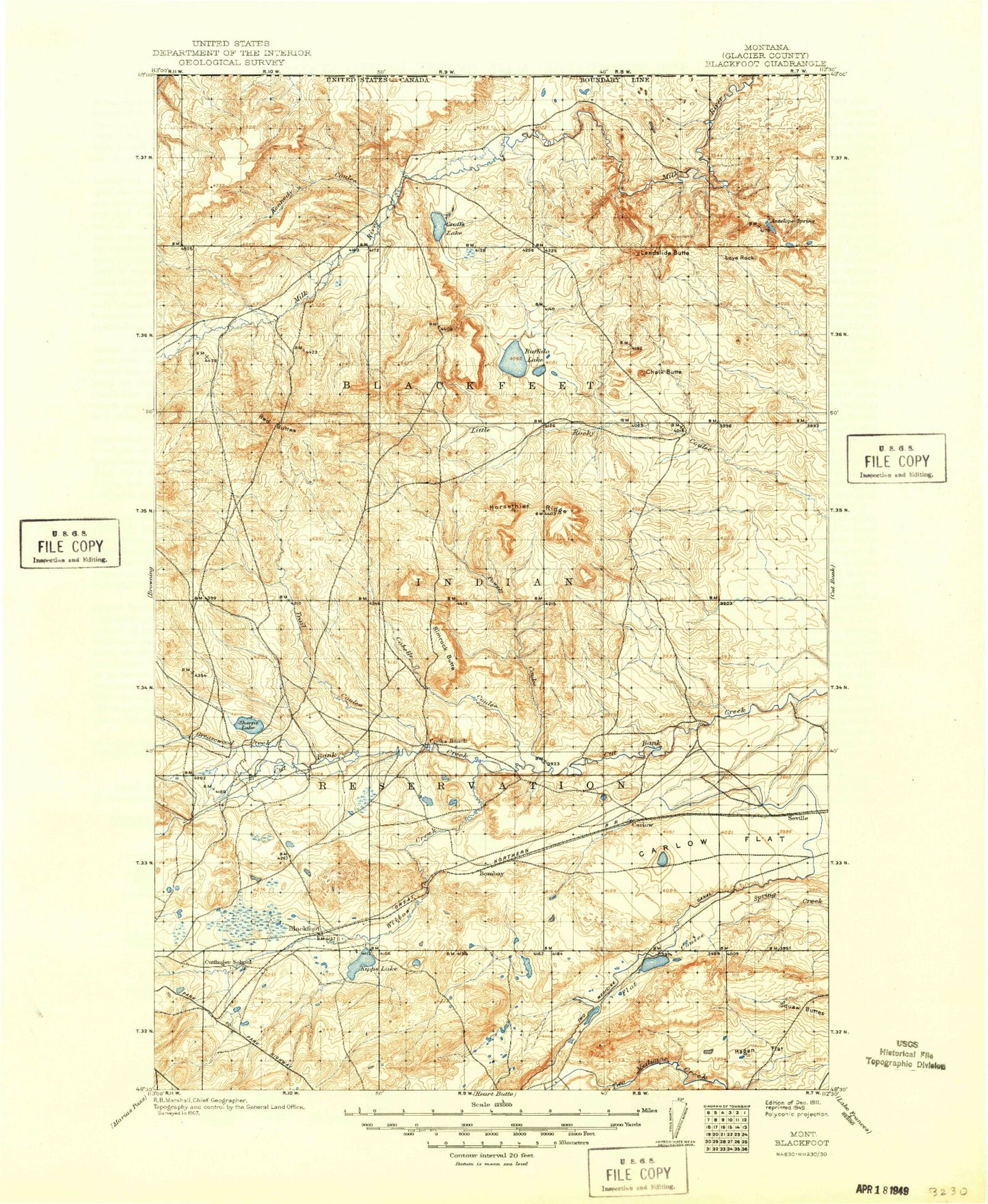
Historical USGS topographic map of Blackfoot in the state of Montana. Scale: 1:125000. Print size: 18" x 24"
This map was published in 1911 and is in the following counties: Glacier.
The map contains contour lines, roads, rivers, towns, streams, and lakes. Printed on high-quality waterproof paper with UV fade-resistant inks.
Contains the following named places: Bish Coulee, Carlow Lake, Coal Bank Coulee, Cobell Coulee, Croffs Lake, Cut Bank John Coulee, Del Bonita, Depot Creek, Eagle Point, Flatiron Creek, Greasewood Creek, Guardipee Lake, Hagan Flat, Hoodoo Coulee, Kennedy Coulee, Kipp Lake, Kittson Coulee, Lamott Springs, Landslide Butte, Love Rock, Meriwether, Mission Lake, Nightshoot Coulee, North Fork Greasewood Creek, Pardue Elevator, Powell Coulee, Q Lateral, Reagan Camp, Reagan Camp Oil Field, Red Buttes, Rimrock Butte, Rimrock Ranch, Rocky Buttes, Seville Flat, Sharp Lake, South Fork Greasewood Creek, Square Butte, Duckhead Buttes, Sundance, Trail Coulee, Two Medicine Main Canal, Upper Mission Lake, Wasteway Coulee, Branderval Ranch, Buffalo Lake, Chalk Butte, Gillam Coulee, Little Buffalo Lake, Little Crown Butte, Willow Creek, Fort Piegan, Mission Lake Dam, Kipp Lake Dam, Reagan Lake Dam, Sunny Mountains Dam, Vigor Dam, Pish Dam, Antelope Butte, Blackfoot, Bushnell Hill, Horsethief Ridge, Blackfeet Indian Reservation, Glacier County, Seville Colony, Blackfoot, Big Sky Colony, Hidden Lake Colony, Glendale Colony, Aubery Lake, Camp Disappointment Historical Marker, Port of Del Bonita, Blackfeet Reservation Division