MyTopo
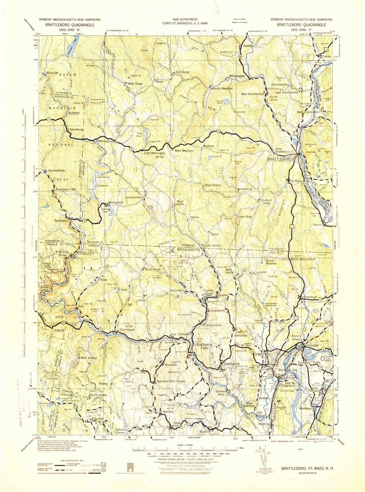
Historic 1943 Brattleboro Vermont 30'x30' Topo Map
Couldn't load pickup availability
Historical USGS topographic map of Brattleboro in the state of Vermont. Scale: 1:125000. Print size: 16" x 24"
This map was published in 1943 and is in the following counties: Bennington, Berkshire, Cheshire, Franklin, Hampshire, Windham.
The map contains contour lines, roads, rivers, towns, streams, and lakes. Printed on high-quality waterproof paper with UV fade-resistant inks.
Contains the following named places: Dunbar Brook, Sherman Reservoir, Wheeler Brook, Windsor Pond, Borden Brook, Phillips Hill, Sanders Brook, Shattuck Brook, West Brook, Fall River, East Branch North River, West Branch Brook, Green River, Keets Brook, Marlboro Branch, Ames Hill, Ames Hill Brook, Amidon Pinnacle, Bear Hill, Beaver Brook, Belden Hill, Black Mountain, Blue Mountain, Branch Brook, Brattleboro, Broad Brook, Brown Brook, Burton Brook, Canoe Brook, Central Mountain, Central Park Station, Charles Hill, Chase Hill, Clark Hill, Cyrus Brook, Deer Hill, Deer Park, Dummerston Center, Dummerston Hill, Dutton Pines State Forest Park, East Dummerston, East Mountain, Fall Brook, Fowler Brook, French Hill, Gallup Pinnacle, Gates Pond, Ginseng Hill, Governors Mountain, Grassy Brook, Green River, Guilford, Guilford Center, Gulf Brook, Hager Brook, Halifax, Halladay Brook, Harrisville, Harrisville Brook, Hidden Lake, Hinesburg Brook, Hogback Mountain, Hosley Hill, Jacksonville, Jacksonville Pond, Jolly Mountain, Joy Brook, Kathan Meadows, Kenny Pond, Laurel Lake, Lily Pond, Lyman Hill, Marlboro, Mill Brook, Molly Stark State Forest, Naulahka, Newfane, Newfane Hill, North Vernon, Olden Ledges, Mount Olga, Oregon Mountain, Owls Head Mountain, Packer Corner, Panel Hill, Pease Brook, Pleasant Valley Reservoir, Pond Brook, Prospect Hill, Prospect Hill, Pulpit Mountain, Putney, Putney Station, Randall Brook, Richardson Mountain, Roaring Brook, Roaring Brook, Round Mountain, Ryder Pond, Sacketts Brook, Salmon Brook, Shatluck Brook, Shippee Pond, South Newfane, South Pond, Sperry Brook, Sprague Brook, Stickney Brook, Stickney Hill, Stowe Brook, Stowe Mountain, Sunset Lake, Sweet Pond, The Basin, Thorne Brook, Vaughn Brook, Vernon, Vernon Dam, Weatherhead Hollow, West Brattleboro, West Dummerston, West Dummerston Dam, West Guilford, West Halifax, West Hill, Whetstone Brook, Wickopee Hill, Wilkens Hill, Williamsville, Williamsville Station, Streeter Hill, Wilmington, Grove, Reid Hollow, Whitneyville, Bellows Brook, Adams Brook, Adams Brook, Atherton Meadow, Baker Brook, Beaver Brook, Beaver Meadow, Bemis Brook, Bill Brook, Binney Brook, Blue Brook, Bond Brook, Boyd Brook, Castle Brook, Castle Hill, Cheney Brook, Clara Lake, Cold Brook, Cooper Hill, Deerfield River, Dover, Dutch Hill, East Branch Deerfield River, East Dover, Ellis Brook, Elwin Meadow, Glastenbury River, Goose City, Graves Brook, Hall Brook, Harriman Dam, Harriman Reservoir, Haystack Brook, Haystack Mountain, Haystack Pond, Heartwellville, Heather Brook, Higley Hill, Howe Pond, Howe Pond Brook, Hunter Brook, Jarvis Hill, Jillson Hill, Johnson Hill, Lamb Brook, Meadow Brook, Medbury Brook, Medburyville, Negus Brook, Number Nine Brook, North Branch Deerfield River, North Hill, Pine Brook, Rake Branch, Lake Raponda, Readsboro, Readsboro Falls, Rice Hill, Rock River, Rose Brook, Sadawga Lake, Searsburg, Searsburg Reservoir, Shep Meadow, Sleepy Hollow, Smith Brook, Mount Snow, Somerset, South Branch Deerfield River, Stratton Hill, Taft Brook, Tobey Brook, Vose Brook, West Branch Deerfield River, West Dover, West River, Whites Hill, Whitingham, Wilder Brook, Wilmington Reservoir, Worden Brook, Atherton Meadow State Wildlife Management Area, Pine Lake, Crystal Pond, Deerfield Ridge Trail, Haystack Mountain Ski Area, Mount Snow Ski Area, Carinthia Ski Area, Brookside, Windham County, Brattleboro Country Club, Harriman Power Plant, Town of Brattleboro, Town of Dover, Town of Dummerston, Town of Guilford, Town of Halifax, Town of Marlboro, Town of Newfane, Town of Putney, Town of Readsboro


