MyTopo
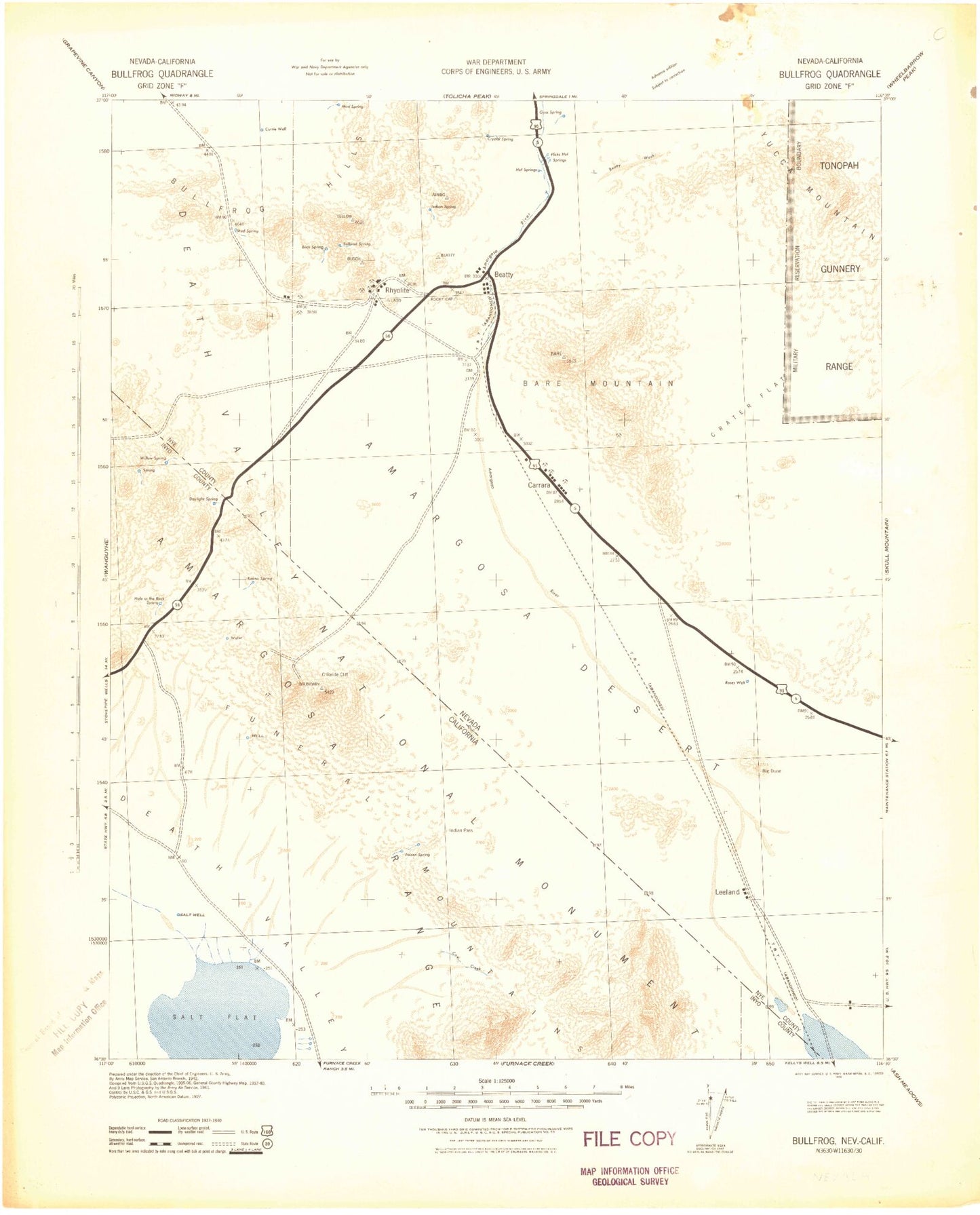
Historic 1942 Bullfrog Nevada 30'x30' Topo Map
Couldn't load pickup availability
Historical USGS topographic map of Bullfrogin the states of Nevada, California. Scale: 1:125000. Print size: 18" x 24"
This map was published in 1942 and is in the following counties: Inyo, Nye.
The map contains contour lines, roads, rivers, towns, streams, and lakes. Printed on high-quality waterproof paper with UV fade-resistant inks.
Contains the following named places: Funeral Mountains, Windy Wash, Amargosa Narrows, Beatty Wash, Big Dune, Black Cone, Black Marble, Black Peak, Box Canyon, Bullfrog Mountain, Burton Mountain, Carrara Canyon, Chuckwalla Canyon, Conejo Canyon, Crater Flat, Crescent Cliff, Dry Canyon, Hooligan Mine, Joshua Hollow, Ladd Mountain, Little Cones, Mayflower Mine, Meiklejohn Peak, Montgomery-Shoshone Mine, National Bank Mine, Panama Mine, Porter Mine, Razorback Ridge, Red Cone, Secret Pass, Senator Stewart Mine, Sober-Up Gulch, Steves Pass, Sutherland Mountain, TT Ranch, Tarantula Canyon, Tates Wash, Thompson Mine, Tungsten Canyon, Velvet Peak, Wildcat Peak, Solitario Wash, Lathrop Wells Cone, Crater Flat Wash, Bare Mountain, Beatty, Bonanza Mountain, Bullfrog Hills, Calico Hills, Montgomery Mountain, Paradise Mountain, Rainbow Mountain, Rhyolite, Sawtooth Mountain, Beatty Mountain, Bare Mountain Peak, T&T Ranch, Oasis Valley, Prospector Pass, Tram Ridge, Buttonhook Wash, Perlite Canyon, King Mine, Lucky Jack Mine, Chloride, Sand Hill Peak, Gold Center Ranch, Gold Bar Mine, Trueba Ranch, Phillips Ranch, Bettles Ranch, Hot Springs, Denver Mine, Fluorspar Canyon, Gibraltar Mine, Gold Ace Mine, Original Bullfrog Mine, Silicon Mine, Crowell Mine, Diamond Queen Mine, Telluride Mine, Tip Top Mine, Daisy Mine, Mexican Mine, Grand Junction Mine, Arista Mine, Harvey Mine, Fluorine Mining District, Bullfrog Mining District, Shoshone Polaris Mine, Homestake Mine, Vanderbilt Mine, Vickies Star Ranch, Ashton, Gold Center, Busch Peak, Tramps Mine, Doris Montgomery Pass, Lee Mining District, Amargosa Desert, Cleft Ridge, Gaunt Ridge, Hooked Ridge, Shepherd Wash, Table Ridge, Tilted Ridge, Wagon Valley, Boundary Canyon, Chloride Cliff, Daylight Pass, Indian Pass, Keane Wonder Mill, Keane Wonder Mine, Lees Camp, Monarch Canyon, National Park Service Headquarters, Nevares Peak, Salt Creek, Funeral Mountains, Cottonball Marsh, West Side Borax Camp, Beatty Junction, Winters Peak, Amargosa Desert, Park Village, Big Bell Mine, Cottonball Basin