MyTopo
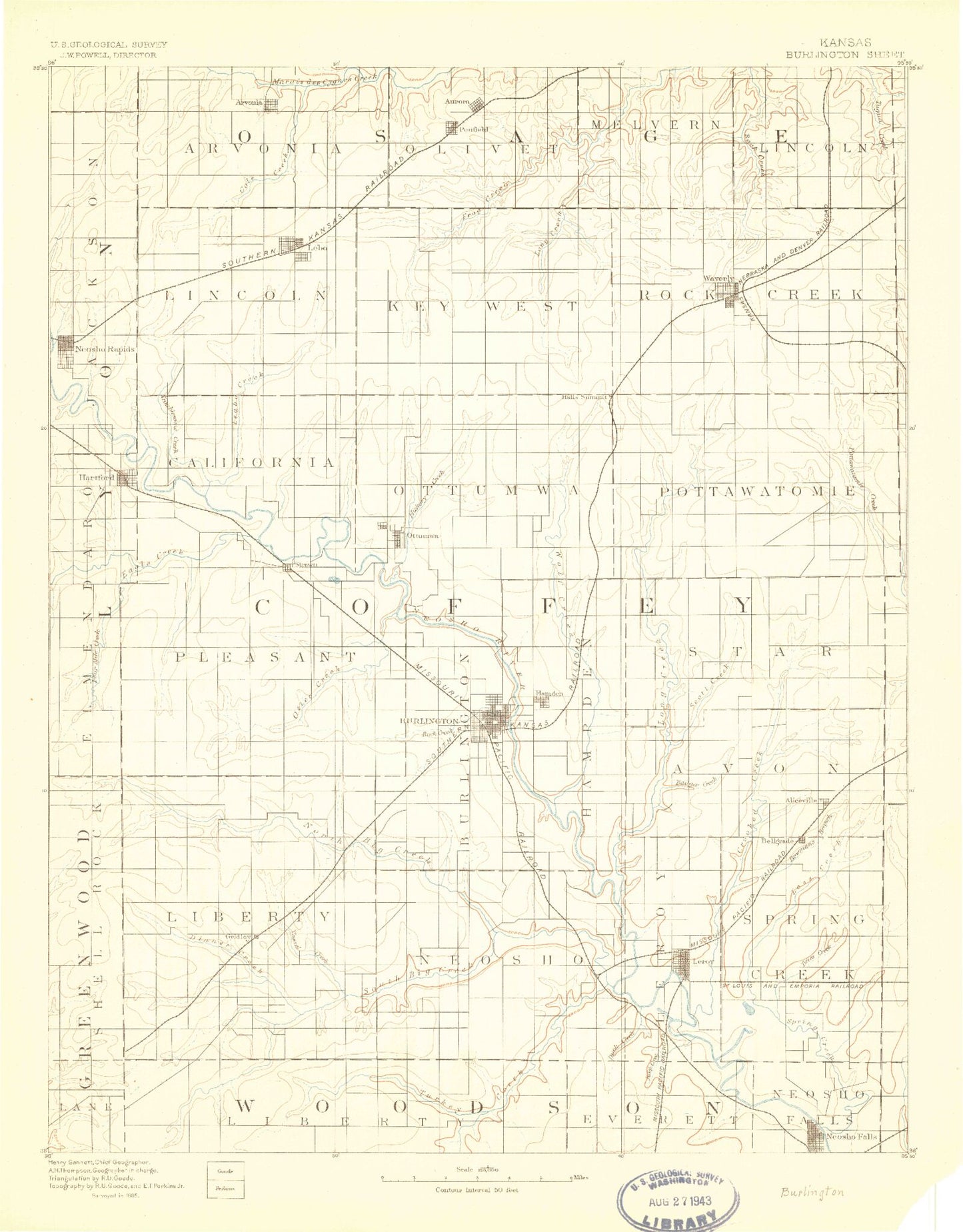
Historic 1885 Burlington Kansas 30'x30' Topo Map
Couldn't load pickup availability
Historical USGS topographic map of Burlington in the state of Kansas. Scale: 1:125000. Print size: 16" x 24"
This map was published in 1885 and is in the following counties: Allen, Anderson, Coffey, Franklin, Greenwood, Lyon, Osage, Woodson.
The map contains contour lines, roads, rivers, towns, streams, and lakes. Printed on high-quality waterproof paper with UV fade-resistant inks.
Contains the following named places: Turkey Creek, Winterscheid Oil Field, Bloody Run, Eagle Creek, Fourmile Creek, Hartford, Hartford Recreation Area, Township of Pleasant, Flint Hills National Wildlife Refuge, Jacobs Creek Landing, Strawn Recreation Area, Jacobs Creek, Otter Creek State Wildlife Management Area, Redmond Cove South Recreation Area, Redmond Cove North Recreation Area, Ottumwa, Hickory Creek West Recreation Area, Hickory Creek East Recreation Area, Kennedy Creek, Benedict Creek, West Hickory Creek, Jordan Creek, Township of Ottumwa, Township of Hampden, New Strawn, Wolf Creek, John Redmond Reservoir, School Creek, Halls Summit, East Hickory Creek, Township of Pottawatomie, Township of Star, Scott Creek, Long Creek, Puleston Creek, Winnifred Creek, Bebo Hill, Logwater Branch, Plum Creek, Troublesome Creek, Neosho Rapids, Lebo, Township of Lincoln, Lebo Creek, Coal Creek, Arvonia, Sand Creek, Township of Key West, Joe Creek, Frog Creek, Olivet, Agricola, South Branch Tequa Creek, Lane Hollow, Township of Rock Creek, Waverly, Little Rock Creek, East Branch Tequa Creek, Birk Lake, Buffalo Creek, Otter Creek Recreation Area, John Redmond Dam, Otter Creek, North Big Creek, Township of Liberty, Mathias Lake, Jackrabbit Hill, Rock Creek, Burlington, Township of Burlington, Township of Neosho, Aliceville, Silver Creek, Tauckett Creek, Badger Creek, Township of Avon, Dunaway Oil Field, Gridley, Gridley Lake, Virgil North Oil Field, Duck Creek, Dinner Creek, Varvel Creek, Rock Creek, Duck Creek, LeRoy, South Big Creek, Big Creek, The Island, Township of Spring Creek, Township of LeRoy, Crooked Creek, Bowmans Branch, Neosho Falls, Riverside Park, Circle Lake, Spogie Ditch, Twiss Creek, Loss Creek, Spring Creek, Cherry Creek, Township of Arvonia, Little Cable Creek, Cable Creek, Melvern Lake, Township of Melvern, Township of Lincoln, John Redmond Wildlife Area, Gridley Dam, Wolf Creek Generating Station, Sharpe, Ridgeton, Beto Junction, Coffey County, City of Burlington, City of Gridley, City of Hartford, City of Neosho Falls, City of Neosho Rapids, City of New Strawn, City of Lebo, City of LeRoy, City of Olivet, City of Waverly, Neosho Rapids Wastewater Treatment Plant, Gridley Sewer Treatment Plant, Waverly Sewer Treatment Plant, Burlington Wastewater Plant, Lebo Sewer Treatment Plant, Hartford Sewer Treatment Plant, New Strawn Wastewater Plant, Burlington Municipal Power Plant, Westphalia Wastewater Plant, Burlington Water Treatment Facility, Leroy City Sewer Treatment Plant, Barrett Mobile Home Park, Botham Mobile Home Park, Desloover Mobile Home Park, Lebo Mobile Home Park, Toy Mobile Home Park, Walters Mobile Home Park, Indian Plains Golf Course, Rock Creek Country Club, Kelley Park Rodeo Arena, Le Roy Co - Operative Association Grain Elevator Number 1, Le Roy Co - Operative Association Grain Elevator Number 2, Hartford Elevator Grain Elevator Number 1, Hartford Elevator Grain Elevator Number 2, Lebo Grain Company Grain Elevator Number 1, Pearson Farms, Dill Farms, Darbyshire Farm, Scoggin Farms, Nixon Farms, Thomsen Farms, Coffey County Lake


