MyTopo
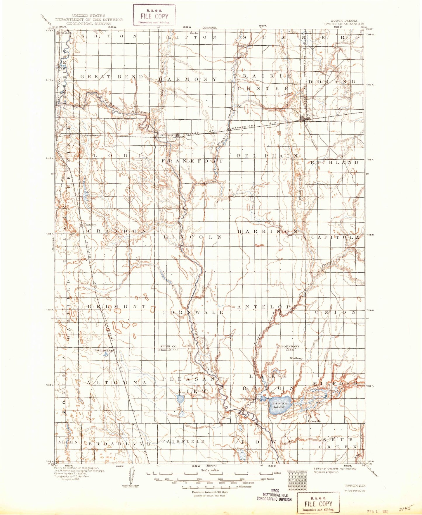
Historic 1895 Byron South Dakota 30'x30' Topo Map
Couldn't load pickup availability
Historical USGS topographic map of Byron in the state of South Dakota. Scale: 1:125000. Print size: 17" x 24"
This map was published in 1895 and is in the following counties: Beadle, Spink.
The map contains contour lines, roads, rivers, towns, streams, and lakes. Printed on high-quality waterproof paper with UV fade-resistant inks.
Contains the following named places: Bonilla, Byron Camp, Lake Byron, Connors Lake, Doland, Doland Ridge, Dry Run, Lake Dudley, Frankfort, Glendale Colony, Hillside Colony, Huron Colony, Piper Lake, Snake Creek, Spink Colony, Timber Creek, Turtle Creek, Mirage Lake, Dudley Dam, Crook Dam, Mirage Dam, James Diversion Dam, Bloomfield, LaDelle, Rodee Grove, Motley Island, Ashton, Crandon, Fisher Grove, Hitchcock, Foster Creek, Spink County, City of Ashton, Township of Broadland, City of Doland, City of Frankfort, Town of Hitchcock, Township of Union, Township of Antelope, Township of Cornwall, Township of Belmont, Township of Capitola, Township of Richfield, Township of Harrison, Township of Belle Plaine, Township of Lincoln, Township of Frankfort, Township of Crandon, Township of Lodi, Township of Spring, Township of Prairie Center, Township of Harmony, Township of Great Bend, Township of LaDelle, Township of Doland, Township of Milford, Township of Liberty, Township of Iowa, Township of Lake Byron, Township of Fairfield, Township of Pleasant View, Township of Altoona, Camrose Colony, Iron River