
MyTopo
Historic 1893 Caldwell Kansas 30'x30' Topo Map
Couldn't load pickup availability
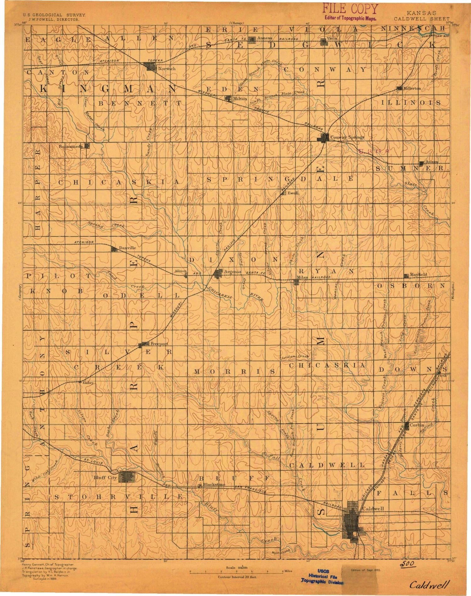
Historical USGS topographic map of Caldwellin the states of Kansas, Oklahoma. Scale: 1:125000. Print size: 16" x 24"
This map was published in 1893 and is in the following counties: Harper, Kingman, Sedgwick, Sumner.
The map contains contour lines, roads, rivers, towns, streams, and lakes. Printed on high-quality waterproof paper with UV fade-resistant inks.
Contains the following named places: Township of Falls, Caldwell, Township of Bluff, Spring Branch, Bluff City, Baehr Creek, Township 4, Silver Creek, Rock Creek, Wildcat Creek, Spring Creek, Rodgers Branch, Township of Caldwell, Spring Creek, East Branch Fall Creek, Wolf Creek, Fall Creek Oil Field, Township of Sumner, Mayfield, Anson, Beaver Creek, Township of Ryan, Milan, Township of Creek, Township of Dixon, Silver Creek, Sand Creek, Argonia, Paradise Lake, Sandy Creek, Spring Creek, Sand Creek, Danville, Latta Northwest Oil Field, Latta Oil Field, Township of Illinois, Township of Springdale, Viola, Township of Conway, South Branch Slate Creek, North Branch State Creek, Township of Eden, Conway Springs, Argonia Creek, Norwich, Milton, Township of Bennett, Township of Canton, Clearwater Creek, Big Spring Creek, Freeport South Oil and Gas Field, Freeport Oil Field, Stohrville Oil Field, Freeport, Shore Creek, Spring Creek, Yarnell Northeast Oil and Gas Field, Yarnell Oil and Gas Field, Walta Oil Field, Township of Morris, Camp Loga Vista, Long Creek, Perth, Corbin, Jordan Creek, West Prairie Creek, Prairie Creek, East Prairie Creek, Township of Chikaskia, Township of Downs, Township 6, Township 5, Wellington City Dam, Wellington Lake, Wichita Prairies, Hawk, Wellington City Park, Metcalf, Doster, Ewell, Runnymede, Millerton, Anness, Adams, Orsemus, Suppesville, Duck Creek, Township of Osborne, City of Caldwell, City of Conway Springs, City of Danville, City of Argonia, City of Bluff City, City of Mayfield, City of Norwich, City of Milan, City of Viola, Viola Wastewater Treatment Facility, Conway Springs Wastewater Treatment Plant, Argonia Wastewater Treatment Facility, Norwich Wastewater Plant, Sumner County Fairgrounds, Mayfield Wastewater Treatment Facility, Suppesville Wastewater Plant, Suppesville Golf Course, Wolf Creek, Wichita Prairies


