MyTopo
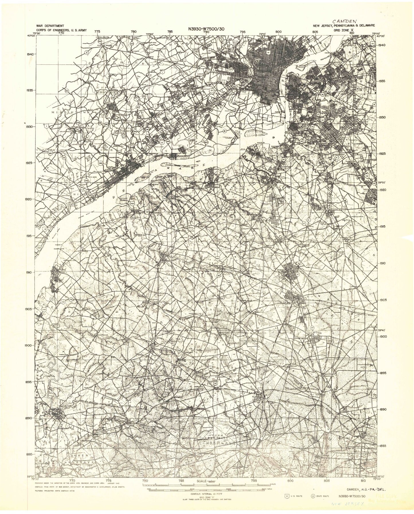
Historic 1942 Camden New Jersey 30'x30' Topo Map
Couldn't load pickup availability
Historical USGS topographic map of Camden in the state of New Jersey. Scale: 1:125000. Print size: 17" x 24"
This map was published in 1942 and is in the following counties: Burlington, Camden, Chester, Cumberland, Delaware, Gloucester, Montgomery, New Castle, Philadelphia, Salem.
The map contains contour lines, roads, rivers, towns, streams, and lakes. Printed on high-quality waterproof paper with UV fade-resistant inks.
Contains the following named places: Pennsauken, Hesters Branch, Fisher Point Dike, Wallworth Park, South Branch Newton Creek, Raccoon Island, Abbots Meadow, Acton, Alcyon Lake, Alcyon Park, Aldine, Algonkin Lake, Alliance, Alloway, Alloway Lake, Almonesson, Almonesson Creek, Almonesson Lake, Asbury, Auburn, Audubon, Audubon Lake, Audubon Park, Aunt Debs Ditch, Aura, Avis Millpond, Back Channel, Ballingers Lake, Barnsboro, Barrington, Lake Basgalore, Baum Pond, Beals Mill, Beaver Brook, Beaver Creek, Beaver Dam, Beaverdam Branch, Bees Branch, Bell Lake Park, Bellmawr, Bells Lake, Bells Lake, Bethel Lake, Bethel Run, Betty Park, Biddles Landing, Big Mannington Hill, Big Timber Creek, Billingsport, Birch Creek, Blackwater Branch, Blackwood, Blackwood Lake, Blackwood Terrace, Blenheim, Bon Air, Bostwick Lake, Bramell Point, Bridgeport, Brooklawn, Brotmanville, Bull Run, Burnt Mill Branch, Camden, Camden County Park, Camp Edge, Camp Karney, Camp Kimble, Camp Roosevelt, Carlisle Run, Carneys Point, Carneys Point, Cartwheel Branch, Cedar Brook, Cedar Crest Manor, Cedar Grove, Cedar Lake, Cedar Lake, Cedar Swamp, Cedarville, Center Square, Center Square Station, Centerton Pond, Centerton, Centre City, Cherry Hill, Cherry Hill Mall, Chester Island, Chestnut Branch, Chestnut Run, Clark Branch, Clarks Run, Clarksboro, Clayton, Clements Bridge, Clems Run, Clonmell Creek, Cobb Island, Cobbs Mill Lake, Cohansey, Collingswood, Colonial Manor, Colwick, Cool Run, Cooper, Cooper Lake, Cooper Point, Cooper River, Cooper River Lake, Cooper River Parkway, Courses Landing, Coxhat Pond, Crab Point, Cramer Hill, Cross Keys, Crystal Lake, Crystal Spring Lake, Culliers Run, Danceys Corner, Daretown, Davisville, Deep Run, Deepwater, Deerfield, Delair, Delair Junction, Delaware Gardens, Downer, Dry Branch, Dudley Grange Park, Duffield Run, Eagle Point, East Camden, East Lake, East Pennsauken, Edwards Run, Eldridge Hill, Elephant Swamp, Elkinton Millpond, Elks Terrace, Ellisburg, Elmer, Elmer Lake, Emerald Lake, Endless Branch, Erial, Erlton, Evans Pond, Ewan, Ewan Lake, Fairview, Fairview, Farnham Park, Farrows Run, Fenwick, Fenwick Creek, Fenwick Monument, Ferrell, Finley Run, Fisher Point, Five Points, Foxs Mill, Franklinville, Franklinville Lake, Friendship, Friendship Station, Fries Mill, Friesburg, Game Branch, Game Creek, Garden City, Garden State Park, Gardenville, Gardenville Center, Garrison Lake, Lake George, Gibbstown, Gilman Lake, Glassboro, Glen Lake, Glen Lake, Glendora, Glenside, Gloucester City, Gloucester Heights, Gloucester Point, Golf Manor, Golf View, Good Intent, Grand Sprute, Grand Sprute Run, Gravelly Run, Green Branch, Green-Fields, Greenfield Heights, Greenland, Greenville, Greenwich Lake, Grenloch, Grenloch Lake, Grenloch Terrace, Haddon, Haddon Heights, Haddon Lake, Haddonfield, Hagerville, Haines Neck, Halls Run, Halltown, Hancocks Bridge, Hardingville, Harmony, Harrisonville, Hayes Branch, Hanby Creek, Hendricksen Park, Hendrickson Millpond, Herwood, Hessian Run, Hessian Run Park, Hi-Nella, Hickstown, Hidden Acres Township Park, Highland Park, Hilltop, Holiness Camp, Holly Run, Hopkins Pond, Horne Run, Hudson Branch, Hudson Lake, Hurffville, Husted, Idle Acres Lake, Indian Run, Iona


