MyTopo
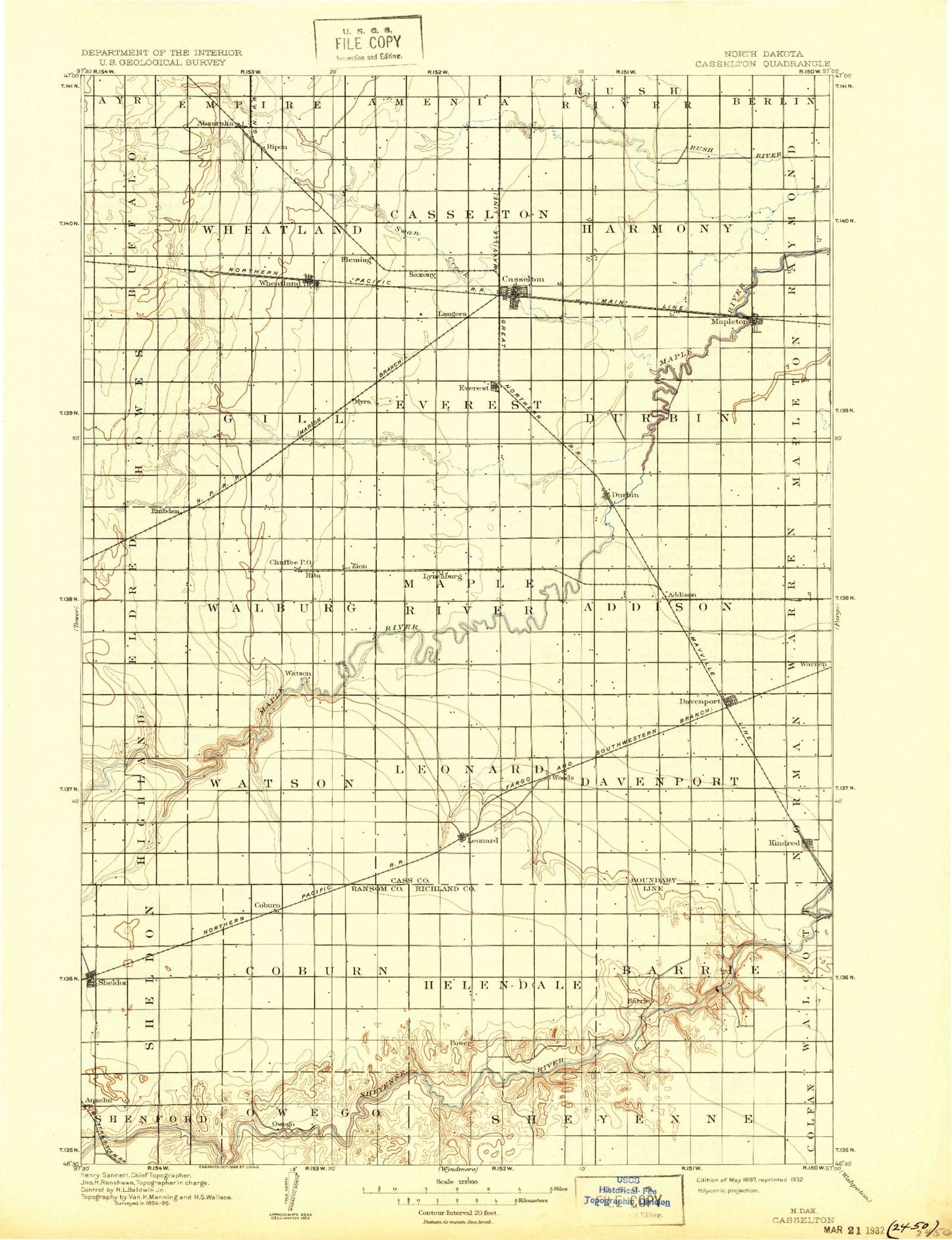
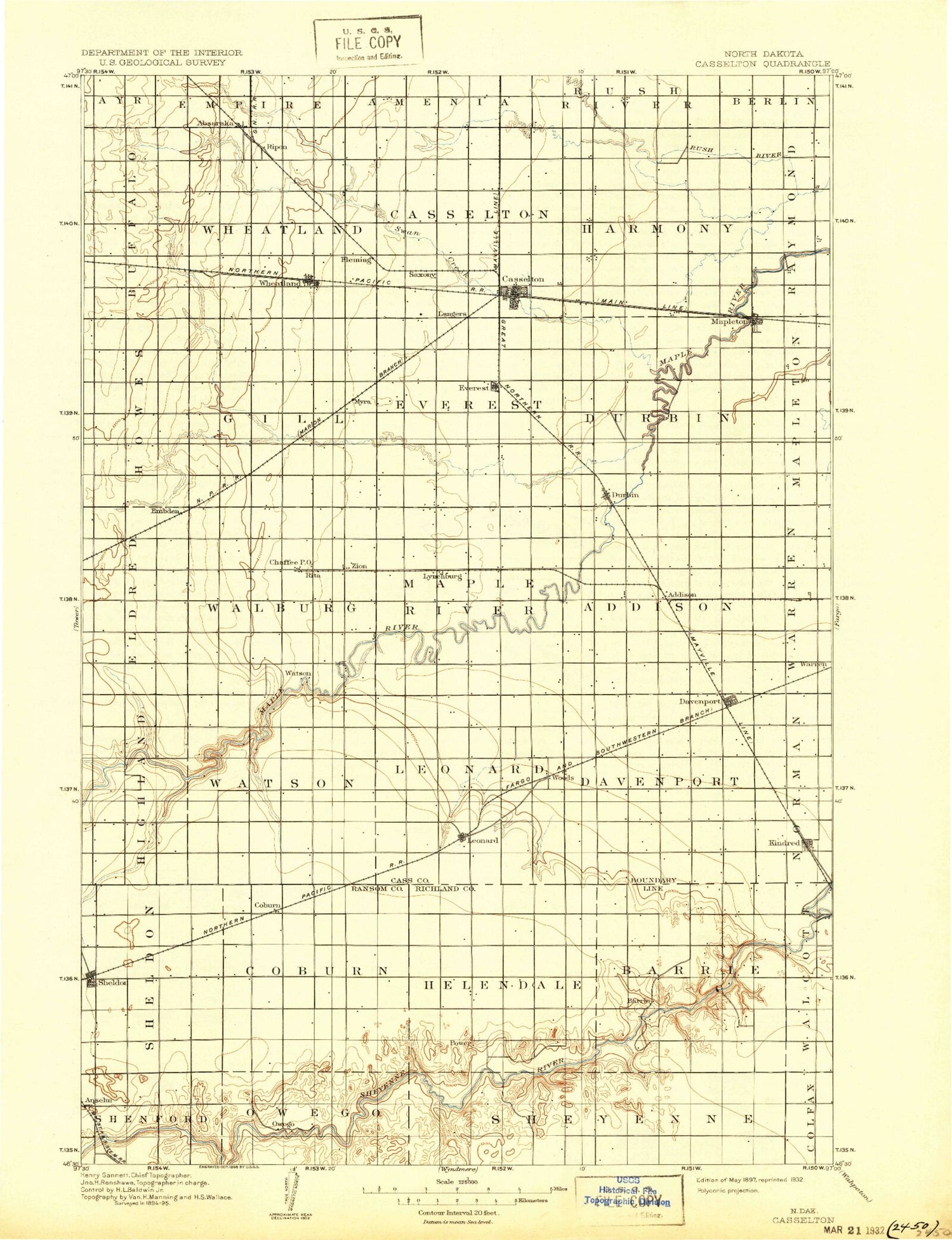
Historic 1897 Casselton North Dakota 30'x30' Topo Map
Couldn't load pickup availability
Historical USGS topographic map of Casselton in the state of North Dakota. Scale: 1:125000. Print size: 16" x 24"
This map was published in 1897 and is in the following counties: Cass, Ransom, Richland.
The map contains contour lines, roads, rivers, towns, streams, and lakes. Printed on high-quality waterproof paper with UV fade-resistant inks.
Contains the following named places: Absaraka, Barrie, Buffalo Creek, Casselton, Chaffee, Dalrymple Spur, Davenport, Durbin, Embden, Four H Camp, Kindred, Leonard, Magnolia State Game Management Area, Mapleton, Prosper, Swan Creek, Wheatland, Swan Buffalo Number 5 Dam, Swan Buffalo Number 8 Dam, Brownlee Dam, Swan Buffalo 12 Dam, Lynchburg, Magnolia, Warren, Woods, Everest, Myra, Newman, Power, Cass County, Anselm, Coburn, Sheldon, Mirror Pool, City of Casselton, City of Davenport, City of Kindred, City of Leonard, City of Mapleton, City of Sheldon, Township of Davenport, Township of Leonard, Township of Watson, Township of Highland, Township of Addison, Township of Durbin, Township of Maple River, Township of Everest, Township of Walburg, Township of Gill, Township of Eldred, Township of Howes, Township of Harmony, Township of Casselton, Township of Wheatland, Township of Buffalo, Township of Barrie, Township of Helendale, Township of Coburn, Township of Greene, Cottonwood Golf Club, Lynchburg East Bound Rest Area, Mapleton West Bound Rest Area