MyTopo
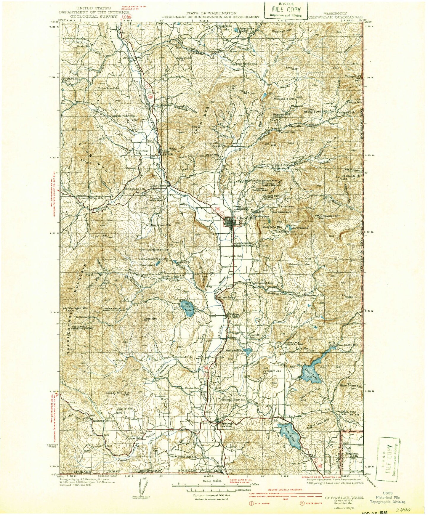
Historic 1930 Chewelah Washington 30'x30' Topo Map
Couldn't load pickup availability
Historical USGS topographic map of Chewelah in the state of Washington. Scale: 1:125000. Print size: 17" x 24"
This map was published in 1930 and is in the following counties: Pend Oreille, Spokane, Stevens.
The map contains contour lines, roads, rivers, towns, streams, and lakes. Printed on high-quality waterproof paper with UV fade-resistant inks.
Contains the following named places: Admiral Mine, Camas Valley, Cooney Mountain, Craney Hill, Deer Meadow, Double Eagle Quarries, Edna Mine, Empey Mountain, Forest Center, Hooker Canyon, Indian Creek, Iron Gate, Keystone Mine, King Meadow, Klein Meadows, Middle Fork Chamokane Creek, Middle Fork Deer Creek, Miller Meadow, North Fork Chamokane Creek, North Fork Deer Creek, North Fork Huckleberry Creek, Service Creek, Sorenson Canyon, South Fork Chamokane Creek, South Fork Huckleberry Creek, Stensgar Mountain, Wabash Detroit Mine, Wells Fargo Mine, Carrs Corner, Cline, Lyons Hill, Addy, Addy Basin, Addy Creek, Addy Mountain, Ahren Meadows, Alice Mine, Amazon Mine, Arden, B B Mine, Bald Mountain, Bayley Creek, Bayley Lake, Bear Canyon, Bear Creek, Beitey Lake, Bell Meadow, Benson Lake, Benson Peak, Betts Meadows, Bingville, Bisbee Meadow, Blacktail Mountain, Blue Bird Mine, Blue Creek, Blue Grouse Mountain, Blue Lake, Blue Lake, Blue Star Mine, Bluecreek, Boudes Hill, Brewer Mountain, Browns Lake, Buck Lake, Bulldog Creek, Burnt Valley, Butte Creek, Buzzard Lake, Calispell Basin, Calispell Peak, Camp Hafer, Cassner Creek, Castle Rock, Cedar Creek, Checops Mine, Chewelah, Chewelah Mountain, Chewelah Silver Mine, Chewelah Standard Mine, Cliff Ridge, Cole Creek, Cole Creek Picnic Area, Colville Valley Mine, Copper Cliff Mine, Copper Queen Mine, Cottonwood Creek, Cozy Nook, Dahlstrom Meadow, Dailey Lake, Deer Creek, Deer Lake, Deer Lake Mountain, Deer Mountain, Devils Canyon, Doe Lake, Donaldson Creek, Drummond Creek, Dry Creek, Dunn Creek, Dunn Mountain, Eagle Mountain, Embrey Hill, Erickson Lake, Fairview, Finch Quarry, Foster Canyon, Fourmile Lake, Franzwa Creek, Goddards Peak, Gold Hill, Grouse Creek, Haller Creek, Ham Mine, Hansen Lake, Hartill Creek, Hartill Meadows, Hatch Lake, Haverland Meadows, Healey Creek, Healey Meadow, Hecla Mine, Hidden Meadows, High Grade Mine, High Lake, Hirsch Pond, Horseshoe Lake, Huckleberry Creek, Imperial Copper Mine, Indian Creek, Indian Hill, Iron Mountains, Jay Gould Mine, Jay Gould Ridge, Jim McGraff Quarry, Johnson Lake, Johnson Mountain, Jumpoff Joe Creek, Jumpoff Joe Mountain, Juno-Echo Mine, Kaniksu Ranch, Keystone Mine, Klein Creek, Krumm Creek, Krumm Meadows, Lane Mountain, Lenhart Meadows, Lenz Lake, Leslie Creek, Liberty Mine, Limekiln Hill, Little Calispell Creek, Little Coyote Mountain, Little King Mines, Little Pend Oreille River, Little Sweden, Long Lake, Long Prairie, Loon Lake, Loon Lake, Loon Lake Mountain, Lost Valley, Marble Valley, May Hill, McDonald Mountain, McKale Canyon, McPherson Mine, Meadow Pond, Merikay Mine, Mill Butte, Miller Reservoir, Moran Creek, Moss-Allen Quarry, Mud Lake, Mullen Mine, Narcisse Creek, Nelson Creek, Nelson Lake, Nelson Peak, Noman Creek, North Basin, North Fork Bear Creek, North Fork Chewelah Creek, Olson Peak, Orin, Pal Moore Meadow, Palmer Creek, Parker Mountain, Paye Creek, Payne Mine, Perry Mine, Phillips Lake, Pierce Lake, Pine Hill, Quartzite Mountain, Red Quarry, Reidel Creek, Reik Gulch, Riecker Mountain, Rocky Butte, Rocky Lake, Rolly Lake, Roundtop Mountain, Saddle Mountain, Sand Canyon, Scrabbler Mountain, Security Copper Mine, Sheep Creek, Sherwood Creek, Silver Point, Sixmile Creek, Slide Creek, Smith Creek, South Fork Chewelah Creek, Wilson Creek, Spratt Creek, Springdale, Aspen Creek, Starvation Lake, Stensgar Creek, Stranger Creek, Starvation Flat, Success Mine, Swamp Creek, Swede Lake, Swiss Valley, The Butte, The Island, The Tinderbox, Thomason Creek, Twelvemile Creek, Valley, Waitts Creek, Waitts Lake, Wessendorf Canyon, Wilson Mountain, Windfall Mine


