MyTopo
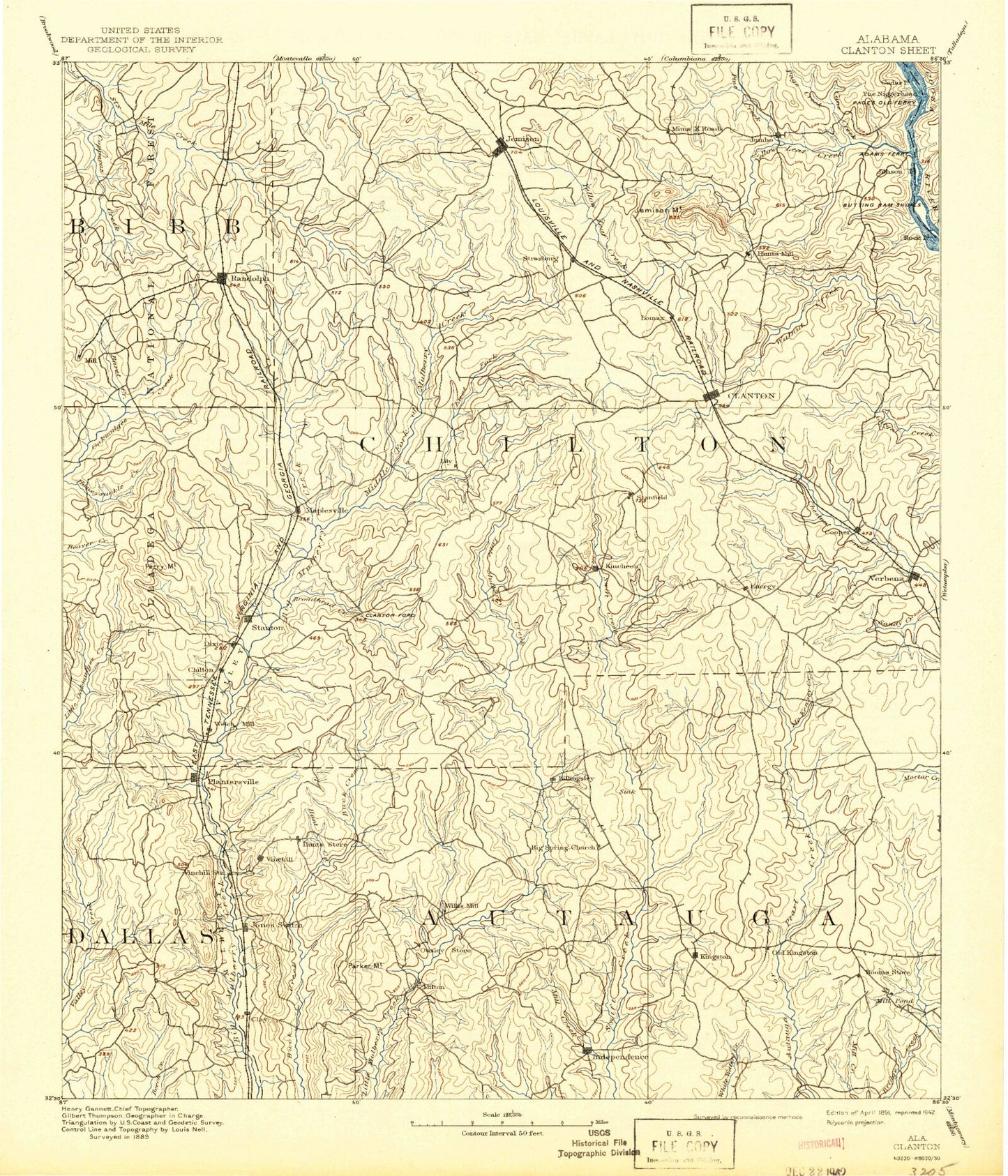
Historic 1891 Clanton Alabama 30'x30' Topo Map
Couldn't load pickup availability
Historical USGS topographic map of Clanton in the state of Alabama. Scale: 1:125000. Print size: 17" x 24"
This map was published in 1891 and is in the following counties: Autauga, Bibb, Chilton, Coosa, Dallas.
The map contains contour lines, roads, rivers, towns, streams, and lakes. Printed on high-quality waterproof paper with UV fade-resistant inks.
Contains the following named places: Abbott Branch, Beam Branch, Bear Branch, Bear Creek, Beaver Branch, Bee Branch, Benson Creek, Bentleys Lake, Big Rock, Big Rock Island, Black Snake Creek, Blue Gut Creek, Booth, Bridge Creek Lake, Broadhead Creek, Brown Branch, Camp Grist, Campbell, Cane Creek, Caney Branch, Caney Branch, Cedar Creek, Cedar Grove Branch, Center Hill, Chandler Mountain, Charlotte Creek, Clear Creek, Cobb Creek, Coon Creek, Coppers Branch, Cove Branch, Cowmire Branch, Cowwild Branch, Cressie Branch, Double Bridges, Dry Branch, Dry Creek, Dry Creek, Dutton Branch, Eiland Branch, Enterprise, Falakto, Flat Branch, Flat Branch, Foshee Islands, Fountainhead Lake, Fox Creek, Gap of the Mountain, Gilchrist Island, Gin Creek, Gold Mine Branch, Goose Pond Creek, Gum Swamp, Haynes, Highland, Hog Creek, Honeycutt Creek, Hurricane Branch, Independence, Indian Creek, Kincheon Creek, Lay Dam, Little Bridge Run, Little Creek, Little Creek, Little Rock Island, Lomax, Mahan Branch, McSwain Branch, Miller Branch, Mineral Springs, Mohorn Creek, Mollie Branch, Morgan Creek, Motley Branch, Mountain Branch, Mulberry, Page Creek, Paint Creek, Parker Branch, Pate Creek, Lake Pearl, Persimmon Branch, Pierce Branch, Pig Pen Creek, Pink Branch, Pletcher, Poley Bridge Creek, Pools Crossroads, Possum Branch, Ram Branch, Reaves Creek, River Branch, Rocky Creek, Rocky Creek, Sam Branch, Sand Branch, Sand Branch, Sandy Branch, Sawmill Branch, Simmons Branch, Spring Branch, Talley Branch, Turkey Creek, Turnback Creek, Turnpike Branch, Union Grove, Varden Branch, Vida, Walkers Lake, Wheatley Branch, White City, Will Redden Branch, Lawrence Lake, F W Lawrence Dam, R M Pendergrass Dam, O'Dell Lake Dam, Bridge Creek Fishing Club Dam, Camp Tukabatchee Lake Dam, Camp Tukabatchee Lake, Rex Waldrop Dam, Rex Waldrop Lake, Valley Creek Park Lake Dam, Shelton Barkley Lake, Shelton Barkley Lake Dam, T J Stewart Lake, J T Stewart Lake Dam, Calfee Lake, Calfee Lake Dam, Demargo Lake, Demargo Lake Dam, Luby Gore Lake, Luby Gore Dam, Lake Fountain Head Dam, Brantley Lake Dam, Lake John Paul, Lake John Paul Dam, Cedar Circle Fish Camp, Brantley Lake, Butting Ram Shoals, Camp Maplesville, Cane Creek, Clanton Golf and Country Club, Samaria, Sears Camp, Pine Bay Marina, Thompson Mine, Beaver Creek, Browntown, New Prospect, Parker Mountain, Whirleys Pond, White Water Lake, Whitewater Camp, Fall Line Hills, Alabama Music Park, Chilton Area Horticulture Sub-Station, Mount Bethel Youth Camp, Peach Queen Camp, Mill Creek, Billingsley, Collins Chapel, Fremont, Isabella, Jemison, Jones, Little Mulberry Creek, Long Branch, Mars Hill, McKensey Creek, Oak Grove, Old Kingston, Poseys Crossroads, South Prong Chestnut Creek, Thorsby, Tukabatchee Camp, Valley Creek Junction, Valley Creek Lake, Verbena, Vine Hill, Ware Island, Yellow Leaf Creek, Dawson Mill, Clay Creek, Valley Grande, Adams, Bessie, Bethel Grove, Bonita, Evergreen, Fairview, Hubbard, Joffre, Jumbo, Kalona, Kincheon, Milton, New Convert, Oak Grove, Pleasant Grove, Poseys Crossroads, Rocky Mount, Vida Junction, Winslow, Maddox Mine, Old Maddox Mine, Clanton, Cooper, Gale Creek, Mount Sinai, Active, Baret Creek, Beaverdam Creek, Bibb Mill, Blue Branch, Boggles Creek, Byrd Creek, Copperas Creek, Cox, Dixie, Elam Creek, Gandy Creek, Harris Branch, Lawley, Little Mill Creek, Maness Creek, Maplesville, Martin Creek, Martin Creek, Maud, Nix Lake, Oakley, Parnell, Perry Mountain, Plantersville, Price Branch


