
MyTopo
Historic 1891 Clay Center Kansas 30'x30' Topo Map
Couldn't load pickup availability
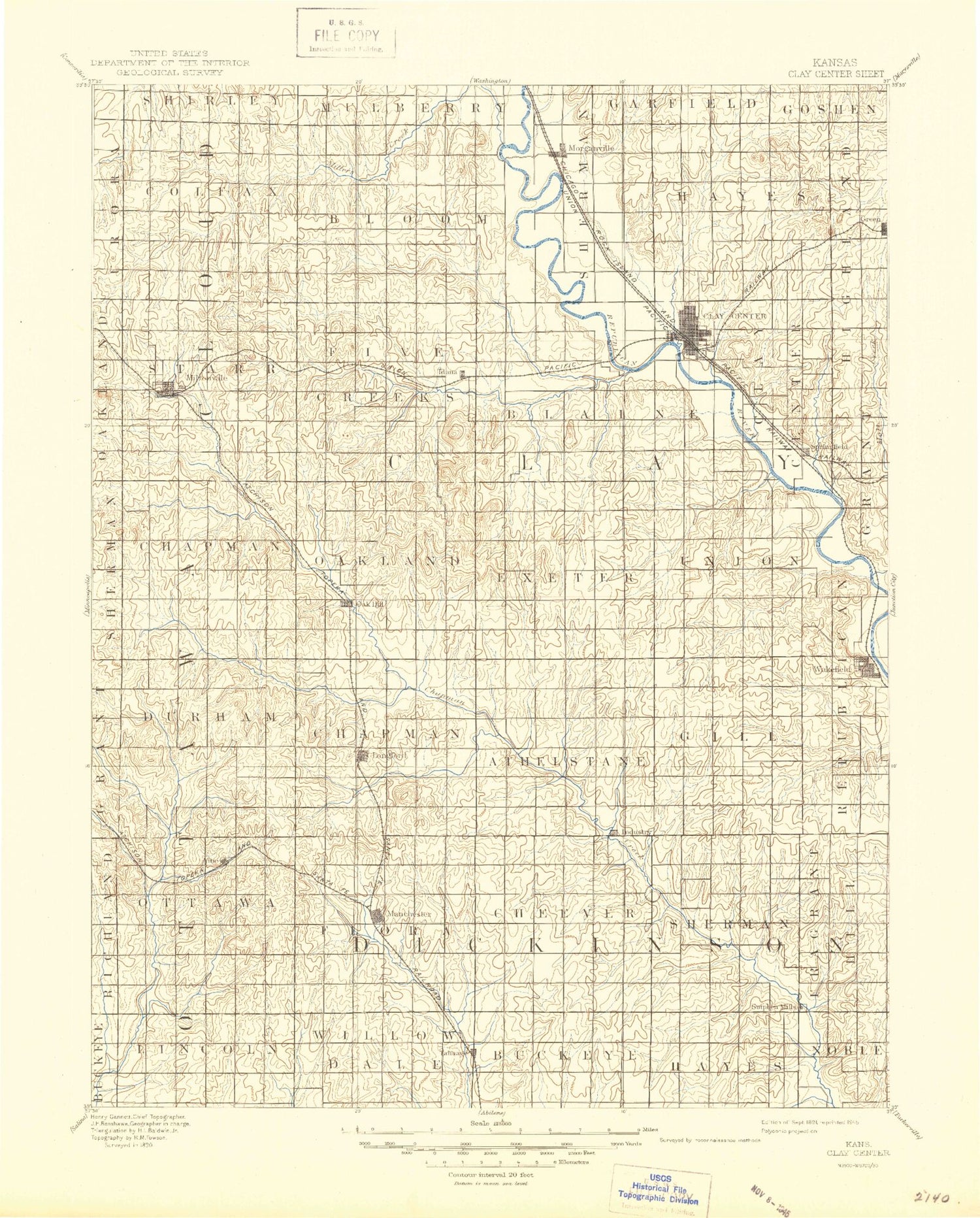
Historical USGS topographic map of Clay Centerin the states of Kansas, Nebraska. Scale: 1:125000. Print size: 17" x 24"
This map was published in 1891 and is in the following counties: Clay, Cloud, Dickinson, Ottawa.
The map contains contour lines, roads, rivers, towns, streams, and lakes. Printed on high-quality waterproof paper with UV fade-resistant inks.
Contains the following named places: Dry Branch, Mulberry Creek, Dry Creek, Township of Colfax, Township of Starr, Township of Bloom, North Branch Five Creek, Township of Five Creeks, Township of Blaine, Morganville, East Branch Dry Creek, Township of Hayes, Township of Clay Center, Spring Creek, Huntress Creek, Huntress Park, Clay Center, Dexter Park, Finney Creek, Lincoln Creek, Green, Miltonvale, Five Creek, West Chapman Creek, Township of Chapman, Tobyne Hill, Table Mounds, Potato Hill, Township of Oakland, Township of Exeter, Pinkerton Branch, Idana, Twin Mounds, Chestnut Branch, Reeder Branch Five Creek, Otter Creek, Township of Union, Cane Creek, Mall Creek, Township of Republican, Township of Durham, Vine Creek, Township of Ottawa, Township of Athelstane, Township of Chapman, Oak Hill, Badger Creek, Longford, Township of Cheever, Township of Flora, Basket Creek, Industry, Township of Gill, Township of Sherman, Township of Fragrant Hill, Wakefield, Township of Lincoln, Manchester, Township of Willowdale, Township of Buckeye, Talmage, Township of Hayes, Upland, Jefferson Point State Park, Clay County Lake Dam, Clay County Lake, Bateham, McMurray Creek, Stillwater Lake, Browndale, Ladysmith, Vine Creek, Buckeye, Sutphen, Moonlight, Clay County, Clay Center Country Club, City of Clay Center, City of Oak Hill, City of Miltonvale, City of Morganville, City of Longford, City of Manchester, City of Wakefield, Morganville Wastewater Plant, Wakefield Wastewater Plant, Clay Center Sewage Plant, Clay Center Industrial Park, Clay Center Zoo, Kansas Arboretum, Clay County Fairgrounds, Longford Wastewater Plant, Manchester Wastewater Plant, Miltonvale Sewer Treatment Plant, Talmage Wastewater Plant, Country Gardens Mobile Home Park, Hawks Landing Mobile Home Park, Agmark Grain Elevator Number 5, Agmark Grain Elevator Number 14, Wakefield Farmers Co - Operative Association Grain Elevator Number 1, Team Marketing Alliance Grain Elevator Number 43, Team Marketing Alliance Grain Elevator Number 46, Farmers Co - Operative Elevator Association Grain Elevator Number 1, Dry Branch


