
MyTopo
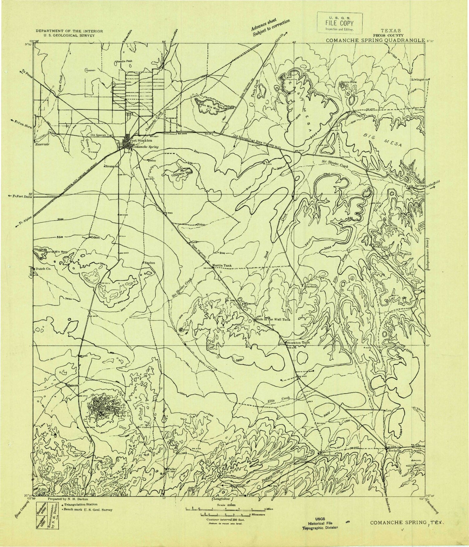
Historic 1928 Comanche Springs Texas 30'x30' Topo Map
Couldn't load pickup availability
Historical USGS topographic map of Comanche Springs in the state of Texas. Scale: 1:125000. Print size: 19" x 24"
This map was published in 1928 and is in the following counties: Pecos.
The map contains contour lines, roads, rivers, towns, streams, and lakes. Printed on high-quality waterproof paper with UV fade-resistant inks.
Contains the following named places: Belding Oil and Gas Field, Big Mesa, Big Tank Windmill, Bill Taylor Tank, Buck Trap Windmill, Bull Trap Windmill, Canyon Windmill, Canyon Windmill, Carlos Draw, Corner Tank, Cox Draw, Divide Windmill, Doodlebug Tank, Doodlebug Windmill, Dry Trap Windmill, Dry Windmill, East Mesa, East Windmill, East Windmill, Ellis Windmill, Elsinhore Ranch, Five Section Windmill, Fivemile Hill, Fivemile Mesa, Flat Top, Fort Stockton, Fort Stockton Oil and Gas Field, Fourteenmile Park, Gap Windmill, Gomez Oil and Gas Field, Government Windmill, Guayule Mountain, Harral Ranch, High Windmill, Highline Ditch, Highway Windmill, Hole-in-the-Ground Tank, Home Pasture Tank, Horse Pasture Windmill, Huelem Tank, Ike Windmill, James Rooney Memorial Park, Kelly Wade Windmill, Lannom Park, Lemon Tank, Lemon Windmill, Lemon Windmill Number One, Lemonds New Windmill, Leon Valley Oil and Gas Field, Little Bull Tank, Little Windmill, McKenzie Ranch, McKenzie Ranch, Middle Windmill, Mitchell Tank, Nineteen Draw, North High Windmill, North Windmill, North Windmill, North Windmill, Number Four Draw, Number Nine Tank, Number Nine Windmill, Old Headquarters Windmill, Old Headquarters Windmill, Panther Bluff, Panther Tank, Partnership Windmill, Pat Taylor Athletic Field, Pikes Peak Gas Plant, Pipeline Windmill, Point Windmill, Posey Windmill, Puckett Windmill, Round Mountain, Round Mountain, Round Mountain Windmill, Saddle Butte, Sevenmile Mesa, Sierra Madera, Sixshooter Draw, Sixshooter Windmill, South Linger Draw, South Linger Windmill, South Six Windmill, Stockton Tank, Tally Taylor Tank, The Needle Point, Three Section Windmill, Twelvemile Mesa, Twenty Foot Windmill, Twomile Hill, Twomile Windmill, Weak Windmill, West Pasture Windmill, West Tank, West Windmill, West Windmill, White Tank, Windmill Number Three, Burnen Tower Draw, Hole in the Ground Draw, Monument Draw, Rock House Draw, Guild, Pecos County, Comanche Creek Dam, Comanche Creek Reservoir, Fort Stockton Division, Alamo Ranchettes Colonia, Bodieville Colonia, Little Mexico Colonia, Panther Stadium, Fort Stockton City Park, City of Fort Stockton


