MyTopo
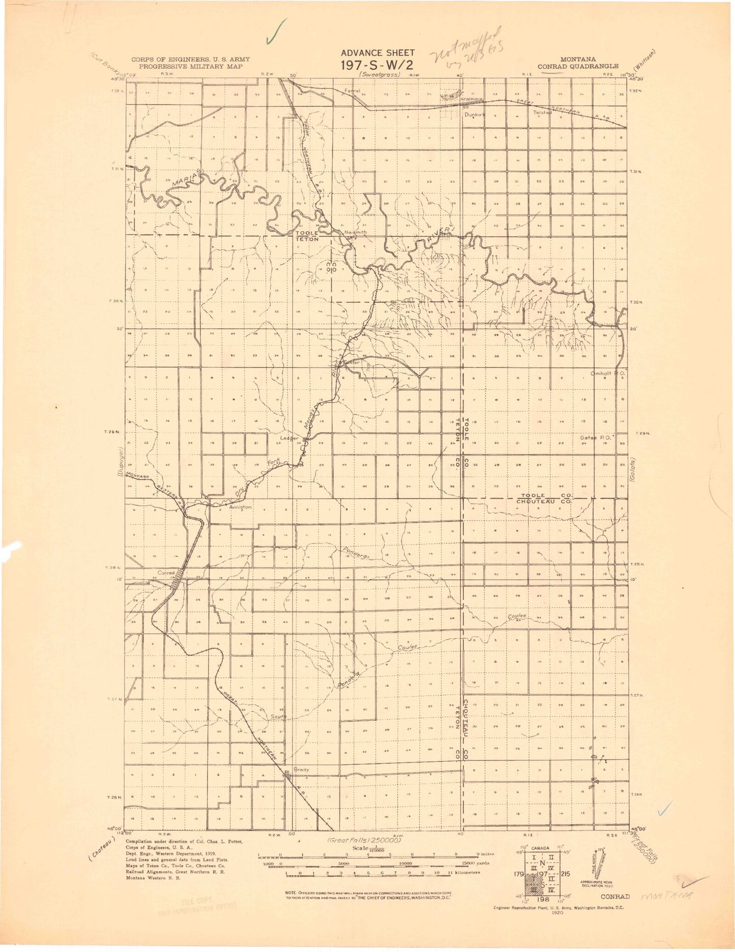
Historic 1920 Conrad Montana 30'x30' Topo Map
Couldn't load pickup availability
Historical USGS topographic map of Conrad in the state of Montana. Scale: 1:125000. Print size: 18" x 24"
This map was published in 1920 and is in the following counties: Pondera, Teton, Toole.
The map contains contour lines, roads, rivers, towns, streams, and lakes. Printed on high-quality waterproof paper with UV fade-resistant inks.
Contains the following named places: Atkinson Flat, Big Flat Coulee, Dry Fork Marias River, Dunkirk, Dunkirk Reservoir, E Ditch, E Ditch, EF Ditch, East Powder Coulee, Eyraud Lakes, F One Ditch, F Four Ditch, F Ditch, Farmers Coulee, Favot Coulee, Fort Conrad Historical Monument, Fowler, Fowler Coulee, Fowler Reservoir, G Canal, G Ditch, Hilger Coulee, K 2 Ditch, K 7 Ditch, K 9 Ditch, K Ditch, Ledger, Letz Lake, Lincoln Park, Little Flat Coulee, Marias Fairground, Marias Valley Golf and Country Club, Melcott Reservoir, Naismith, P Canal, P-6 Canal, Pearson Coulee, Rocky Coulee, Roosevelt Park, S Seven Ditch, S Canal, S Canal, Schultz Coulee, South Pondera Coulee, Spring Creek, Summers Reservoir, Swift Coulee, Tank Flat, Underdal Ranch, Whoop-up Rodeo Ground, Williamson Park, Bullhead Creek, Keil Ranch, South Rigby Dam, Wilson Number 1 Dam, Wilson Reservoir, Wilson Number 2 Dam, Wilson Reservoir, Wanken Dam, Wanken Reservoir, Ed McIntyre Dam, Ed McIntyre Reservoir, G N R R Dunkirk Reservoir Dam, Melcott Dam, M Ratzburg Dam, M Ratzburg Reservoir, D Ratzburg Dam, D Ratzburg Reservoir, Ovens Dam, Ovens Reservoir, McCracken Brothers Dam, Westermark Dam, White Dam, Johnson Dam, Walstom Dam, Rigby Dam, Bergstroms Farms Dam, Fowler Dam Number 2, Bergstroms Farms Number 2 Dam, Skorupa Dam, Shelby Sewage Lagoon Dam, Letz Lake Dam, Kauk Dam, Tom McCracken Dam, Jim Judisch Dam, Jim Judisch Reservoir, Harold Phillips Dam, Berland Skorupa Berland Dam, Keil Ranch Reservoir Number 1 Dam, Banka Dama Dam, Black Out Dam, Apocolipse Dam, Otilalda Dam, Orcutt Ranch Company Number 1 Dam, Cancer Dam, Cracker Dam, Fowl Mouth Dam, Aldebaran Dam, Lester Peters Number 1 Dam, Dato Dam, Dachau Dam, Marias Hereford Ranch Number 30 Dam, Sruddy Dam, The Moonspinner Dam, Loubren Incorporated Number 1 Dam, Sagittaurius Dam, Bar Z F Ranch Incorporated Number 1 Dam, Three Dollar Bill Dam, German Reservoir Dam, Pondera Golf Club, Telstad Pumping Station, Brady, Conrad, Conrad Butte, Whoop-Up Trail Historical Marker, Uncle Sam Coulee, Welch Coulee, Brady Coulee, Railroad Coulee, School Section Coulee, Sim Oliver Coulee, Oliver Coulee, Power Coulee, Ferguson Coulee, Berens Coulee, Wilkcox Coulee, Gibbons Coulee, Miller Coulee, Bird Coulee, Freebury Coulee, Snake Creek, Floberg Coulee, Columbia Grain International Incorporated Elevator, Freds Trailer Court, Legion Park, Conrad City Park, Kiwanis Park, Abel Park, Great Western Malting Company Elevator, Triangle Terminal Co-Operative Association Elevator, General Mills Incorporated Elevator, Columbia Grain International Incorporated Elevator, Spartan Manor Trailer Park, Speer Trailer Park, Torens Trailer Park, Sunrise Trailer Court, Pondera Trailer Park, Pondera Village Shopping Center, Valier Junction, Fowler, Ledger, Conrad, Brady, Williamson Park Campground, Oily Boid Gets the Woim Historical Marker, Snow Coulee, Russell Coulee, Zell Coulee, Moore Coulee, Twin Coulee, Naismith, Dunkirk, Conrad Division, Shelby Division, City of Conrad, Midway Colony, Camrose Colony


