
MyTopo
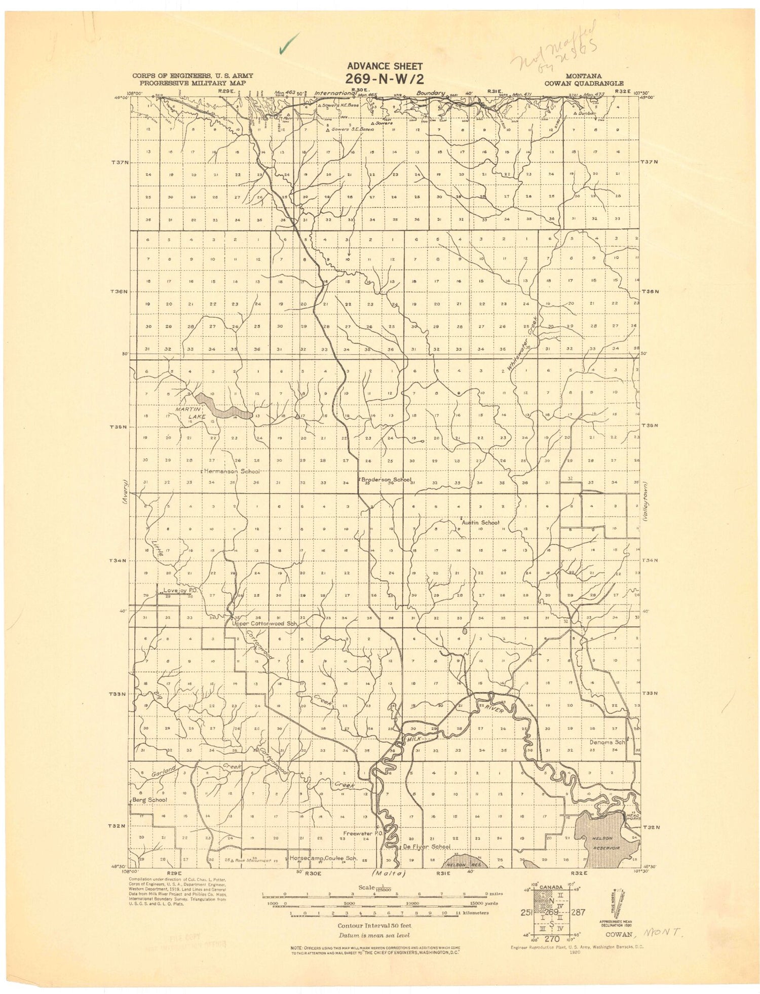
Historic 1920 Cowan Montana 30'x30' Topo Map
Couldn't load pickup availability
Historical USGS topographic map of Cowan in the state of Montana. Scale: 1:125000. Print size: 18" x 24"
This map was published in 1920 and is in the following counties: Phillips.
The map contains contour lines, roads, rivers, towns, streams, and lakes. Printed on high-quality waterproof paper with UV fade-resistant inks.
Contains the following named places: Morgan, Adair Reservoir, Alkali Coulee, Austin Dam, Austin Lake, Big McNeil Slough, Butte Coulee, Canty Coulee, Clark Coulee, Coop Coulee, Cottonwood Creek, Cree Crossing, Garland Creek, Gregory Coulee, Hanson Dam, Hewitt Lake, Hewitt Lake National Wildlife Refuge, Little Cottonwood Creek, Lone Tree Sag, Loring, Lush Coulee, Martin Lake, Martins Coulee, McNeil Slough, Nelson Canal, Nelson South Canal, Oxarart Dam, Pea Lake, Plum Reservoir, Spring Coulee, Tattnall, White Dam, Whitewater, Nelson Dikes A B C and D, Hewitt Dam, PR-156 Dam, PR-88 Dam, Not Much Dam, Demontigny Dam, PR-54 Dam, Compton Dam, Watkins Number 2 Dam, Morrison Dam, Austin Number 2 Dam, E Wasson Number 2 Dam, Split Rock Dam, Austin Dam, Jumbo Number 1 Dam, Three Hundred Dam, E Wasson Number 1 Dam, Hanson Dam, Bozo Dam, French Fry Number 1 Dam, French Fry Number 2 Dam, Cottonwood Grazing Number 4 Dam, Whitewater Dam, Ada Reservoir, Gustin Coulee, 3 Way Number 2 Reservoir, Tondra Reservoir, Waterfowl Reservoir, Hilo Reservoir, Titan Reservoir, Kohola Reservoir, Palea Reservoir, Dibble Creek, Lone Tree Coulee, Lovejoy, Fanny Hill, Austin Coulee, Dunham Coulee, Tea Kettle Butte, Dunbar Coulee, East Fork Whitewater Creek, Sarm Reservoir, Nerve Reservoir, Haukos Coulee, Ethel Reservoir, Artie Reservoir, Lester Reservoir, Hymer Coulee, Joe Bell Coulee, Cottonwood Coulee, Shotgun Creek, Provost Coulee, Voje Coulee, Lone Tree Coulee, Big Coulee, Martin Lake Coulee, Barton Coulee, Dry Sag Coulee, Lake Coulee, Nelson Reservoir Campground, Loring Colony, Big Bend, Whitewater Division, Phillips County Waterfowl Production Area


