MyTopo
Historic 1912 Cut Bank Montana 30'x30' Topo Map
Couldn't load pickup availability
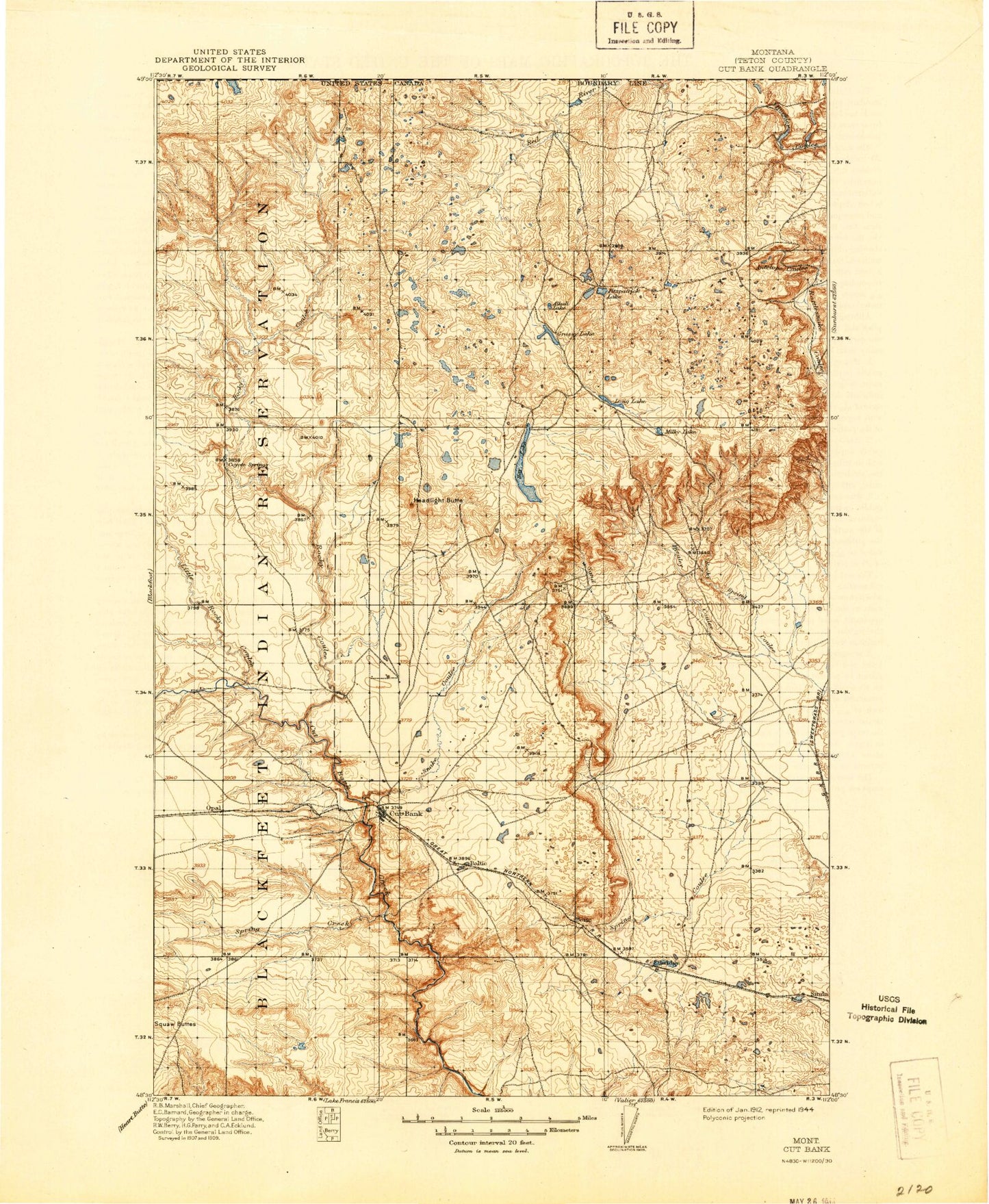
Historical USGS topographic map of Cut Bank in the state of Montana. Scale: 1:125000. Print size: 18" x 24"
This map was published in 1912 and is in the following counties: Glacier, Toole.
The map contains contour lines, roads, rivers, towns, streams, and lakes. Printed on high-quality waterproof paper with UV fade-resistant inks.
Contains the following named places: Alkali Lake, Allison Lake, Aloe Lake, Big Rock Coulee, Cut Bank, East Fork Big Rock Coulee, Ethridge, Fitzpatrick Coulee, Fitzpatrick Lake, Flat Coulee, Glacier Colony, Grassy Lake, Gunsight, Hay Lake, Headlight Butte, Healy Coulee, Hillside Colony, Hope Lake, Kevin Sunburst Oil Field, Long Lake, Mud Lake, Old Maids Coulee, Pearsons Coulee, Red Creek Oil Field, Rim Rock Colony, Rocky Springs Coulee, Sand Coulee, Santa Rita, Seville Community Hall, Snake Coulee, Spring Coulee, Spring Creek, Whetstone Camp, Little Rock Coulee, South Fork Little Rock Coulee, McLean Dam, McLean Reservoir, Hillside Colony Dam, Brady Lakes Dam, Eyraud Lakes, Cut Bank Sewage Lagoon Dam, Yunck Dam, Ramcharger Dam, Upsilon Dam, Tsadi Dam, Omicron Dam, Vasboe Dam, Marathon Dam, Hagerty Dam, GJP Suta Dam, Looney Tuney Dam, Hillkleberry Coulee Dam, Miss Easy Pride Dam, Rocky Mountain High Dam, Long Lake Dam, Cut Bank Sewage Disposal Pond Dam, Cut Bank Refinery, Aloe, Potter Coulee, Johns Coulee, Mansfield Coulee, Rocky Ridge Coulee, Treadwell Coulee, Mars Coulee, Foxtail Lakes, Benton Trail Lakes, Davis Lakes, Cowboys Lake, Frenchman Lake, Farrell Coulee, Hemmings Lake, Twin Lakes, Halfway Coulee, Grassy Lake, Ethridge, Cut Bank, General Mills Incorporated Elevator, Harvest States Cooperatives Elevator, Montana Wheat Growers Incorporated Elevator, Northern Village Shopping Center, Skyland Trailer Park, Gary Smith Memorial, Shady Grove Campground, Riverview Campground, Cut Bank Golf and Country Club, Conway Lake, Spring Coulee, Head Light Coulee, Boundary Lake, Lukins Lake, Union Oil Company of California Spur, Cut Bank Division, City of Cut Bank, Glacier County Waterfowl Production Area, Horizon Colony, Zenith Colony