
MyTopo
Historic 1899 De Smet South Dakota 30'x30' Topo Map
Couldn't load pickup availability
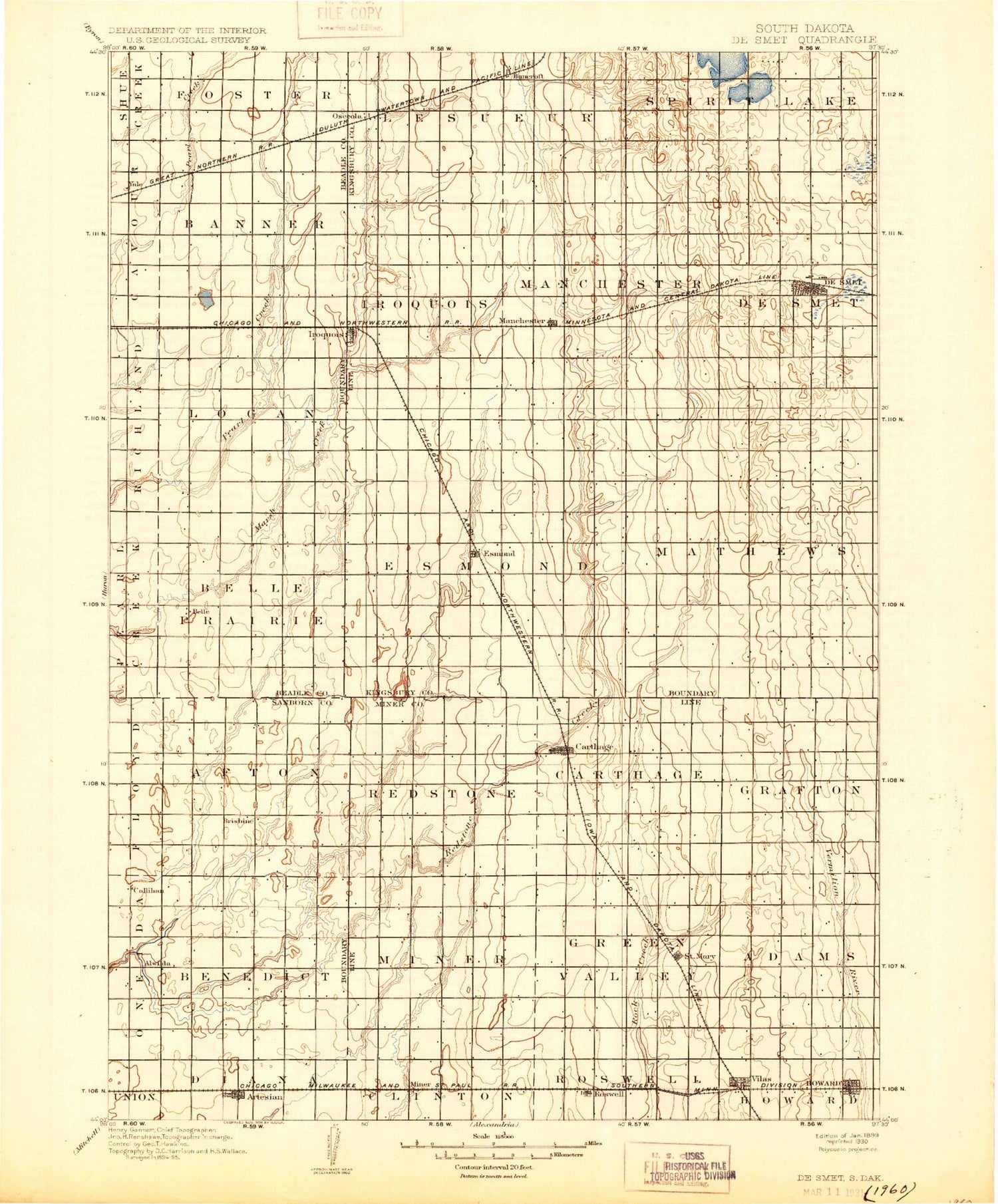
Historical USGS topographic map of De Smet in the state of South Dakota. Scale: 1:125000. Print size: 17" x 24"
This map was published in 1899 and is in the following counties: Beadle, Kingsbury, Miner, Sanborn.
The map contains contour lines, roads, rivers, towns, streams, and lakes. Printed on high-quality waterproof paper with UV fade-resistant inks.
Contains the following named places: Lake Agnew, Bancroft, Lake Carthage, Cloverleaf Colony, Fedora, Iroquois, Lake Iroquois, Mud Lake, Osceola Lake, Pearl Creek Colony, Rifle Lake, Spirit Lake, Vilas, West Redstone Creek, Yale, Carthage Dam, Amsden Dam, Argonne, Osceola, De Smet, Esmond, Manchester, Artesian, Howard, Miner County, Carthage, Roswell, Town of Artesian, Town of Bancroft, City of Carthage, City of De Smet, City of Howard, City of Iroquois, Town of Roswell, Town of Vilas, Town of Yale, Township of Afton, Township of Benedict, Township of Woodworth, Township of Redstone, Township of Carthage, Township of Grafton, Township of Miner, Township of Green Valley, Township of Adams, Township of Belle Prairie, Township of Logan, Township of Foster, Township of Banner, Township of Le Sueur, Township of Spirit Lake, Township of Manchester, Township of De Smet, Township of Esmond, Township of Mathews, Township of Iroquois, Miner County Waterfowl Production Area


