MyTopo
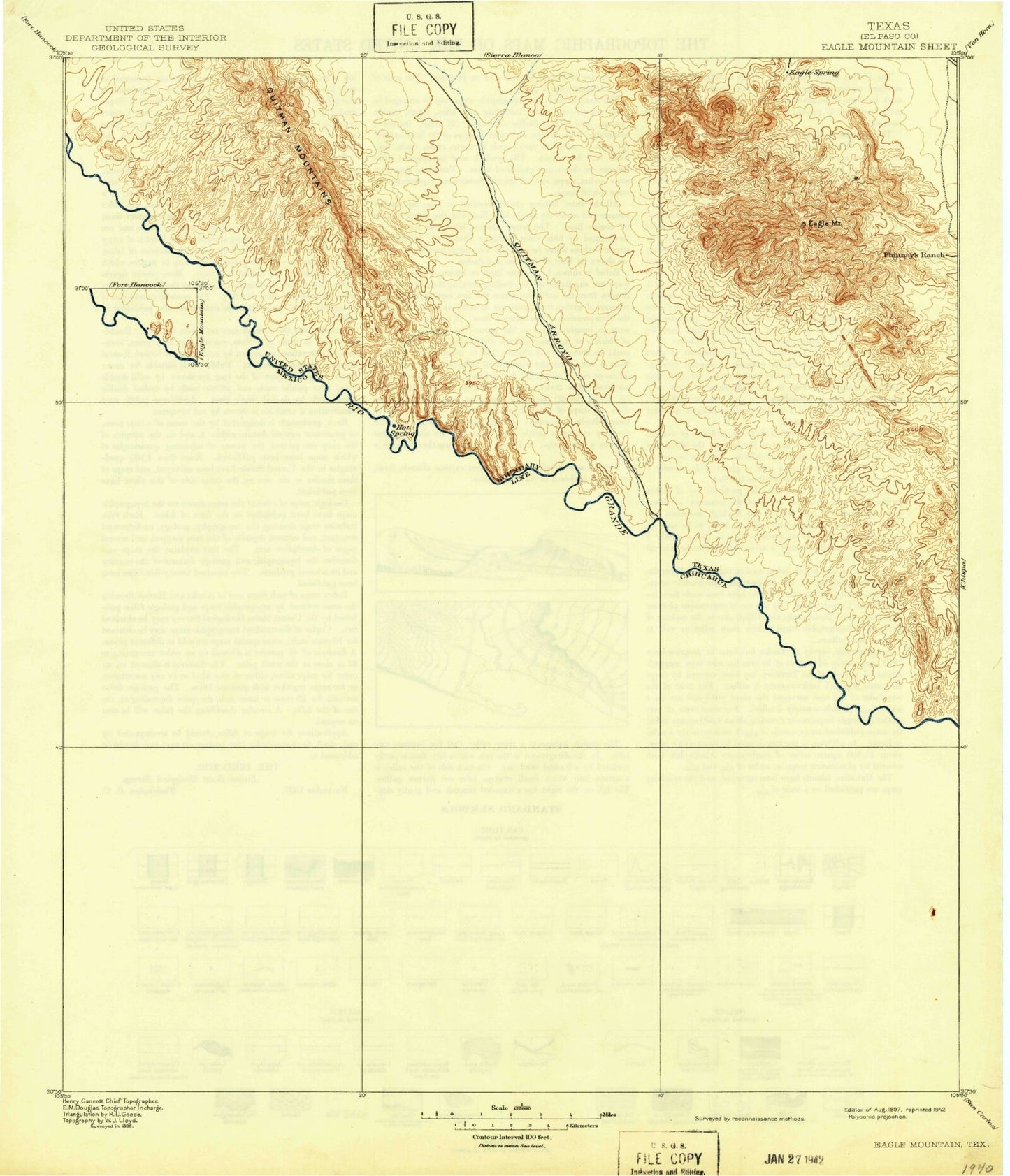
Historic 1897 Eagle Mountain Texas 30'x30' Topo Map
Couldn't load pickup availability
Historical USGS topographic map of Eagle Mountain in the state of Texas. Scale: 1:125000. Print size: 18" x 24"
This map was published in 1897 and is in the following counties: Hudspeth.
The map contains contour lines, roads, rivers, towns, streams, and lakes. Printed on high-quality waterproof paper with UV fade-resistant inks.
Contains the following named places: Adobe Tank, Arroyo Caballo, Asebuches Arroyo, Babb Tank, Binocular Canyon, Black Diamond Mine, Bramblett Ranch, Bramlett Ranch, Buckhorn Tank, Camp Tank, Carpenter Canyon, Cedar Arroyo, Cedar Windmill, Central Tank, Cottonwood Canyon, Cummings Ranch, Cypress Canyon, Davis Arroyo Tank, Deer Peak, Double Tank, Eagle Mountain Ranch, Eagle Mountains, Eagle Peak, Echo Canyon, Echo Tank, ElPadre Canyon, Escondido Tank, Faultline Tank, Frenchmans Canyon, Goat Canyon, Hayter Ranch, Horse Canyon, Indian Hot Springs, Indian Water Hole, Indio Ranch, Love Ranch, Mayfield Canyon, Mesa Windmill, Middle Tank, Oxbow Lake, Oxford Canyon, Panther Peak, Porcher Canal, Porcher Ranch, Purple Sage Mine, Red Bluff Windmill, Red Bull Canyon, Red Bull Hill, Red Hills Arroyo, Red Light Windmill, Red Rock Tank, Schroder Arroyo, Smugglers Arroyo, Smugglers Gap, Split Tank, Squaw Pass, Squaw Peak, Suicide Flat, The Gap, The Ice Cream Cone, The Little Big Bend, The Palisades, The Pot Hole, Water Canyon, White Hill Tank, Willow Tank, Windmill Tank, Cow Arroyo, Guerra Farm, Hackberry Arroyo, Mule Canyon, Red Light Draw, Talley Ranch, Eagle Canyon, Squaw Creek, Gibson Dam, Gibson Reservoir