
MyTopo
Historic 1925 Edgeley North Dakota 30'x30' Topo Map
Couldn't load pickup availability
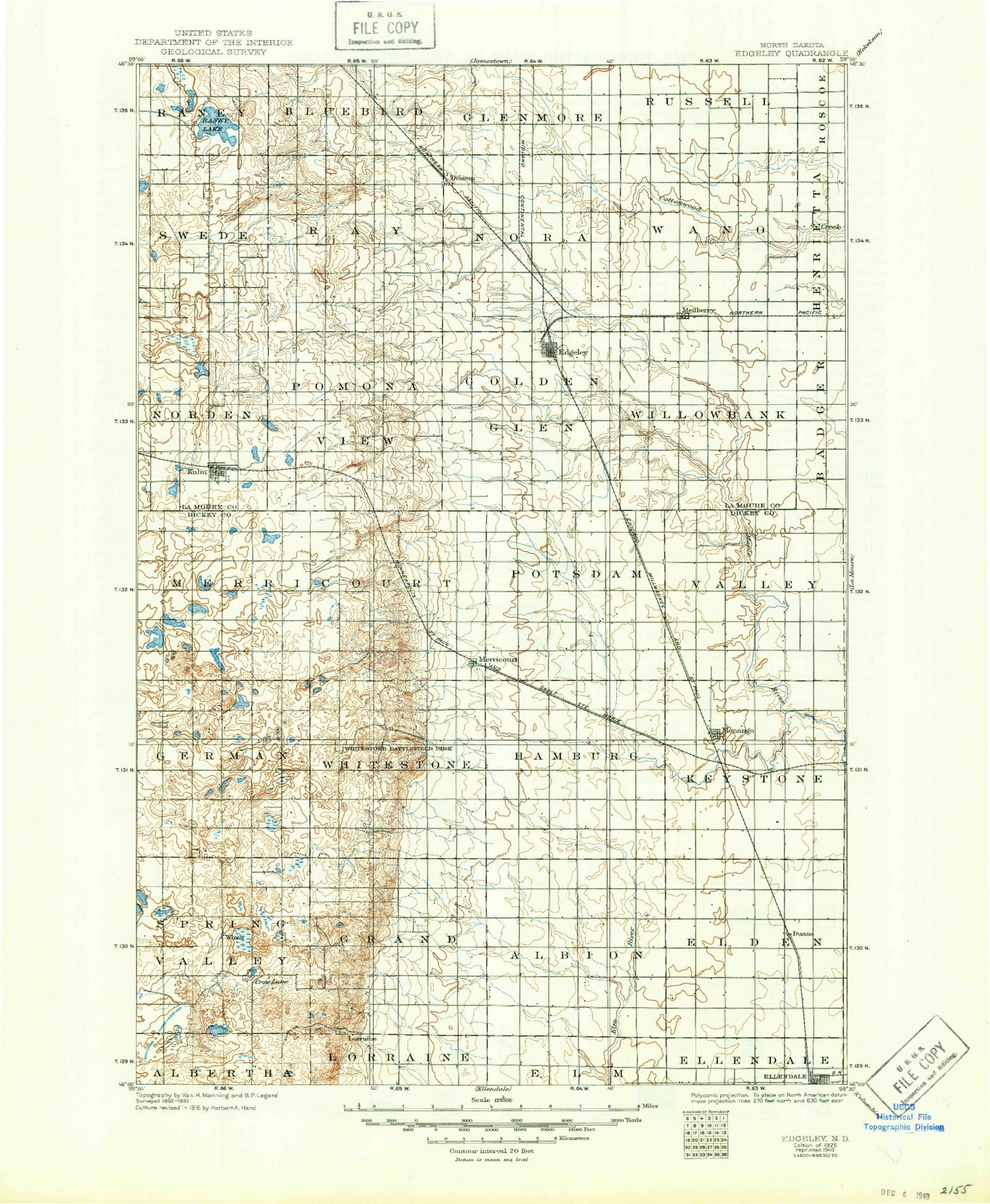
Historical USGS topographic map of Edgeley in the state of North Dakota. Scale: 1:125000. Print size: 17" x 24"
This map was published in 1925 and is in the following counties: Dickey, LaMoure.
The map contains contour lines, roads, rivers, towns, streams, and lakes. Printed on high-quality waterproof paper with UV fade-resistant inks.
Contains the following named places: Bristol Gulch, Crab Tree Lakes, Crow Lake, Ellendale, Happy Lake, Hilles Lake, Merricourt, Monango, Pheasant Lake, Whitestone Battlefield State Park, Wilson Dam, Wood Lake, Elm River Dam, Wilson Dam, Moores Dam, Moores Lake, Deisem, Edgeley, Kulm, Maple Creek, Medberry, Kulm-Edgeley Dam, Nora Township Dam, Swede Dam, Schlecht-Weixel Dam, Schlecht-Thom Dam, Jolin Dam, Edgeley Junction, Duane, Wirch, Schlecht-Thom Dam, Lazy Dollar Ranch, Rainbow Ranch, Boynton, Monango Crossing, South Fork Maple River, LaMoure County, Dickey County, City of Edgeley, City of Ellendale, City of Kulm, City of Monango, Township of Elden, Township of Enterprise, Township of Albion, Township of Grand Valley, Township of Keystone, Township of Valley, Township of Shelby, Township of Hamburg, Township of Potsdam, Township of Whitestone, Township of Young, Township of German, Township of Northwest, Township of Golden Glen, Township of Pomona View, Township of Norden, Township of Wano, Township of Nora, Township of Ray, Township of Swede, Township of Willowbank, Township of Spring Valley, Edgeley Rest Area, Willowbank Colony


