MyTopo
Historic 1899 Ellensburg Washington 30'x30' Topo Map
Couldn't load pickup availability
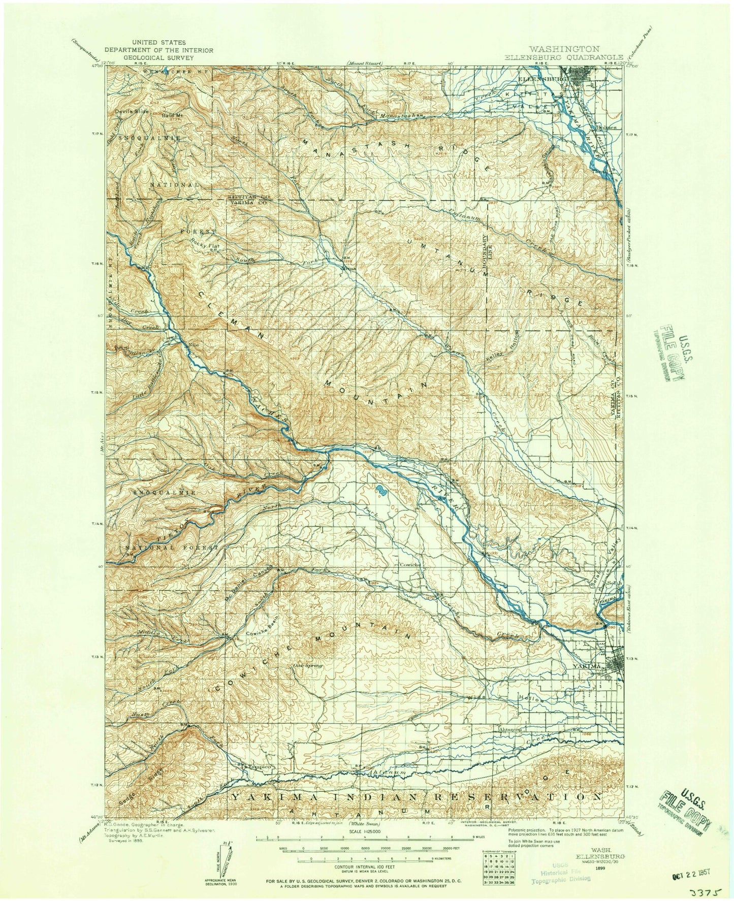
Historical USGS topographic map of Ellensburg in the state of Washington. Scale: 1:125000. Print size: 18" x 24"
This map was published in 1899 and is in the following counties: Kittitas, Yakima.
The map contains contour lines, roads, rivers, towns, streams, and lakes. Printed on high-quality waterproof paper with UV fade-resistant inks.
Contains the following named places: Barnes Cabin, Benwy Canyon, Black Canyon, Buckskin Slough, Bull Ditch, Cherry Creek, Congdon Canal, Cottonwood Creek, Cowiche Canyon, Cowiche Creek, Crusher Canyon, Davis Trail, Dry Creek, East Unit 1 Highline Canal, Fogarty Ditch, Franklin Park, Gilbert Park, Gleed Ditch, Goodwin Canyon, Iowa Flat, Kelley Hollow, Kelly Ditch, Lady Bug Canyon, Larson Park, Lateral C, Lateral J, Lateral L, Lateral N, Lateral P, Lateral T, Lions Park, Longmire Wenas Canal, Lookout Point, Lower Naches Community Park, Lower Naches Grange, Lower Naches Valley, Lowry Ditch, Miller Park, Milroy Park, Mountain View Park, Naches and Cowiche Ditch, Naches Heights, Number 1 Lateral, Number 2 Lateral, Pecks Canyon, Pine Canyon, Ramblers Park, Selah Valley, Shushuskin Canyon, Spring Canyon, Spring Creek, Spring Creek, Spud Canyon, The Cottonwoods, Tjossem Ditch, Twin Bridges, Union Canal, Wenas Valley Grange, West Side Park, Wide Hollow, Yakima, Ahtanum Youth County Park, Lake Myron, Carlon Park, Wixon Park, Palm Park, Legion Park, Elks Memorial Park, Broadway Park, Brace, Eschbach, Holmes, Tasker, Thrall, Weikel, Bonlow, Bannister, Congdon, Eastman, Exchange, Henrybro, Indian Painted Rocks State Park, Mallett, Elliott Ave, Wenas Dam, Orchard, Stewart, Schwarder, Ahtanum, Cowiche, Craigs Hill, Fruitvale, Gleed, Gromore, Harwood, Holtzinger, Naches, Pleasant Hill, Selah, Selah Heights, Tietonview Grange, Wiley City, Lateral K, Tjossem Pond, Wenas Lake, Chalet Mall Shopping Center, Glenwood Shopping Center, Meadow Brook, Meadowbrook Mall, Nob Hill Plaza, Southgate Shopping Center, Viking Village Shopping Center, Westpark Shopping Center, Yakima Mall, Ahtanum Canal, Ahtanum Ridge, Ahtanum Valley, Bachelor Creek, Bald Mountain, Bear Canyon, Bear Canyon, Benton Creek, Big Burn Canyon, Box Spring Canyon, Burn Canyon, Canteen Flats, Carmack Canyon, Carpenter Gulch, Carrol Flats, Catlin Canyon, Cheney Ranch, Cleman Mountain, Clint Canyon, Coleman Canyon, Cottonwood Canyon, Cougar Canyon, Counterfeit Creek, Cow Canyon, Cowiche Basin, Cowiche Mountain, Devils Slide, Dipping Vat Canyon, Dry Creek, Dry Creek, Eagle Rock, Ellensburg, Ellensburg Pass, Evans Canyon, Fisher Flat, Foundation Creek, French Canyon, Garrett Canyon, Gold Creek Trail, Hanging Tree Campground, Hardy Canyon, Hatton Creek, High Valley Ranch, Hoover Canyon, Horse Trough Canyon, Horseshoe Bend, Hudson Creek, Indian Creek, John Cox Ditch, Johnson Canyon, Jones Canyon, Lateral A, Lateral B, Lateral C, Lateral E, Lateral F, Lateral G, Lateral R, Lateral S, Lefthand Fork Rock Creek, Lemon Canyon, Lesh Ditch, Little Mud Lake, Little Rattlesnake Creek, Logger Canyon, Long Tom Canyon, Manastash Creek, Manastash Lake, McDaniel Canyon, Meloy Canyon, Mercer Creek, Meystre Canyon, Middle Fork Canyon, Milk Canyon, Milk Lake, Mill Canyon, Mud Flats, Mud Lake, NPK Canyon, Naches River, Nasty Creek, Nile, Nile Creek, North Fork Ahtanum Creek, North Fork Cowiche Creek, North Fork Manastash Creek, North Fork Oak Creek, North Fork Wenas Creek, North Riggs Canyon, Oak Creek, Oak Creek State Wildlife Area, Pine Canyon, Pine Mountain, Pine Tree Canyon, Rattlesnake Creek, Rattlesnake Ranger Station, Reecer Creek, Reed Canyon, Reynolds Creek, Righthand Fork Rock Creek, Rimrock Retreat, Rock Creek, Rock Creek, Rocky Prairie, Rocky Saddle, Sanford Canyon, Sanford Pasture, Sedge Ridge, Selah Valley Canal, Sentinel Creek, Sentinel Rock, Shaw Knox Ditch, South Branch Extension, South Fork Ahtanum Creek, South Fork Manastash Creek, South Fork Oak Creek, South Fork Wenas Creek, South Riggs Canyon, Stone Quarry Canyon, Summit Trail, Tampico, Tepee Creek