MyTopo
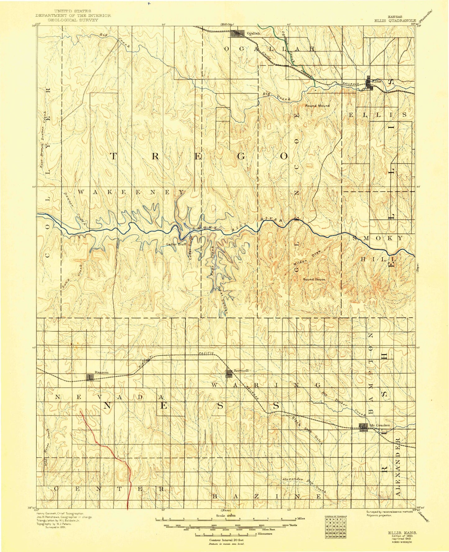
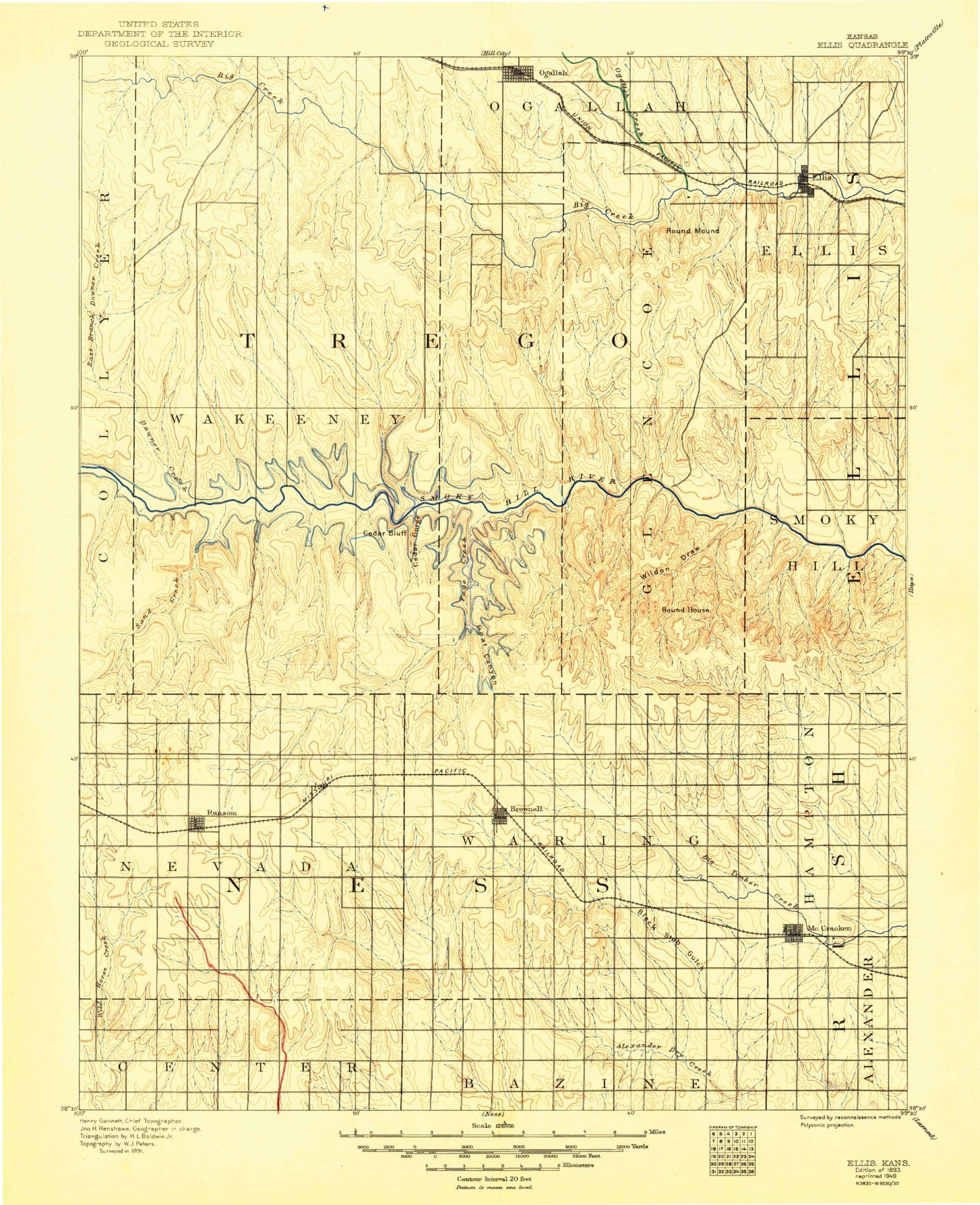
Historic 1893 Ellis Kansas 30'x30' Topo Map
Couldn't load pickup availability
Historical USGS topographic map of Ellis in the state of Kansas. Scale: 1:125000. Print size: 17" x 24"
This map was published in 1893 and is in the following counties: Ellis, Ness, Rush, Trego.
The map contains contour lines, roads, rivers, towns, streams, and lakes. Printed on high-quality waterproof paper with UV fade-resistant inks.
Contains the following named places: Downer Creek, Township of Nevada, Sand Creek, Forrester Creek, Township of Forrester, East Branch Downer Creek, Trego Center, Ogallah Oil Field, Ogallah, Round Mound, Township of Glencoe, Ellis, Pleasant Oil Field, Township of Wilcox, Cedar Bluff Reservoir, Cedar Gorge, Cedar Bluff, Township of Riverside, Page Creek, Wildon Draw, Tunnel Creek, Cedar Bluff Dam, Cedar Bluff National Fish Hatchery, Groff Oil Field, Sunny Slope Oil Field, Younger Oil Field, Cedar Bluff Canal, Solburn Oil Field, Pleasant West Oil Field, East Branch Sand Creek, Ransom, Goat Canyon, Township of Waring, Big Rimber Creek, Brownell, McCracken, Cedar Bluff Wildlife Area, Wilson Wildlife Area, Round House Rock, Rohr Jacobs Lake, Riga, Fort Downer, Osgood, Trego County, Township of Ellis, Spring Creek, City of Ellis, City of Brownell, City of McCracken, City of Ransom, Cedar Bluff State Park Broken Spur Campground, Cedar Bluff State Park Crooked Arrow Campground, Cedar Bluff State Park Prickly Pear Campground, Cedar Bluff State Park Wagon Rut Campground, Ransom Sewer Treatment Plant, McCracken Wastewater Facility, Kansas Department of Transportation Trego County Rest Area, Ellis Wastewater Plant, Cedar Bluff State Park Bluffton Campground, Ellis Country Club, Big Creek Golf Course, Ness County Country Club, Frontier Agricultural Grain Elevator Number 19