MyTopo
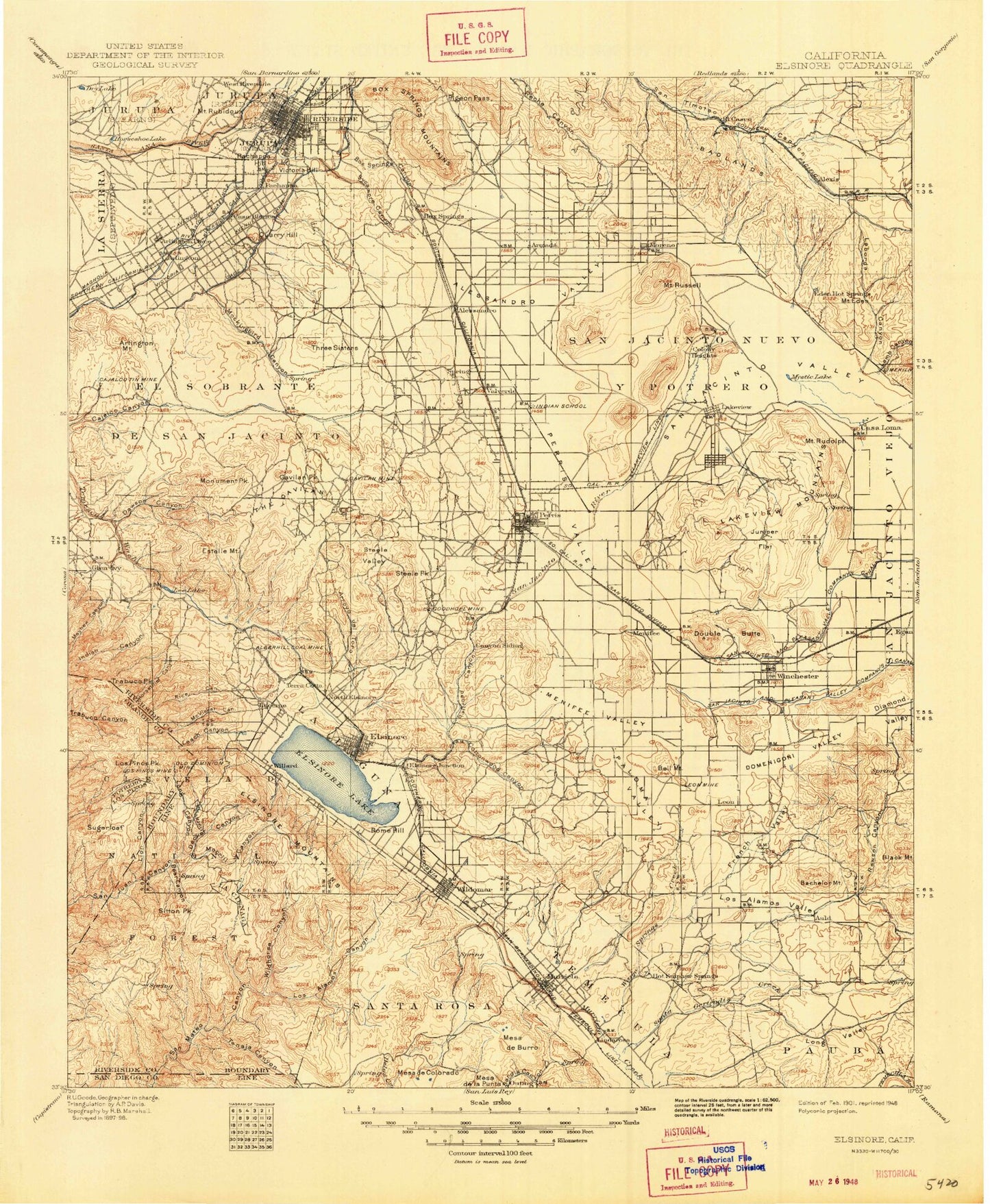
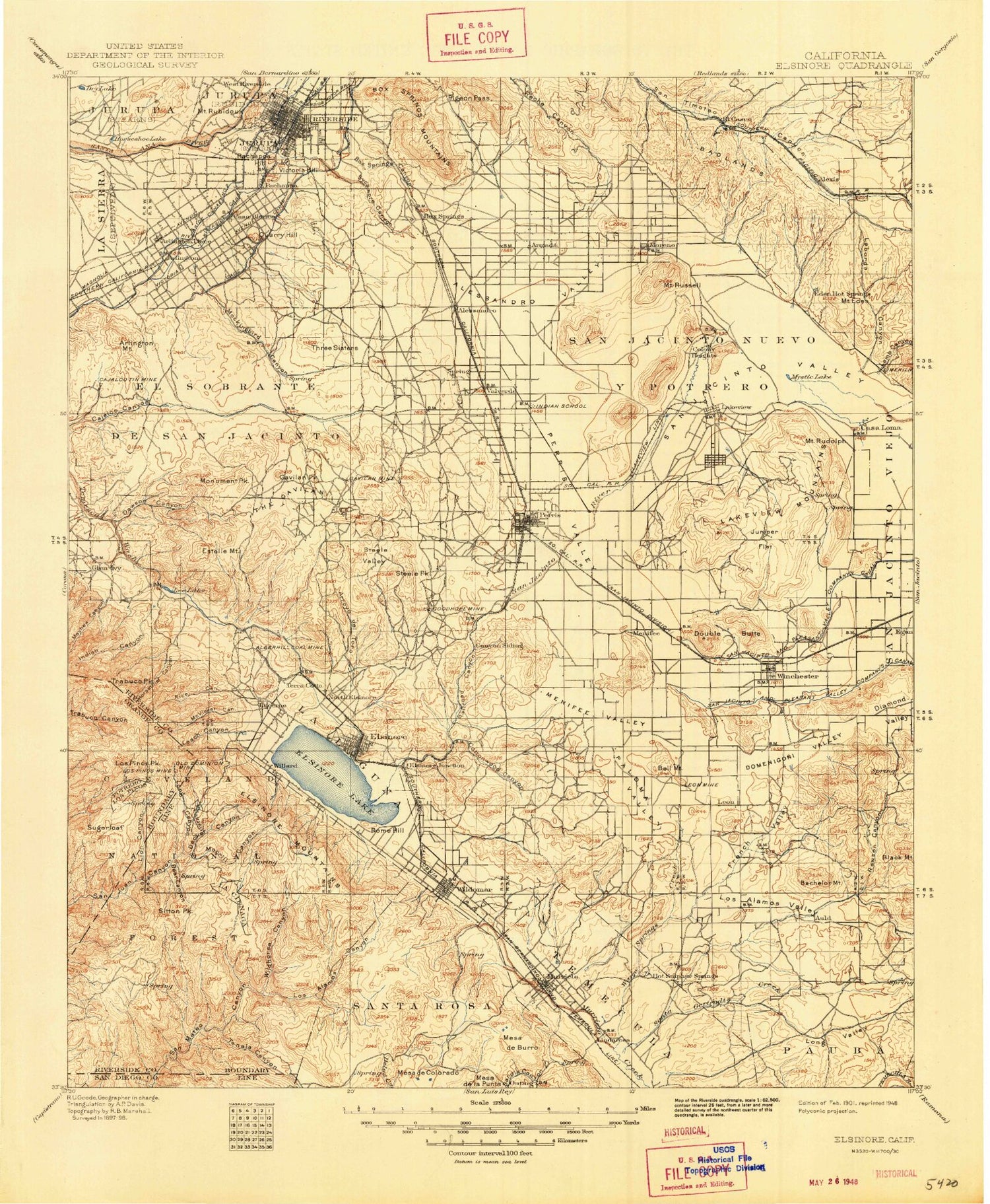
Historic 1901 Elsinore California 30'x30' Topo Map
Couldn't load pickup availability
Historical USGS topographic map of Elsinore in the state of California. Scale: 1:125000. Print size: 18" x 24"
This map was published in 1901 and is in the following counties: Orange, Riverside, San Diego.
The map contains contour lines, roads, rivers, towns, streams, and lakes. Printed on high-quality waterproof paper with UV fade-resistant inks.
Contains the following named places: Tequesquite Arroyo, Arlington, Arlington Plaza, Arlington Station, Arlington Valley Channel, Auld Valley, Bachelor Mountain, Banta Beatty Park, Bar V Ranch, Bear Canyon, Belardes Potrero, Bell Mountain, Bernasconi Hills, Bernasconi Pass, Black Mountain, Bluewater Canyon, Bluewater Truck Trail, Bordwell Park, Box Springs, Box Springs Canyon, Box Springs Lookout, Box Springs Mountains, Camp Evans, Camp Tree Mont, Casa Loma Canal, City Hall Mall, Clark Trail, Cole Canyon, Cottonwood Lake, Crown Valley, De Anza Trail Monument, Decker Canyon, Diamond Valley, Domenigoni Valley, Double Butte, Mount Eden, Edgemont, Elsinore Peak, El Casco Lake, Ethanac Siding, Evans Park, Lake Evans, Fairmount Park, Fishermans Camp, French Valley, Gage Canal, Gavilan Mine, Granite Spur, Hogbacks, Hole Lake, Horseshoe Lake, Hunt Park, Hunter Park, Hyatt School, Ida-Leona Mine, Indian Potrero, Indian Potrero Truck Trail, Jones Park, Juniper Flat, Jurupa, Jurupa Ditch, Juvenile Hall, La Sierra Heights, La Sierra Park, Laborde Canyon, Lakeview Hot Springs, Lakeview Mountains, Lawless Ranch, Leon Mine, Lincoln Park, Lion Canyon, Long Canyon, Long Canyon, Long Valley, Los Alamos Canyon, Los Alamos Ranch, Los Alamos Truck Trail, Low Park, Lower San Juan Campground, March Field, May, Mayer Farms, Maze Stone Historical Marker, Mead Valley, Menifee Valley, Menifee-Antelope Community Hall, Mesa de la Punta, Mesa de Burro, Mesa de Colorado, Miller Canyon, Miller Mountain, Mockingbird Reservoir, Moreno, Moreno Valley, Morgan Trail, Morrell Canyon, Morrell Potrero, Morrell Ranch, Mount Rubidoux Park, Newman Park, Nichols Park, Nickel Canyon, North Hill, North Park, Oak Flats, Oak Springs Ranch, Pachappa Hill, Paloma Valley, Patterson Park, Pedley Hills, Perris Reservoir, Perris Valley, Perris Valley Storm Drain, Pigeon Pass, Pigeon Pass Valley, Poorman Reservoir, Potrero Creek, Quarry Hill, Rancho de las Piedras, Rawson Canyon, Reinhardt Canyon, Riverside Plaza, Round Potrero, Mount Rudolph, Mount Russell, San Diego Canal, San Juan Trail, San Mateo Trail, San Mateo Truck Trail, Santa Gertrudis Creek, Santa Rosa, Santa Rosa Mine, Santa Rosa Ranch, Shamel Park, Sitton Peak, Sitton Peak Truck Trail, Skinner Reservoir, Skunk Hollow, Slaughterhouse Canyon, Spring Brook, Squaw Mountain, Steele Peak, Steele Valley, Stewart Ranch, Sugarloaf, Sugarloaf Mountain, Sunnyslope Channel, Sycamore Canyon, Temecula Hot Springs, Tenaja Canyon, Tenaja Guard Station, Tenaja Truck Trail, The Badlands, Three Sisters, Tract Between San Jacinto and San Gorgonio, Tres Cerritos, Tucalota Hills, Upper San Juan Campground, Val Verde Tunnel, Verdugo Potrero, Verdugo Truck Trail, Victoria Hill, Villegas Park, Warm Springs Creek, Wheeler Ranch, White Park, Wildhorse Canyon, Wildomar Truck Trail, Woodcrest Dam, Bishop Canyon, Murrieta, Egan, Hinda, Menifee, Riverside Junction, Val Verde, Potrero de Los Cienega, Mount Rubidoux, West Riverside Canal Lateral Number Two, West Riverside Lateral Number One, Arlington Mountain, Arroyo Del Toro, Black Rocks, Brooks Canyon, Bundy Canyon, Cajalco Canyon, Cajalco Tin Mine, Cajalco Tunnel, Cariso Truck Trail, Coldwater Canyon, Cottonwood Canyon, Cow Canyon, Dawson Canyon, Dickey Canyon, Durant Siding, Eagle Valley, Edwards Canyon, El Cariso Guard Station, El Sobrante de San Jacinto, Elsinore Mountains, Lake Elsinore, Estelle Mountain, Gavilan Peak, Gavilan Plateau, Gavilan Springs Ranch, Glen Ivy Hot Springs, Good Hope Mine, Guthrie Canyon, Hammack Ranch, Harlan Canyon, Horsethief Canyon, Horsethief Trail, Indian Canyon, Indian Pictographs Historical Marker, Indian Truck Trail, Johnson Canyon, La Laguna, Lake Mathews, Lamb Canyon, Leach Canyon, Lee Lake, Little San Gorgonio Creek, Los Pinos Peak, Main Divide Truck Trail, Mathews Dam, Mathews Dike, Mayhew Canyon, McConville Nudist Camp, McVicker Canyon, Mockingbird Canyon, Monument Peak, Noble Creek, North Elsinore, Old Dominion Mine, Olsen Canyon, Pauba


