MyTopo
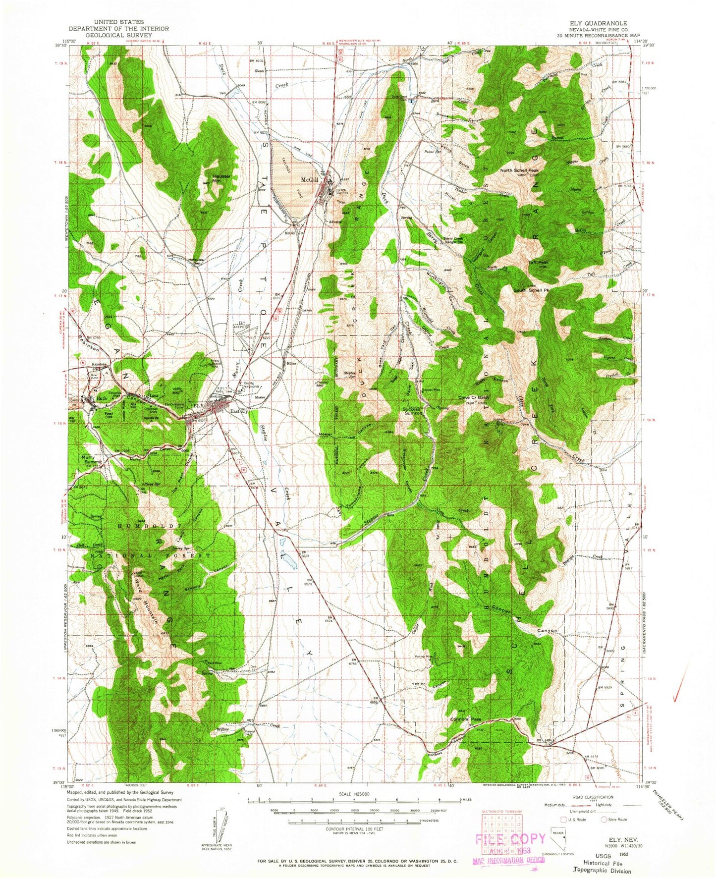
Historic 1952 Ely Nevada 30'x30' Topo Map
Couldn't load pickup availability
Historical USGS topographic map of Ely in the state of Nevada. Scale: 1:125000. Print size: 17" x 24"
This map was published in 1952 and is in the following counties: White Pine.
The map contains contour lines, roads, rivers, towns, streams, and lakes. Printed on high-quality waterproof paper with UV fade-resistant inks.
Contains the following named places: Dunham McGill Ditch, Ada Shaft, Boston Mine Shaft, Connors Pass, Deep Ruth Shaft, Deuce Mine, Duck Creek Overflow Canal, Elijah Mine, Ely-Centennial Tunnel, Fisher Canyon, Garnet Fields, Hayes Ridge, Jones Canyon, Juniper Dump, Keystone Dump, Keystone Hill, Lane Valley, Lusetti Canyon, Lusetti Ranch, Monitor Shaft, Ocher Valley, Puritan Dump, Rattlesnake Canyon, Romeo Ranch, Smith Valley, Sorehead Tunnel, Steptoe Slough, Sunshine Dump, Tailings Creek, Taylor Canyon, Taylor Peak, The Calcite, The Cove, The Dolomite, The Rabbit Mine, Ada Hill, Elijah Hill, Lane City, McGill, Ruth, Saxton Shaft, Squaw Peak, The Cliffs, Twin Peaks, Willard Hill, Hercules Gap, Spring Valley Ranger Station, Landmark Letters, Hornbek Ranch, Connors Canyon, Lane, Cooper Meadow, Bishop Pit, Monitor Mine, Reynolds Tunnel, Argus Mine, San Francisco Mining District, Hercules Mining District, Mineral City, Garnet Hill, Robust Mill, Ruth Shaft, Brilliant Shaft, Juniper Shaft, Copper Flat, Eureka Shaft, Star Pointer Shaft, Clipper Shaft, Lead King Mine, Mayflower Mine, Providence Mine, Ely Gibralter Mine, Capitol Hills Mine, Ward Mining District, Steptoe Mine, McDonough Pits Mine, Duck Creek Mining District, Cleve Creek Mining District, Nevada Mining District, Enterprise Mine, Merrimac Mine, Platt Mine, Alameda Mine, Gore Mine, Taylor Mining District, Piermont Mine, Piermont Mining District, Wagner Hill, Isaacs Mine, Garnet Hill Mine, Keystone Mine, Robinson Mining District, Aultman Mine, Willard Mine, Monroe Mine, Wedge Pit, Chainman Shaft, Kimbley Pit, Revenue Shaft, Taylor Shaft, Hayes Shaft, Witch Shaft, Columbia Shaft, Elk Flat Campground, Adverse, Calumet, Glenn, Keystone, Keystone Junction, Kogan Place, Steptoe, Heusser Mountain, Verza Canyon, Garnet Fields Rockhound Area, Ely Township, Bassett Lake, White Pine County, McCoy Creek, Argus Mill, Axehandle Pass, Baltimore Mill, Bassett Creek, Bastian Creek, Bell Shaft, Berry Creek, Berry Creek Forest Service Station, Big Lake, Bird Creek, Black Spot Mine, Blue Spring Canyon, Bone Yard Canyon, CCC Ranch, Caesar Shaft, Camel Peak, Camp Success, Cattle Camp Wash, Cave Creek, Cave Creek Reservoir, Cave Mountain, Clear Creek, Cleve Creek Baldy, Cleve Creek Campground, Comins Lake, Comins Meadow, Cooper Canyon, Cooper Summit, Cooper Wash, Davis Canyon, Defiance Claim, Doe Canyon, Duck Creek Dam, Duck Creek Range, East Creek, East Ely, Elderberry Canyon, Ely, Farnsworth-Ely Metal Mine, Fossil Hill, Gallagher Gap, Gallaghers Canyon, Garden Creek, Georgetown Ranch, Gilford Creek, Gleason Creek, Gordon Creek, Grasshopper Canyon, Gubler Canyon, Hiline, Horse Camp Wash, Ice Plant Canyon, Ingersol Canyon, Joe Shaft, John Shaft, Josephine Shaft, Jupiter Ridge, Kelly-Leach Mine, Kolcheck Basin, Kolcheck Mine, Kraft Canyon, Lavon, Little Lake, Lower Terrace, Lowry Canyon, Majors Place, McDonald Creek, McGill Junction, Miller Gulch, Minoletti Shaft, Monitor Field, Monitor Mill, Mosier, Mosier Canyon, Murry Canyon, Murry Creek, Murry Rock, Murry Summit, Natural Arch, Natural Arch, North Creek, North Fork Berry Creek, North Fork Cleve Creek, North Fork Sawmill Canyon, North Schell Peak, Old Quaker Mine, Open Spring Canyon, Ostergard Canyon, Paine Gulch, Paymaster Mine, Piermont Creek, Pipeline Canyon, Pleides Shaft, Powder House Canyon, Quincy Mine, Ragsdale Canyon, Ranger Creek, Rattlesnake Knoll, Robinson Canyon, Sage Hen Canyon, Saxton Peak, Schell Creek Range, Snake Canyon, South Fork Cave Creek, South Fork Willow Creek, South Schell Peak, Square Top, Squaw Point, Steptoe Creek, Stillwater Dump, Success Mine, Success Summit, Taft Peak, Tamberlaine Canyon, The Big Bluff, The Narrows, The Rabbit Canyon, Timber Creek


