
MyTopo
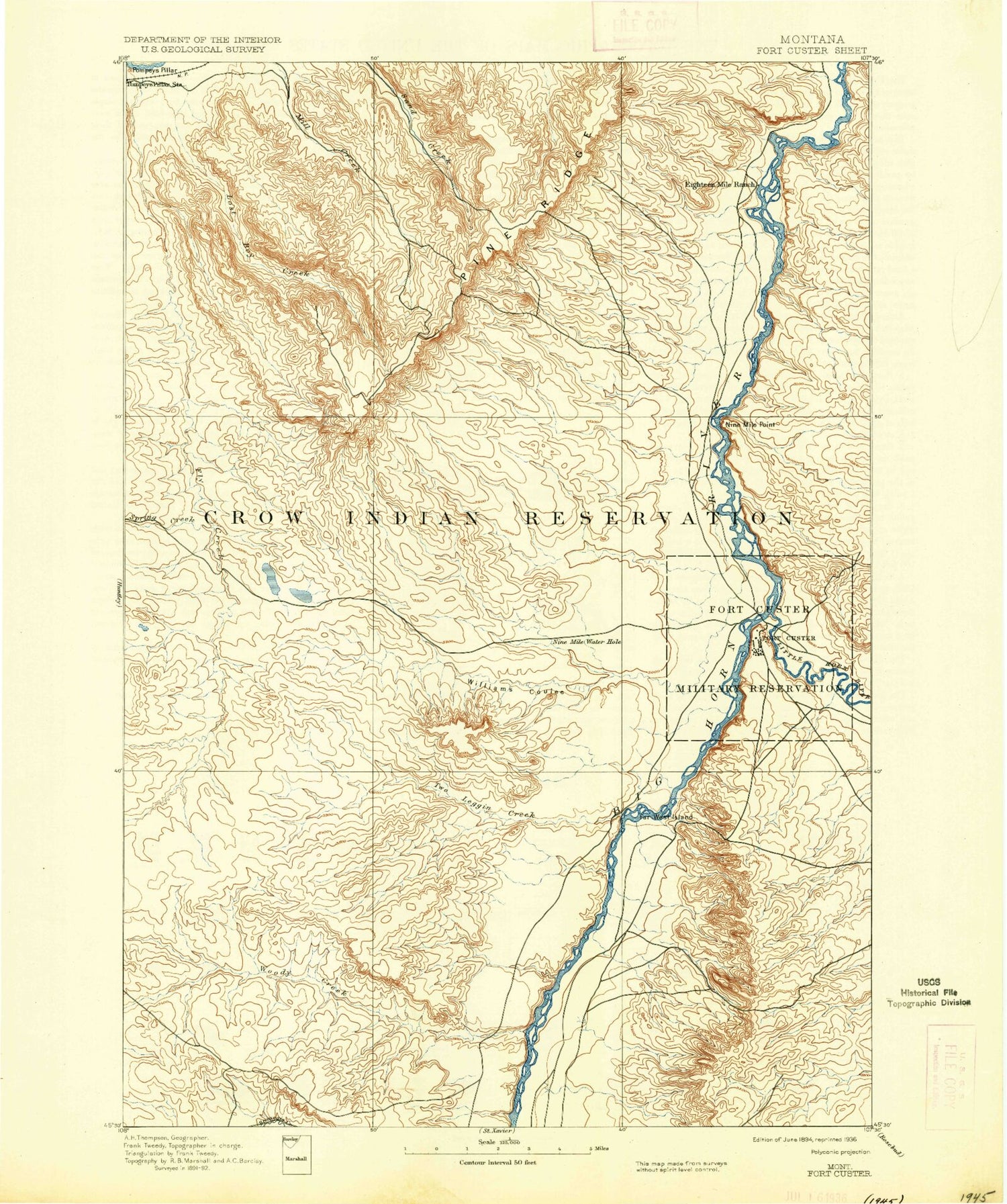
Historic 1894 Fort Custer Montana 30'x30' Topo Map
Couldn't load pickup availability
Historical USGS topographic map of Fort Custerin the states of Montana, Wyoming. Scale: 1:125000. Print size: 17" x 24"
This map was published in 1894 and is in the following counties: Big Horn, Yellowstone.
The map contains contour lines, roads, rivers, towns, streams, and lakes. Printed on high-quality waterproof paper with UV fade-resistant inks.
Contains the following named places: Whitman Coulee, Barley Coulee, Bentonite Flats, Big Horn Low Line Canal, Big Woody Creek, Brant Coulee, Campbell Camp Number One, Chapman Coulee, Chimney Creek, Corinth, Cotters Coulee, Cottonwood Creek, Crow Road Coulee, Crows Nest Camp, Dana Coulee, Davis Coulee, Deadmans Coulee, Deer Creek, Dry Creek, Dunmore, Egnew Coulee, Fly Creek, Foster, Good Horse Coulee, Halfway House Coulee, Hardin, Hay Creek, Humphrey Coulee, Kingley, Kopac Camp, Lemon Ranch, Little Bighorn River, Little Ninemile Creek, Little Woody Creek, Lone Tree Coulee, Lone Tree Coulee, Lost Boy Creek, Lost Cabin Coulee, Middle Fork Two Leggins Creek, Miller Ranch, Ninemile Creek, Ninemile Point, North Cottonwood Creek, North Fork Pocket Creek, North Fork Sorrel Horse Creek, North Fork Two Leggins Creek, North Fork Whitman Coulee, North Telegraph Creek, Ottum Ranch, Peritsa Creek, Pine Ridge, Pocket Creek, Pompeys Pillar, Prante Ranch, Reservoir Line Canal, Robs Coulee, Smith Coulee, South Branch Whitman Coulee, South Cottonwood Creek, South Fork Sorrel Horse Creek, South Fork Dawussuua Ashkaate, South Fork Two Leggins Creek, South West Park, Spring Creek, Spring Creek, Telegraph Creek, Tenmile Creek, Toluca, Two Leggins Canal, Two Leggins Creek, Two Leggins Tunnel, Wagon Box Canal, Wagon Box Coulee, Walker Hill, West Fork Brant Coulee, Whiskey Coulee, Williams Coulee, Williams Coulee, Woody Creek, Woody Creek Camp, Rowley, Wild Horse Coulee, Hardin Sewage Lagoon Dam, Atkins Number 2 Dam, J R Scott Number 1 Dam, J R Scott Number 5 Dam, J R Scott Number 8 Dam, J R Scott Number 9 Dam, J R Scott Number 12 Dam, B-Downs Number 8 Dam, Christensen L and C Number 2 Dam, Crow Number 45 Dam, Kjeldgaard Number 2 Dam, Christensen L and C Number 1 Dam, R E Peterson Number 1 Dam, Rowley C B and O Number 1 Dam, Ottun Number 6 Dam, Ottun Number 5 Dam, Ottun Number 8 Dam, R Downs Number 7 Dam, Coibson Number 1 Dam, Crow Number 20 Dam, Crow Number 32 Dam, Crow Number 36 Dam, Crow Number 42 Dam, Kjeldgaard Number 1 Dam, Eagle Land Number 1 Dam, Campbell Number 1 Dam, Crow Number 24 Dam, Crow Number 22 Dam, Raglands Number 1 Dam, Crow Number 16 Dam, R Downs Number 4 Dam, R Downs Number 10 Dam, R Downs Number 6 Dam, R Downs Number 5 Dam, Ottun Number 9 Dam, Ottun Number 3 Dam, Fort Custer Golf Club, Dunmore, Sitting Bull Rapids, Far West Island, Campbells, Hive Butte, Grant Marsh Wildlife Management Area, Harvest States Cooperatives Elevator, Bowman Grain and Seed Elevator, Big Horn County Fairgrounds, Westside Playground, Wilson Park, Big Horn County Softball Fields, Brennan Kiddie Park, Arapooish Recreation Park, Arapooish Pond, Sunset Village, Grandview Campground, Hardin KOA Campground, Reno, Hardin, Grant Marsh Wildlife Management Area Fishing Access Site, Mallards Landing Fishing Access Site, General Custer Fishing Access Site, Arapooish Fishing Access Site, Two Leggins Fishing Access Site, Hardin Division, Huntley Project Division, Little Bighorn Valley, City of Hardin, Little Bighorn River, Little Bighorn Valley


