MyTopo
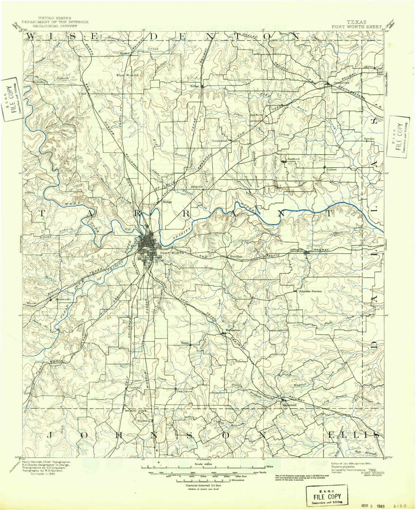
Historic 1894 Fort Worth Texas 30'x30' Topo Map
Couldn't load pickup availability
Historical USGS topographic map of Fort Worth in the state of Texas. Scale: 1:125000. Print size: 18" x 24"
This map was published in 1894 and is in the following counties: Dallas, Denton, Ellis, Johnson, Tarrant, Wise.
The map contains contour lines, roads, rivers, towns, streams, and lakes. Printed on high-quality waterproof paper with UV fade-resistant inks.
Contains the following named places: Lake Arlington, Arnold Park, Baggett Branch, Benbrook Dam, Benbrook Lake, Berrey Park, Blue Mound, Blue Mound, Bluebonnet Circle Park, Bowman Branch, Britton, Broadview Picnic Area, Brushy Mound, Buck Sansom Park, Buffalo Creek, Bunche Park, Burger Lake, Burleson, Burnett Park, Cable Branch, Camp Burnett, Camp Carter, Camp Leroy Schuman, Capps Park, Carter Park Site, Casino Park, Cobb Park, College Hill Park, Lake Como, Conover Lake, Cottonwood Creek, Craft Point, Crowley, Dalworthington Gardens, Deer Creek, Derrett Creek, Diamond Hill Park, Dosier Creek, Dosier Slough, Dove Creek, Dutch Branch, Dutch Branch Park, Eastover Park, Echo Lake, Elliot Lake, Elm Branch, Emerald Hills Memorial Park, Estelle Creek, Euless, Everman, Fort Worth and Dallas Freight Depot, Fair Oaks Shopping Center, Farmers Branch, Farrington Field, Farris Branch, Fielder Park, Flemming Slough, Forest Hill, Fosdick Lake, Foster Park, Garden Acres, Gilmore Branch, Glenwood Park, Goat Island, Grapevine, Grassy Creek, Greer Island, Handley, Handley Park, Haslet, Haynes Park, Higgins Branch, Hillcrest Observation Point, Hillside Park, Hogpen Branch, Holiday Park, Hollings Branch, Hudgens Branch, Indian Creek, Inspiration Point, Jeff Davis Park, Johnson Creek, Johnsons Station, Jones Branch, Kee Branch, Keller, Kellis Park, Kennedale, King Branch, Kirkwood Branch, Lake Como Park, Lake Crest Estates, Lake Shore Estates, Lake Worth, Lake Worth Beach, Lancaster Yards, Lillian, Lincoln Park, Lindberg, Little Carter Slough, Little Dosier Creek, Little Dosier Slough, Live Oak Creek, Lone Point, Longhorn Park, Low Branch, Lucas Triple L Park, Lynn Creek, Mansfield, Marine Park, Marys Creek, McCann Branch, Meadowbrook Park, Meadowbrook Park, Melody Hills, Midway Park, Minters Chapel, Monticello Park, Morehead Branch, Mosque Point, Moss Branch, Mustang Creek, Newton Branch, Normandy Park, North Side Park, Oakhurst Park, Oakland Lake Park, Old Union, Paddock Park, Pantego, Peoples Burial Park, Poverty Knob, Quil Miller Creek, Reece Branch, Rendon, River Oaks, Rock Creek, Rockwood Park, Rosemont Park, Rush Creek, Saginaw, Sansom Park, Shady Grove, Shannon Creek, Silver Lake Branch, Snake Island, Soap Creek, South Seminary, Southlake, Southland Acres, Sycamore Park, Sylvania Park, Tarrant, Tate Springs, Turkey Peak, Twin Points Beach, Valley Branch, Valley Ridge, WT Maddox Park, Walnut Creek, Watsonville, Webb, Westland, Westover Hills, Westworth, White Lake, White Settlement, Whites Branch, Wildcat Branch, Will Rogers Memorial, Willow Branch, Willow Island, Wood Island, Woodlawn Park, Lake Worth, Big Bear Creek, Arlington, Bakers Branch, Barbrook Park, Bedford, Bedford Branch, Benbrook, Big Fossil Creek, Boys Ranch Variety Club, Calloway Branch, Carter Slough, Colleyville, Coppell, Cottonwood Branch, Cottonwood Creek, Eagle Mountain Lake, Ederville, Forest Park, Grapevine Lake, Haltom City, Hart Spur, Hurst, Kings Branch, Little Bear Creek, Little Fossil Creek, Marine Creek, May, Mesquite Branch, North Richland Hills, Randol Mill Park, Richland Hills, Silver Creek, Smithfield, Sulphur Branch, Sycamore Creek, Trinity Park, Village Creek, Walker Branch, Watauga, Joe Pool Lake, Murray Hill, Avondale, Belt Junction, Bisbee, Bransford, Estelle, Florence Hill, Keeler, Lytle, Moselle, Oak Grove, Plover, Primrose, Retta, Sublett, Westlake, Fort Worth, Tarrant County, Bear Creek, Clear Fork Trinity River, Arlington Sewage Disposal


