MyTopo
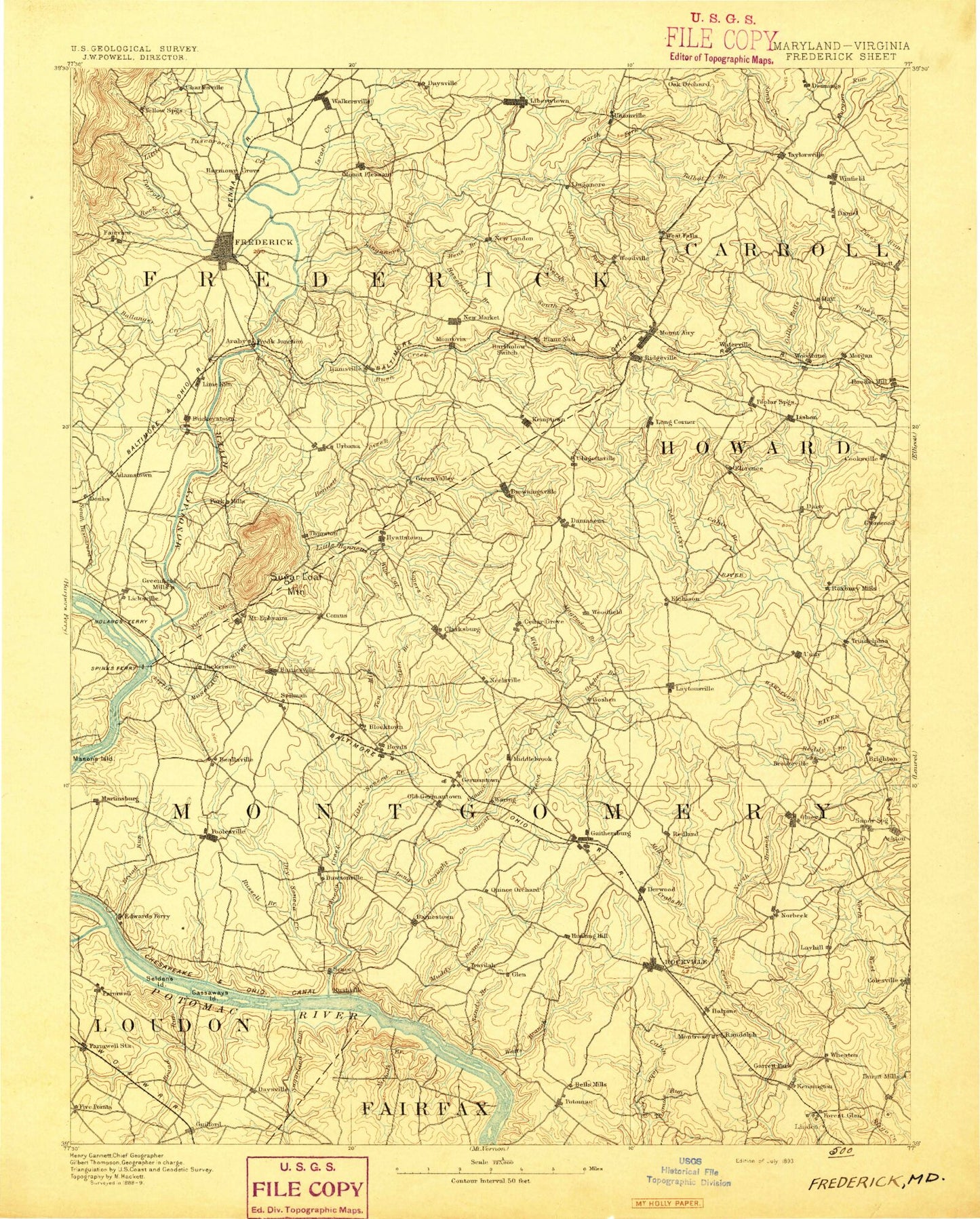
Historic 1893 Frederick Maryland 30'x30' Topo Map
Couldn't load pickup availability
Historical USGS topographic map of Frederick in the state of Maryland. Scale: 1:125000. Print size: 16" x 24"
This map was published in 1893 and is in the following counties: Carroll, Fairfax, Frederick, Howard, Loudoun, Montgomery.
The map contains contour lines, roads, rivers, towns, streams, and lakes. Printed on high-quality waterproof paper with UV fade-resistant inks.
Contains the following named places: Wildcat Branch, Addison Run, Annapolis Rock, Ashton, Baker Park, Ballenger Creek, Barrett, Bartholows, Bealls Island, Bear Branch, Bennett Creek, Bens Branch, Birdsaw Island, Blockhouse Point, Blocktown, Bogley Branch, Boyds, Braddock, Brighton Dam, Broad Run, Brownstown, Buck Branch, Buck Branch Park, Buckeystown Station, Buckhorn Branch, Buckhorn Run, Bucklodge Branch, Burnt Mills Reservoir, Burnt Mills Village, Bush Creek, Cabbage Run, Cabbage Spring Branch, Cabin Branch, Cabin Branch, Cabin Branch, Cabin Branch, Cabin John Regional Park, Calvin Park, Camp Bennett, Carroll Branch, Carroll Creek, Cattail Creek, Chesapeake and Ohio Canal National Historical Park, Chestnut Grove, Chisel Branch, Clagett Island, Clarksburg, Clifford Hollow, Conn Island, Cool Spring Branch, Cox Island, Crabbs Branch, Culler Lake, Damascus, Daniel, Dark Branch, Day, Dickerson, Dollyhyde Creek, Dorsey Branch, Dry Seneca Creek, East Branch Cattail Creek, Edgemont, Edgewood, Elm Island, Elysium Lake, Fahrney Branch, Flint Hill, Florence, Forest Glen, Frederick, Friendship, Furnace Branch, Gambrill State Park, Garrett Park, Germantown, Gillis Falls, Glade Creek, Gladys Island, Goshen Branch, Grapevine Island, Great Falls, Great Seneca Creek, Greenbrier Branch, Gunners Branch, Haights Branch, Lake Halcyon, Harmony Grove, Hay Meadow Branch, Hazelnut Run, Lake Helene, Hookers Branch, Horsehead Run, Horsepen Branch, Ijamsville, Inspiration Lake, Israel Creek, James Creek, Katie Island, Kilgour Branch, Knowler Park, Laytonsville, Lelands Corner, Limekiln Branch, Linganore Creek, Lisbon, Little Bennett Creek, Little Cattail Creek, Little Monocacy River, Little Seneca Creek, Little Tuscarora Creek, Lock Island, Long Branch, Long Corner, Long Draught Branch, Luxmanor, Lake Lynette, Magruder Branch, Martinsburg, Meadow Island, Middle Run, Mill Creek, Minnehaha Island, Monocacy Natural Resources Area, Monocacy River, Monrovia, Mount Airy, Mount Pleasant, Muddy Branch, Muddy Run, New London, New Market, Lake Nirvana, Nolands Island, Norbeck, North Branch Bennett Creek, North Branch Rock Creek, North Creek, North Fork Linganore Creek, Old Farm Creek, Park Mills, Parrs Ridge, Pine Lake, Piney Branch, Lake Placid, Pond Island, Poplar Springs, Powhatan Island, Purdum, Reddy Branch, Redland, Rich Branch, Rock Creek, Rockville, Rocky Fountain Run, Rocky Springs, Russell Branch, Sams Creek, Sandy Branch, Sandy Spring, Scott Branch, Seneca, Seneca Creek, Sevenfoot Rock, Sharpshin Island, Snakeden Branch, Soper Branch, South Fork Linganore Creek, Stewart Town, Stone Lake, Sugar Loaf Mountain, Sunshine, Sycamore Island, Talbot Branch, Taylorsville, Tenfoot Island, Tenmile Creek, Three Sisters Lakes, Tilden Park, Town Branch, Triadelphia Reservoir, Tuckers Branch, Tuscarora Creek, Tuscarora Creek, Urbana, Van Deventer Island, Lake Varnuna, Viers Mill Village, Walkersville, Walkersville Reservoir, Watersville, Watkins Island, Watts Branch, Weldon Creek, Wheaton, Wheaton Hills, Wheaton Regional Park, Whetstone Run, Wickford, Wildcat Branch, Winfield, Woodbine, Woodside, Woodville Branch, Yellow Springs, Monocacy National Battlefield, Batchellors Run, Bel Pre Creek, Williamsburg Run, Manor Run, Nursery Run, Lutes Run, Lisbons Little Creek, Cliff Bland Recreation Area, Little Seneca Lake, Annapolis Rock, Bootjack, Brink, Brinklow, Bucklodge, Claysville, Comus, Daisy, Dorsey Crossroads, Elmer, Franklinville, Frederick Junction, Gary, Gosnell, Green Valley, Hipsleys Mill, Hoods Mill, Inwood, Kings Valley, Linganore, McKaig


