MyTopo
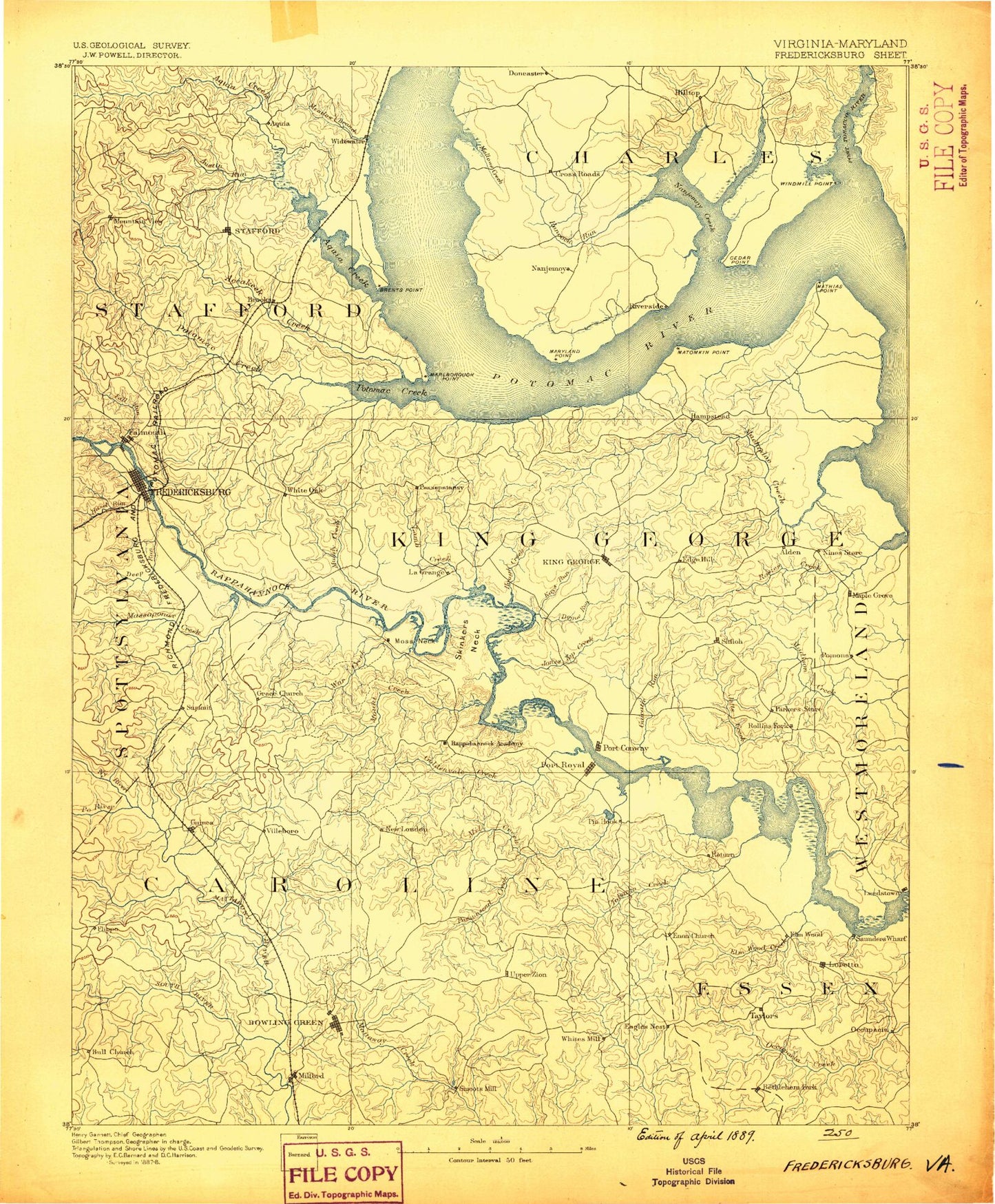
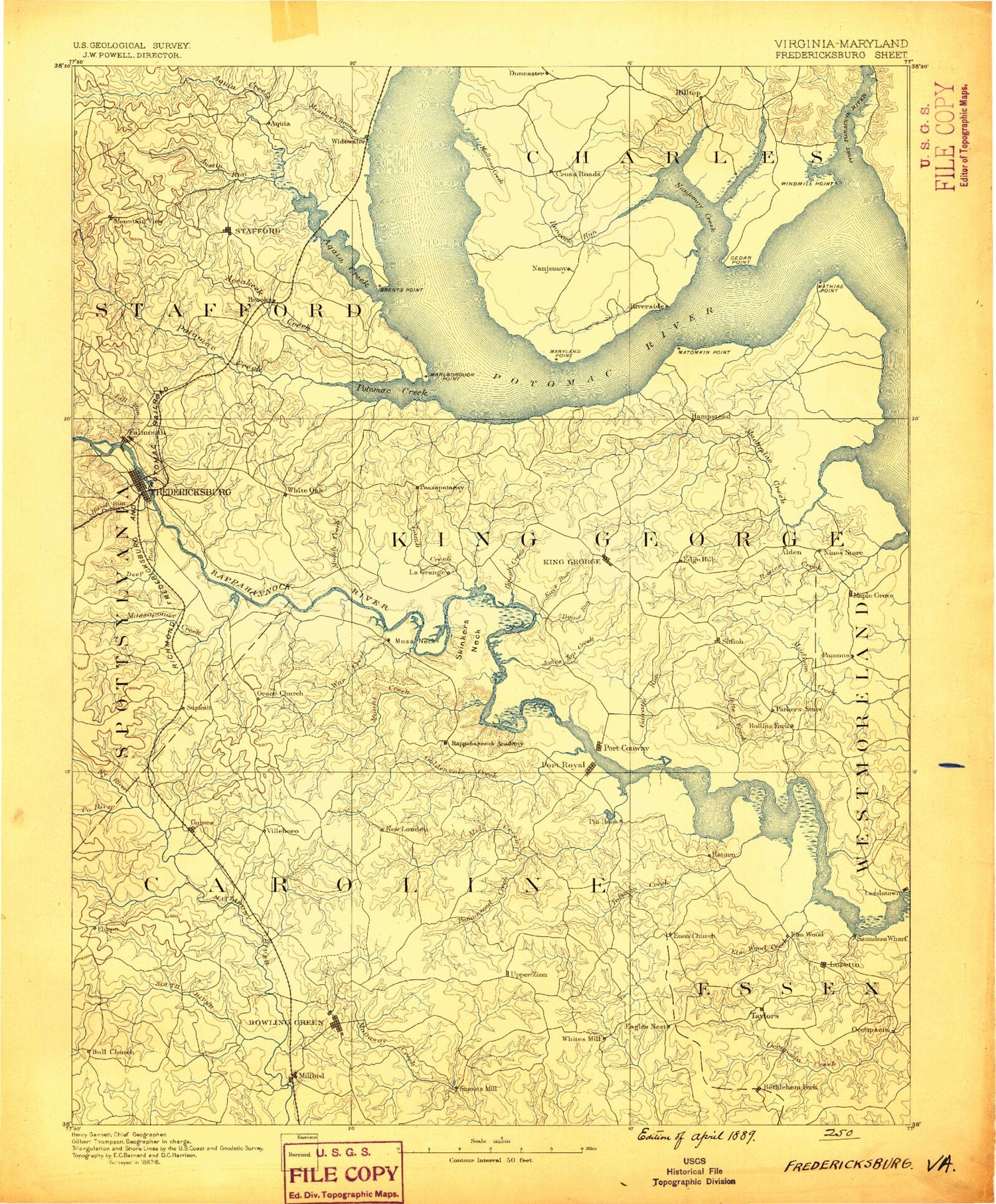
Historic 1889 Fredericksburg Virginia 30'x30' Topo Map
Couldn't load pickup availability
Historical USGS topographic map of Fredericksburg in the state of Virginia. Scale: 1:125000. Print size: 17" x 24"
This map was published in 1889 and is in the following counties: Caroline, Charles, Essex, Fredericksburg (city), King George, Spotsylvania, Stafford, Westmoreland.
The map contains contour lines, roads, rivers, towns, streams, and lakes. Printed on high-quality waterproof paper with UV fade-resistant inks.
Contains the following named places: Accokeek Creek, Aquia Creek, Austin Run, Baber Point, Bagnalle Branch, Baylors Creek, Baylors Pond, Beaverdam Run, Beaverdam Run, Belle Plains, Bennetts Point, Bethesda Church, Bethlehem Fork, Big Marsh, Birchwood Run, Black Marsh, Black Swamp, Black Swamp Branch, Black Water Swamp, Blind Point, Boars Creek, Boom Swamp, Bowling Green Park, Boykins Island, Brent Marsh, Brent Point, Bristol Mine Run, Brooke, Broomstraw Trail, Buckners Reach, Bull Bluff, Burkes Shop, Campbell Creek, Cannon Creek, Cattlet Creek, Cedar Trail, Chinns Run, Chopawamsic Creek, Chotank Creek, Claiborne Run, Cleve Marsh, Clifton Point, Cole Trip Camp, Coon Trail, Corbins Neck, Cosbys Corners, Cow Swamp, Crash Trail, Crows Nest Point, Crucifix Monument, Dahlgren, Dalton Millpond, Decatur Store, Deep Creek, Deep Run, Delos Lake, Devils Elbow, Devils Reach, Dicks Creek, Dirt Bridge, Dirt Bridge Run, Doctor Branch, Dogue, Dogue Run, Downers Branch, Drakes Marsh, Elmwood Creek, Fall Quarry Run, Falls Run, Farmers, Farmers Fork, Farmers Pond, Fish Hook Lake, Fosters Millpond, Fredericksburg Battlefield, Gambo Creek, Garretts Store, Gingoteague Creek, Goat Island, Goldenvale Creek, Gouldin, Gouldman Pond, Gourds Point, Government Island, Gracik Trail, Green Bay, Greenlaw Wharf, Haislip Pond, Hamilton Pond, Hayfield Wharf, Hideaway Pond, Hobby Swamp, Holmes Pond, Honeysuckle Gate, Horse Head Point, Howland Point, Hunters Millpond, Hustle, Igo, Index, Indian Point, Jackson Shrine, Jetts Creek, Jones Pond, Jones Run, Jones Top Creek, Kell Trail, Ketch Point, Keys Run, King George Point, Kings Mill Creek, Lambs Creek, Laucks Island, Line Creek, Little Falls Run, Lonesome Gulch Pond, Long Branch, Long Branch, Long Branch, Long Point, Madison Pond, Mansion Trail, Marlboro Point, Marsh Point, Mashbox Run, Mason Swamp, Massaponax Creek, Mathias Point, Mathias Point Neck, Matta River, Mays Run, Meade Pyramid, Meadow Creek, Meadow Creek Pond, Metomkin Point, Mill Creek, Millbank Creek, Millers Pond, Moss Neck, Motto River, Mount Bethel Recreation Center, Mount Creek, Mount Swamp, Mountain View, Mountjoy Store, Muddy Creek, Murder Trail, Nanzatico Bay, Ni River, Nocam, North Bend, Office Hall, Old Landing Point, Old Sycamore, Overland Trail, Owens, Owl Hollow, Passapatanzy Creek, Passing, Pepper Mill Creek, Persimmon Point, Peumansend Creek, Pine Hill Creek, Po River, Poni River, Popcastle, Popcastle Creek, Poplar Neck Creek, Portage Run, Portobago Bay, Portobago Creek, Portobago Run, Potomac Creek, Waugh Point, Pumpkin Neck, Rappahannock Academy, Rectory, Return, Reynolds Run, Ritchie Point, Rollins Fork, Roys Run, Ruffins Pond, Saunders Wharf, Sawdust Trail, Scotts Island, Seegars Point, Shackley Point, Shady Grove Run, Camp Barrett, Wrights Run, Sheltons Shop, Simms Point, Skinkers Creek, Skinkers Neck, Smoots Run, Snow Creek, South River, Stafford Wayside, Stillwater Creek, Stone Point, Stony Point, Stuart Point, Stuart Wharf, Summit, Supply, Taliaferro Pond, Tank Creek, Tanyard Run, Tetotum Flats, Thorney Point, Thorofare, Tobys Point, Travis Lake, Troy Creek, Turkey Track Creek, Upper Machodoc Creek, Ware Creek, Watsons Point, Welcome, West Branch Mount Creek, Whipsawasons Point, White Lake, White Marsh, White Oak Run, White Run, Widewake, Wilderness Trail, Williams Creek, Wilmont Wharf, Wood Island, Cockerel Creek, Belle Grove, Cleve, Hop Yard Bar, Acors Corner


