MyTopo
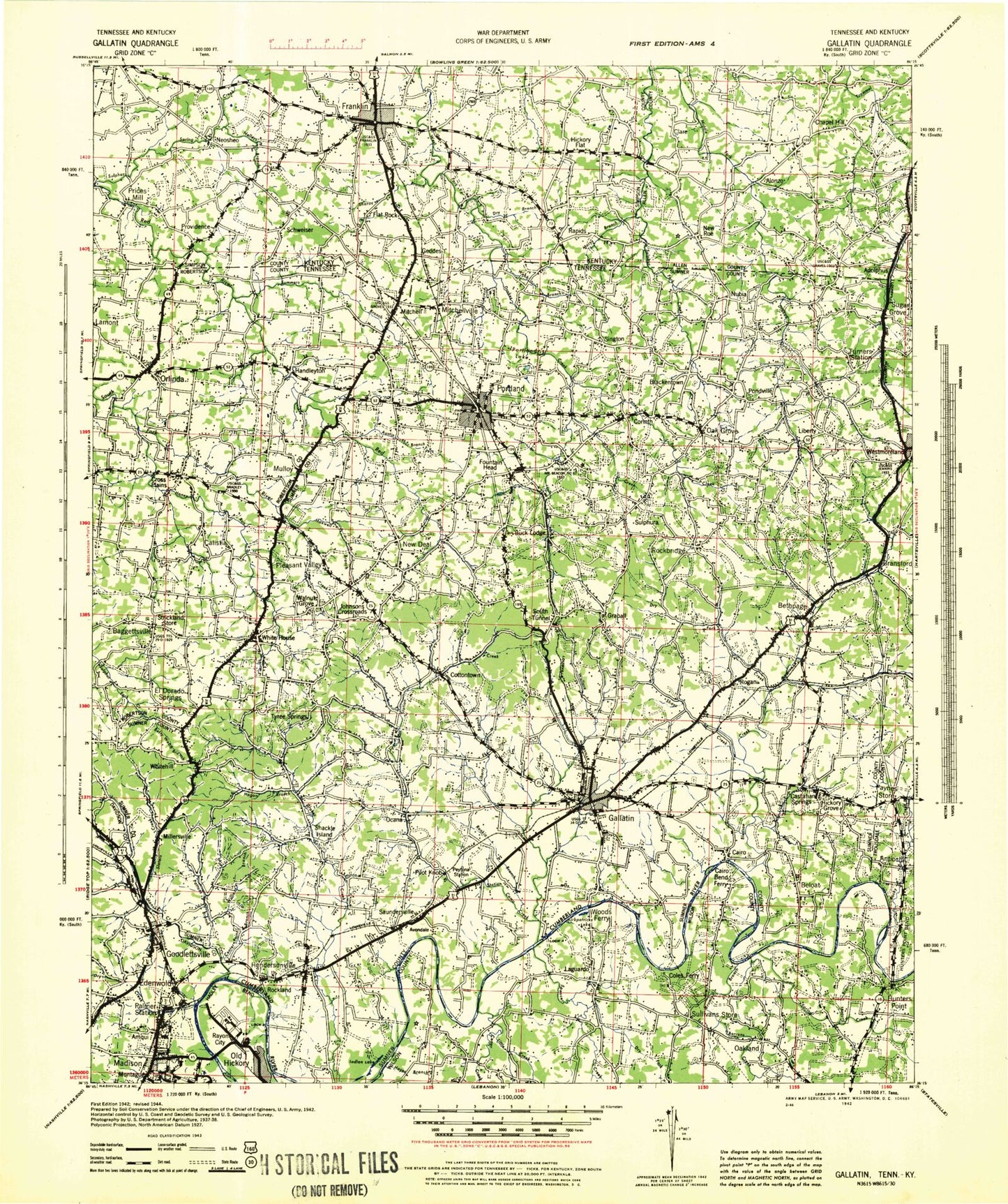
Historic 1942 Gallatin Tennessee 30'x30' Topo Map
Couldn't load pickup availability
Historical USGS topographic map of Gallatin in the state of Tennessee. Scale: 1:100000. Print size: 24" x 26"
This map was published in 1942 and is in the following counties: -.
The map contains contour lines, roads, rivers, towns, streams, and lakes. Printed on high-quality waterproof paper with UV fade-resistant inks.
Contains the following named places: Black Jack, Mays Branch, Rock Quarry Branch, Sulphur Fork Creek, Thompson Branch, Webb Branch, Crutcher Lake, Hendersonville Park, Hills Island, Horn Springs Branch, Maxwell Branch, Old Hickory Lake, Rogues Fork Creek, Shaw Branch, Shipp Hollow, Shoot Hollow, Slaters Creek, Smith Branch, Somerville Branch, South Tunnel, Spring Creek, Stone Branch, Stone Hill, Strother Branch, Sugar Camp Hill, Sulphur Branch, Summers Branch, Sumner County Home, The Narrows, Town Creek, Trousdale, Turners Station, Turpin Hollow, Two Chestnut, Union Hill, Walker Branch, Walkers Creek, Wallace Branch, Walnut Grove, Wattwood Branch, Webb Branch, West Prong Caney Fork Creek, White Hill, Whitson Branch, Wild Cat Hollow, Williamson Branch, Willis Branch, Willow Lake, Woodchopping Branch, Anderson Lake, Andrew Jackson Camp, Arterburn Branch, Austin Branch, Avondale, Baggettsville, Bakers Fork, Bandmill Hollow, Bates Branch, Belotes Bend, Bethpage, Bledsoe, Brackentown, Bradley Hill, Briggance Branch, Brinkley Branch, Brunley Branch, Brush Fork, Brushy Fork Creek, Bug Hollow, Bulls Creek, Buntin Branch, Bursby Hollow, Cages Bend, Cairo, Cairo Bend, Calistia, Caney Fork Creek, Cedar Grove, Cedarcroft Branch, Cedarcroft Hill, Center Point Branch, Cherry Mount Hill, Chestnut Hill, Chestnut Ridge, Coleman Lake, Cooks Branch, Corinth, Cottontown, County House Hill, Covington Hill, Crab Hollow, Cummings Crossroads, Dan Kirk Branch, Doodle Hollow, Dry Creek, Dry Fork, Dry Fork Branch, Dry Fork Creek, Durham Hollow, Dutch Creek, East Fork Bledsoe Creek, East Fork Slaters Creek, Echo Hollow, Eden Corner, Elm Springs Branch, Empson Branch, Empson Hill, Fisher Hollow, Fountain Head, Frey Branch, Gallatin, Goodlettsville, Graball, Grace Creek, Graves Branch, Greenbriar Lake, Gregory Hollow, Groundhop Hollow, Hall Town, Hall Town Creek, Handleyton, Happy Valley, Harbour Island, Hays Branch, Hendersonville, Herrin Hollow, Hogan Branch, Honey Run, Howell Hollow, Hunters Point, Hunters Point Bend, Hutlet Hollow, Indian Ladder Bluff, Indian Trail Creek, Jackson Hollow, Jernigan Town, Joel Hollow, Johnsons Crossroads, Jones Branch, Jones Hill, Kilgore Station, Kill Buck Knob, Kirk Hill, Liberty Branch, Liberty Community Hall, Lick Creek, Liggett Branch, Lindsley Bend, Linsey Hollow, Little Creek, Locke Branch, Lumsley Fork, Lytles Bend, Madison, Madison Creek, Madison Park, Mansker Creek, Mansker Island, Martin Hollow, McMurtry Hollow, Millersville, Mud Hollow, Mulloy, Mutton Branch, Neal Branch, New Deal, New Hope Hollow, Number One, O'Ryan Knob, Oak Grove, Oakdale, Odoms Bend, Oil Well Hollow, Orlinda, Otter Fork, Pages Lake, Palmer Branch, Pattens Branch, Payne Hill, Paynes Store, Pee Dee Creek, Phillips Hollow, Pilot Knob, Pitt Hill, Polk Lake, Pondville, Poplar Hollow, Portland, Providence, Pryor Branch, Rankin Branch, Rayon City, Reubensville, Robertson Branch, Rock Bridge, Rockhouse Hollow, Rockland, Rocky Cliff, Rocky Creek, Roney Creek, Rowland Hollow, Sanders Branch, Sandy Valley, Saundersville, Scattersville, Scobey Hill, Sengtown, Sevenmile Bluff, Shallow Ford Hill, Cedar Hill Lake, Cedar Hill Lake Dam, Five Coves Dam, Five Coves Lake, Norman Lake Dam, Norman Lake, L A Green Dam, L A Green Lake, Crutcher Lake Dam, Womack Lake, Womack Lake Dam, Phillip Bradshaw Lake, Phillip Bradshaw Lake Dam, Pine Lake Dam, Pine Lake, Larry Collins Lake, Larry Collins Dam, Sumner County Sportsman Club Lake Dam, Sumner Sportsman Club Lake, Portland City Lake, Portland City Lake Dam, Meadowbrook Game Farm Lake, Meadowbrook Game Farm Dam, East Camp Creek, Spencer Creek, Station Camp Creek, Sugar Grove


