MyTopo
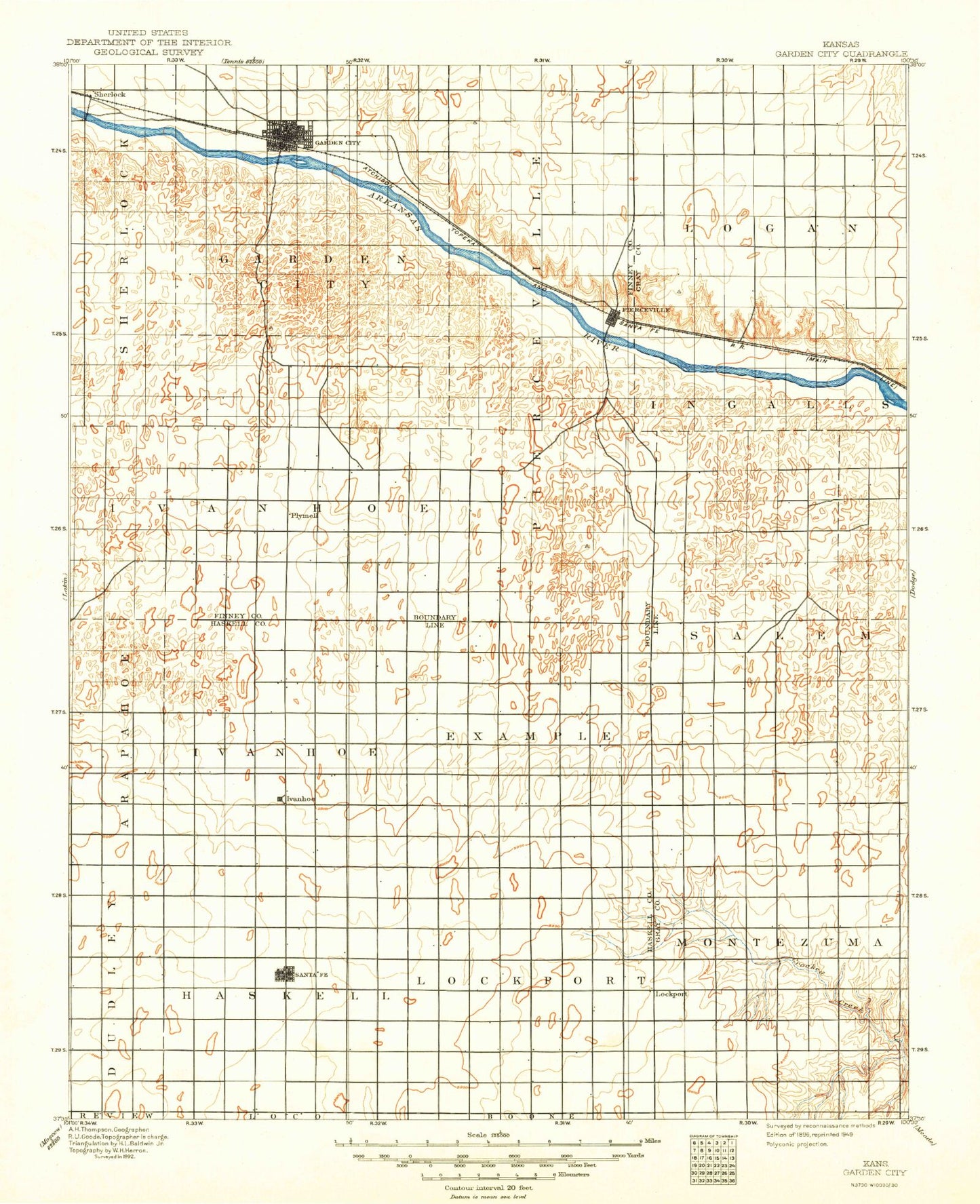
Historic 1896 Garden City Kansas 30'x30' Topo Map
Couldn't load pickup availability
Historical USGS topographic map of Garden City in the state of Kansas. Scale: 1:125000. Print size: 17" x 24"
This map was published in 1896 and is in the following counties: Finney, Gray, Haskell.
The map contains contour lines, roads, rivers, towns, streams, and lakes. Printed on high-quality waterproof paper with UV fade-resistant inks.
Contains the following named places: Township of Haskell, Township of Copeland, Township of Garden City, Garden City, Finney County Game Refuge, Holcomb, Finnup Park, Kansas State University Southwest Research - Extension Center, Pierceville, Plymell, Township of Ingalls, Charleston, Wild Horse Lake, Copeland, Mansfield, Tice, Quinby, Township of Lockport, Township of Pierceville, Township of Logan, Township of Ivanhoe, Wild Horse Lake, Haskell County, City of Garden City, City of Copeland, City of Holcomb, Garden City Municipal Airport Wastewater Treatment Plant, Garden City Regional Airport Industrial Park, Western Plains Regional Landfill, Garden City Amtrak Station, Finney County Fairgrounds, The Airport Raceway, Lee Richardson Zoo, Garden City Community College Williams Stadium, Copeland Wastewater Treatment Facility, Garden City Wastewater Department, Holcomb East Wastewater Plant, Acres West Mobile Home Park, Countryside Estates Mobile Home Park, East Garden Mobile Home Village, Eastside Trailer Park, Geier Trailer Park, J and J Trailer Park, Kent's Trailer Park, Kingston Trailer Park, Meadow Lark Mobile Home Park, Miller Trailer Park, Ponderosa Mobile Home Park, Prairie Wind Mobile Home Park, Rancho Trailer Park, Wagon Wheel Mobile Home Park, Westhaven Mobile Home Park, RJ's Recreational Vehicle Park, Buffalo Dunes Golf Course, Southwind Country Club, Golden Locket Golf Course, Providence Grain Elevator Number 1


