MyTopo
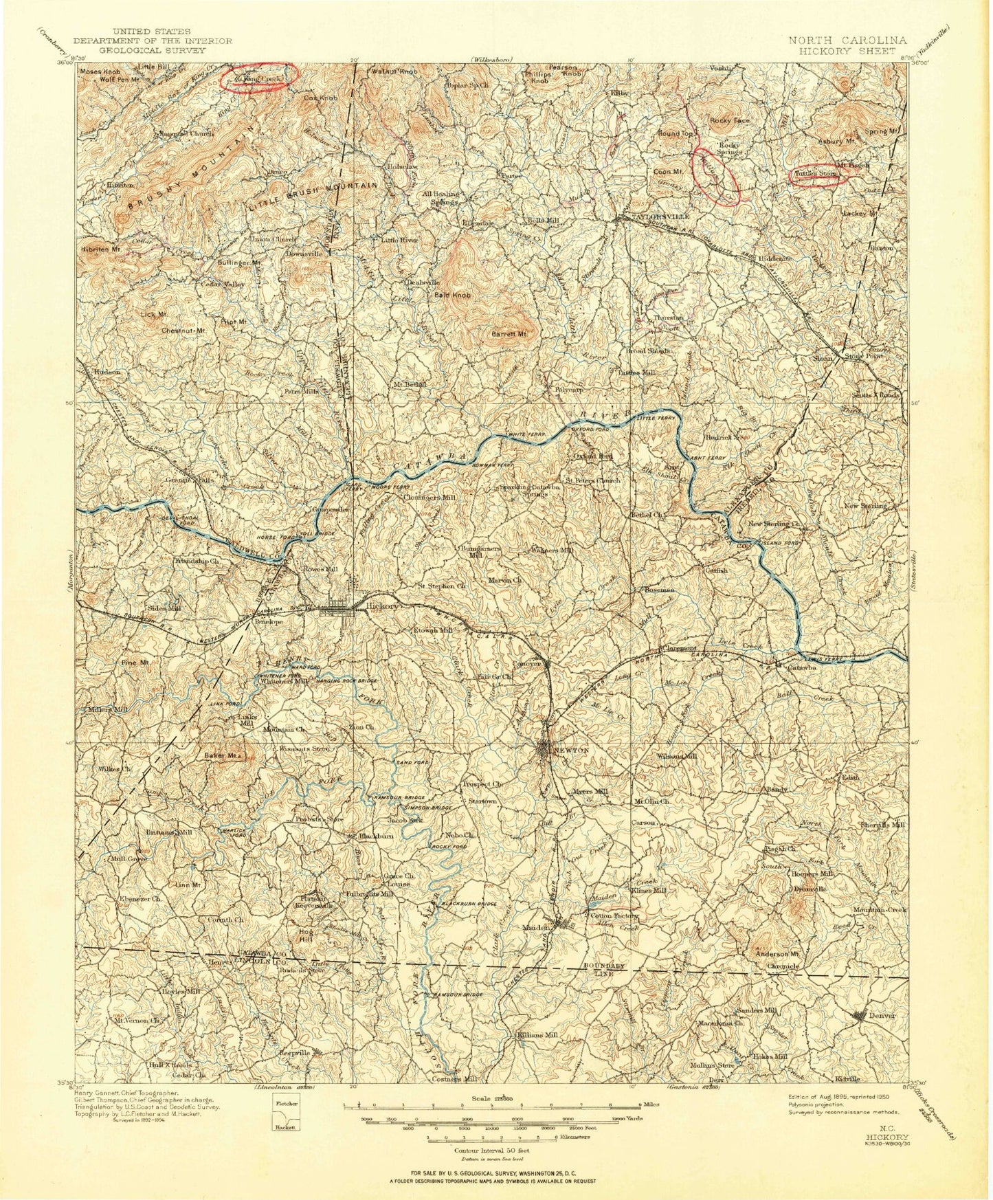
Historic 1895 Hickory North Carolina 30'x30' Topo Map
Couldn't load pickup availability
Historical USGS topographic map of Hickory in the state of North Carolina. Scale: 1:125000. Print size: 17" x 24"
This map was published in 1895 and is in the following counties: Alexander, Burke, Caldwell, Catawba, Cleveland, Iredell, Lincoln, Wilkes.
The map contains contour lines, roads, rivers, towns, streams, and lakes. Printed on high-quality waterproof paper with UV fade-resistant inks.
Contains the following named places: Abee Creek, Advent Crossroads, Allen Creek, Anderson Mountain, Angley Creek, Bakers Creek, Bald Knob, Balls Creek Campground, Bandy, Banoak, Barger Branch, Barrett Mountain, Battle Run, Beaver Branch, Beaverdam Creek, Bee Branch, Benfield Creek, Betts Branch, Big Branch, Big Branch, Bills Branch, Billy Branch, Blackburn, Broad Meadow Creek, Brushy Fork, Buffalo Shoals Creek, Bull Branch, Bullinger Mountain, Camp Creek, Camp Dogwood, Camp Sain, Carpenter Creek, Cat Square, Catawba Country Club, Cedar Rock Country Club, Cedar Valley, Chestnut Mountain, Cline Creek, Conover, Cooksville, Cow Branch, Cox Knob, Cripple Creek, Cullys Branch, Dellinger Creek, Douglas Creek, Drowning Creek, Duan, Duck Creek, East Prong Lower Little River, Elk Shoal Creek, Elk Shoals Creek, Fairview Park, Falling Creek, Freemason Creek, Frye Creek, Geitner Branch, Ginger Creek, Gladdens Lake, Glade Creek, Glenn Oaks Golf Club, Goble Creek, Gold Mine Creek, Grace and Truth Bible Camp, Grassy Creek, Greasy Creek, Guys Branch, Haas Creek, Hagan Fork, Harve Creek, Hayes Mill Creek, Henry, Henry Fork, Herman Branch, Hibriten Mountain, Hickory, Hickory Motor Speedway, Lake Hickory, Hiddenite, Hildebran, Hildebran Creek, Hog Branch, Holsclaw Creek, Hop Creek, Horseford Creek, Horseshoe Lake, Howards Creek Mill, Hudson, Hudson Drag Strip, Hulls Crossroads, Icard, Isaac Creek, Island Creek, Jacob Fork, Jones Lake, Jumping Run, Jumping Run, Jumping Run, Killian Crossroads, Kings Creek, Lackey Mountain, Lake Hickory Country Club, Lambert Fork, Larkard Creek, Lick Mountain, Link Creek, Lippard Creek, Little Dam, Little Gunpowder Creek, Little Indian Creek, Little Pott Creek, Long Branch, Long Creek, Long Shoal Creek, Longview Creek, Lookout Shoals Dam, Lookout Shoals Lake, Lower Little River, Lyle Creek, Maiden, Maiden Creek, Mathis Chapel, McLin Creek, McRary Creek, Middle Little River, Midway, Mill Creek, Mill Creek, Miller Branch, Miller Creek, Millers Creek, Moretz Dam, Morris Creek, Moses Knob, Mount Herman, Mountain Creek, Mountain Run, Muddy Creek, Muddy Fork, Mull Creek, Mundy Creek, Murrays Mill Lake, Naked Creek, Newton, Nolden Creek, North Fork Mountain Creek, Oak Hill, Old Millpond, Oxford Dam, Oxford Park, Pearson Knob, Pilot Branch, Pilot Mountain, Pinch Gut Creek, Pine Mountain Campground, Piney Mountain, Plateau, Poplar Creek, Pott Creek, Pumpkin Center, Punchbowl Creek, Reed Creek, Reepsville, Reitzel Cove, Rhodes Mill Creek, Rhodhiss Dam, Rink Dam, Rock Barn Golf Club, Rock Creek, Rock Creek, Rock Creek, Rock Springs Campground, Rocky Face, Rocky Face Branch, Rocky Springs, Saint Pauls Memorial Park, Sampson Creek, Sawmill Branch, Scotts, Shady Branch, Sharon, Shooks Lake, Silver Creek, Smyre Creek, Snow Creek, South Fork Mountain Creek, Spring Creek, Spring Mountain, Startown, Stirewalt Creek, Stony Point, Sweetwater, Taylorsville, Tims Creek, Town Creek, Upper Little River, Vale, Wallace Creek, Weavers Avenue Park, White Creek, Wilkinson Creek, Witherspoon Crossroad, Taylors Lake, Taylors Lake Dam, Quinlen Lake, Quinlen Lake Dam, Jones Lake Dam, Hart Lake Dam, Hart Lake, Hart Lake Dam, Maiden Water Plant Lake Dam, Maiden Water Plant Lake, Leatherman Lake, Leatherman Dam, Little Mountain Aircraft Lake, Little Mountain Aircraft Dam, Bel-Air Pond, Bel-Air Pond Dam, Knolls Association Lake, Knolls Association Dam, Comm Scope Dam, Comm Scope Lake, James Lake, James Dam, Newton City Lake Dam, Newton City Lake, Murrays Mill Pond Dam, Gaither Lake, Gaither Dam, Griffin Dam, Griffin Lake, Elmore Dam, Elmore Lake, Henry River Lake, Henry River Dam, Shuford Mills Lake


