MyTopo
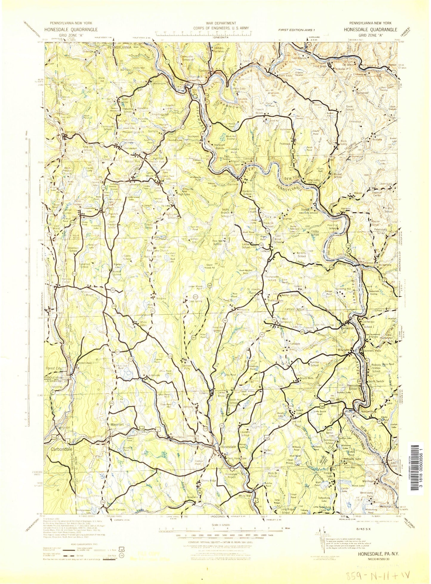
Historic 1943 Honesdale Pennsylvania 30'x30' Topo Map
Couldn't load pickup availability
Historical USGS topographic map of Honesdale in the state of Pennsylvania. Scale: 1:125000. Print size: 16" x 24"
This map was published in 1943 and is in the following counties: Broome, Delaware, Lackawanna, Pike, Sullivan, Susquehanna, Wayne.
The map contains contour lines, roads, rivers, towns, streams, and lakes. Printed on high-quality waterproof paper with UV fade-resistant inks.
Contains the following named places: West Branch Delaware River, Cat Hollow, Starboard Creek, Aldenville, Alder Marsh Brook, Alder Marsh Pond, Mount Ararat, B'nai B'rith Camp, Balls Creek, Balls Eddy, Barkley Lake, Beach Lake, Beach Lake, Bear Swamp, Beaver Meadow, Beaver Pond, Beaverdam Creek, Belmont Lake, Berlin Center, Bethany, Big Brook, Big Hickory, Biglow Lake, Bone Pond, Brace Brook, Brace Brook Reservoir, Bronson Pond, Brownell Reservoir, Buckingham Access Point, Bucks Falls, Bunnells Pond, Burns Pond, Butcher Pond, Cadjaw Pond, Calkins Creek, Camp Blue Ridge, Camp Chicopee, Camp Equinunk, Camp Geneva, Camp Moshava, Camp Munsee, Camp Navajo, Camp Onibar, Camp Tabor, Camp Tioga, Camp Towanda, Camp Wayne, Camp Willoway, Camp Winona, Camp-With-A-Wind, Carley Brook, Carr Pond, Lake Charlotte, Cherry Ridge, Chestnut Lake, Church Hill, Clemo, Cline Pond, Coal Brook, Cold Spring, Collins Brook, Lake Como, Cooley Creek, Coxton Lake, Cramer Creek, Creamton, Crockenburg Pond, Crooked Creek, Curtis Pond, Damascus, Day Pond, Duck Harbor Pond, Dunn Pond, Dyberry, Dyberry Creek, East Branch Lackawanna River, East Honesdale, Elk Lake, Lake Elsie, Equinunk, Equinunk Creek, Factory Creek, Falls Creek, Fallsdale Pond, Farrell Corners, Faulkner Brook, Fiddle Lake Creek, Finnegan Corners, Flat Rock, Forest City Station, Fork Mountain Pond, Fortenia, Galilee, Gardinier Corners, General Edgar Jadwin Dam, Glass Pond Number One, Glass Pond Number Two, Glass Pond Number Three, Golf Hill, Gredlein Pond, Hankins Pond, Hawks Nest, Headley Brook, Hempstead Lake, Herrick Center, Hetzel Pond, Hiawatha Creek, Hiawatha Lake, Hickory Lake, High Knob, High Lake, Hines Corners, Hoadley Pond, Hoadleys, Holbert Creek, Hollister Creek, Honey Mud Pond, Horse Hollow, Howell Pond, Huff Pond, Independent Lake, Indian Head Camp, Indian Orchard, Island Lake, Johnson Creek, Keen Lake, Kingsbury Hill, Kinneyville Creek, Kinneyville Pond, Lake Como, Lakewood, Laurel Lake, Little Biglow Lake, Little Equinunk Creek, Little Hickory Lake, Little Keen Pond, Little Mud Pond, Braman, Long Pond, Long Pond, Long Ridge Pond, Lookout, Lake Lorain, Lovelace Pond, Lower Twin Lake, Lower Woods Pond, Mach Pond, Mansfield Hill, Maple Hill, Margaret Lake, Merrigan Creek, Mican Pond, Middle Branch Dyberry Creek, Milanville, Mile Brook, Miller Pond, Moores Hill, Mud Pond, Mud Pond, Mud Pond, Mud Pond, Mud Pond, Nabbys Lake, Nettle Hill, North Branch Calkins Creek, Open Woods Pond, Orson, Orson Pond, Panther Bluff Pond, Penn Hill, Perch Pond, Peterson Lake, Pine Swamp, Pine Swamp Pond, Pleasant Mount, Pleasant Valley, Pond Brook, Poyntelle Lake, Preston Center, Preston Park, Prompton, Lenape Lake, Randall Lake, Rattlesnake Ridge, Reining Pond, Richmondale, Riley Creek, Robinson Pond, Rock Lake, Rocky Run, Rose Pond, Rose Pond Branch, Rosner Pond, Salem Hill, Salt River Brook, Schoolhouse Creek, Seelyville, Shadigee Creek, Shehawken, Shehawken Creek, Shehawken Lake, Sherman, Shingle Hollow, Shrawder Mountain, Silver Lake, Simpson, Sky Lake, Slocum Hill, Sly Lake, Smith Hill, Snyder Pond, South Branch Calkins Creek, South Branch Equinunk Creek, Spruce Lake, Spruce Pond, Star Creek, Star Pond, Starlight, Starlight Camp, Starlight Lake, Starrucca, State Game Lands Number 159, State Game Lands Number 70, Stillwater Lake, Stockport Creek, Sugarloaf Mountain, Sunny Brook, Sunset Lake, Suydam Pond, Swago Pond, Tamarack Swamp Pond, Tarbox Brook, Telshaw Pond, The Notch, Twin Falls Campground, Tyler Hill


