MyTopo
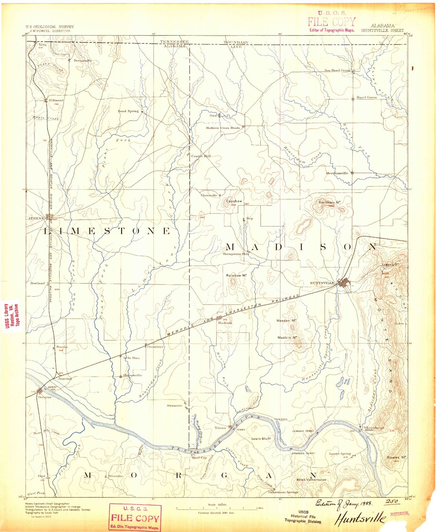
Historic 1888 Huntsville Alabama 30'x30' Topo Map
Couldn't load pickup availability
Historical USGS topographic map of Huntsville in the state of Alabama. Scale: 1:125000. Print size: 17" x 24"
This map was published in 1888 and is in the following counties: Giles, Limestone, Lincoln, Madison, Marshall, Morgan.
The map contains contour lines, roads, rivers, towns, streams, and lakes. Printed on high-quality waterproof paper with UV fade-resistant inks.
Contains the following named places: Givens Branch, Alabama State Docks Terminal, Aldridge Creek, Alum Cave Hollow, Anderson Plantation, Anderson Pond, Aquadome Park, Ardmore, Athens, Bailey Cove, Bailey Cove Estates, Bailey Swamp, Bald Knob, Bald Mountain, Banyon Swamp Creek, Barren Fork Creek, Bartee Branch, Bayside, Beaverdam Creek, Beaverdam Creek, Beaverdam Swamp, Beaverdam Swamp, Bell Bluff, Bell Hill, Bell Point, Bethel, Bettinger Mountain, Betts Mountain, Betts Spring Branch, Big Pond, Black Bluff, Black Branch, Black Branch, Black Hollow, Blackwell Run, Blackwell Swamp, Blair Swamp, Blevins Gap, Blue Hole, Blue Hole Branch, Bobo, Bonneville, Bonnie Doone, Bowling Branch, Bradford Creek, Bradford Mountain, Brahan Spring Park, Braly Lake, Brandontown, Broglan Branch, Brookhurst, Brooksville, Brookwood Forest, Browns Corner, Brush Creek, Brush Mountain, Buckeye Pond, Buffalo Branch, Burgreen Gin, Burleson Mountain, Burningtree Estates, Burningtree Mountain, Burwell Mountain, Byrd Spring Lake, Camelot, Campbell Cove, Capshaw, Capshaw Mountain, Carter Grove, Cavalry Hill, Cave Spring Ridge, Cedar Mountain, Certain Gap, Chapman Heights, Chapman Mountain, Chelsea, Chunn Hill, Clark Spring Branch, Lake Clark, Clarkdale, Clift Acres, Cloud Cove, Coffee Bluff, Collier Branch, Copeland Creek, Copperrun Branch, Cotaco Creek, Country Club Acres, Crabtree Slough, Cribbs Pond, Crowder Slough, Dallas, Dallas Branch, Dancy Quarters, Darwin Downs, Davis Branch, Davis Branch, Davis Hills, Decatur, Delano Park, Denton Branch, Devils Den, Devils Race Track, Dewitt Hollow, Dinsmore Slough, Disco Harbor, Doc Brown Point, Dogwood Flats, Drake Cove, Drake Mountain, Dry Branch, Dry Creek, Dry Creek, Dry Creek, Dry Creek, Dry Creek, Dry Creek Cove, Dunlap Cove, Dyas Swamp, East Hampton, Echols Hill, Edmonton Heights, Elkmont, Elkwood, English Pond, English Village, Esslinger Cove, Fagan Creek, Fagan Hollow, Fairmount, Fairview, Fairview, Falls Hollow, Farley, Five Points, Five Points, Fleming Hills, Fleming Meadows, Flemington Heights, Flint Creek Island, Flint River, French Mill Creek, Funland Park, Garth Mountain, Lake Gary, General Shoe Tank, Giers Branch, Ginhouse Branch, Gladstone, Gooch Creek, Goose Pond, Gourdneck Valley, Gravel Branch, Greenbrier, Greenwycke Village, Grindle Hole, Hale Hollow, Hambrick Slough, Haney Bottoms, Hannah, Hardiman Branch, Hardin Branch, Harris Mountain, Harris Station, Harvest, Hatfield Lake, Hatton Mountain, Hauskin Branch, Hays Mill, Haysland Estates, Hickory Flat, Hickory Hills, Hillandale, Hobbs Island, Hobbs Island, Holland Creek, Hoover, Hornbuckle Hollow, Huckleberry Branch, Huntsville Mountain, Huntsville Park, Jenkins Branch, John Black Mountain, John Blue Co Tank, Johnson Pond, Johnson Pond, Jones Valley, Jones Valley Estates, Jude Hollow, Kay Branch, Knox Creek, Lady Ann Lake, Lakewood, Lee Gap, Lee Hollow, Leemon Slough, Lees Pond, Lehman Point, Lehmans Bluff, Leslie Branch, Lewis Buff, Liberty Hill, Lily Flagg, Lily Pond, Limestone Creek, Limestone Slough, Lincoln, Linde Siding, Lipscomb Pond, Little Burwell Mountain, Little Limestone Creek, Little Piney Creek, Little Piney Creek, Little Pond, Logan Point, Long Branch, Longleaf Estates, Love Ditch, Maddux Cove, Madison, Madison County Park and Boat Harbor, Madkin Mountain, Magnusson Branch, Magnusson Hollow, Maplewood, Martin Branch, Martin Branch, Martin Hollow, Mason Ridge, Mathis Mountain, Matney Branch, Mayfair, McCathey Hollow, McCutcheon Mountain, McDonald Creek, McKay Hollow


