MyTopo
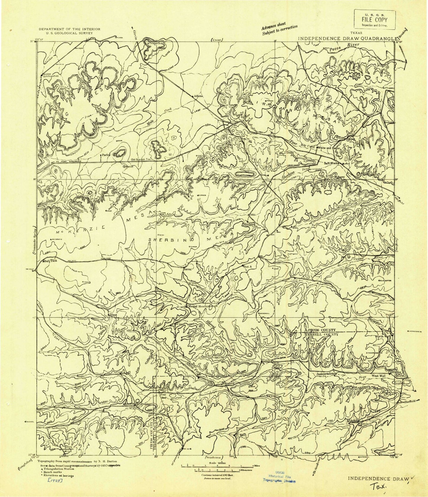
Historic 1929 Independence Draw Texas 30'x30' Topo Map
Couldn't load pickup availability
Historical USGS topographic map of Independence Draw in the state of Texas. Scale: 1:125000. Print size: 19" x 24"
This map was published in 1929 and is in the following counties: Crockett, Pecos, Terrell.
The map contains contour lines, roads, rivers, towns, streams, and lakes. Printed on high-quality waterproof paper with UV fade-resistant inks.
Contains the following named places: Abilene Christian College Ranch, Augustine Ranch, Baker Ranch, Big Baldy Peak, Big Harkey Canyon, Big Mesa, Bootleg Canyon, Bruce Ranch, Claude Owens Ranch, Coates Ranch, Conn Ranch, Darrels Peak, Escondido Ranch, Fannie Woodward Ranch, Fivemile Creek, Hackberry Draw, Harral Draw, Harrelson Ranch, Hassie Hunt Gas Plant, Hat-A Ranch, Hillin Ranch, Hog Peak, Indian Mesa, Jasper Gas Plant, Jeff Owens Ranch, Ligon Ranch, Little Mesa, Louis Woodward Ranch, Manny Ranch, McDonald Ranch, McKenzie Mesa, McKenzie Ranch, McKenzie Ranch, Mitchell Gas Plant, Mitchell Ranch, Monroe Ranch, Montgomery Ranch, North Fork Independence Creek, Owen Ranch, Owens Ranch, Perry Ranch, Porter Ranch, Porter Ranch, Priest Beavers Oil Field, Puckett Gas Plant, Seventeen Draw, Seventeen Ranch, Sherbino Mesa, Sherbino Ranch, Skyscraper Peak, Slaughter Ranch, Squawteat Peak, Taylor-Link Oil and Gas Field, Toborg Oil Field, Trans-Pecos Ranch, Upper Fourmile Draw, W A Harral Ranch, W W Harral Ranch, Walker Oil Field, White Baker Oil Field, Wilson Ranch, Bill and Fred Harral Ranch, Livingston Canyon, Bakersfield, Smoky Mountain Ranch, Grey Ranch Pumping Station, Iraan Division